WARNING TO USERS OF THIS SYSTEM
This computer system, including all related equipment, networks, and network devices (including Internet access), is provided by the Department of the Interior (DOI) in accordance with the agency policy for official use and limited personal use.
All agency computer systems may be monitored for all lawful purposes,
including but not limited to, ensuring that use is authorized, for management of the system, to facilitate protection against unauthorized access, and to verify security procedures, survivability and operational security. Any information on this computer system may be examined, recorded, copied and used for authorized purposes at any time.
All information, including personal information, placed or sent over this system may be monitored, and users of this system are reminded that such monitoring does occur. Therefore, there should be no expectation of privacy with respect to use of this system.
By logging into this agency computer system, you acknowledge and consent to the monitoring of this system. Evidence of your use, authorized or
unauthorized, collected during monitoring may be used for civil, criminal, administrative, or other adverse action. Unauthorized or illegal use may subject you to prosecution.
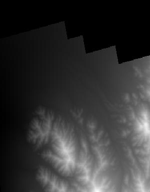
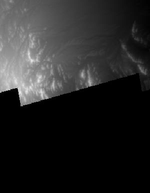
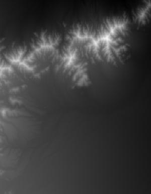
Index of /vdelivery/Datasets/Staged/Elevation/1m/Projects/CA_Riverside_B2_2019/browse/
Index of /vdelivery/Datasets/Staged/Elevation/1m/Projects/CA_Riverside_B2_2019/browse/
../
USGS_1m_x61y373_CA_Riverside_B2_2019.jpg           24-Apr-2020 19:14                3023
USGS_1m_x61y374_CA_Riverside_B2_2019.jpg           24-Apr-2020 19:09                3462
USGS_1m_x62y372_CA_Riverside_B2_2019.jpg           24-Apr-2020 19:20                 829
USGS_1m_x62y373_CA_Riverside_B2_2019.jpg           24-Apr-2020 19:15                7789
USGS_1m_x62y374_CA_Riverside_B2_2019.jpg           24-Apr-2020 19:10                7559
USGS_1m_x63y372_CA_Riverside_B2_2019.jpg           24-Apr-2020 19:20                2920
USGS_1m_x63y373_CA_Riverside_B2_2019.jpg           24-Apr-2020 19:16                6209
USGS_1m_x63y374_CA_Riverside_B2_2019.jpg           24-Apr-2020 19:10                8435
USGS_1m_x63y375_CA_Riverside_B2_2019.jpg           24-Apr-2020 19:04                9445
USGS_1m_x63y376_CA_Riverside_B2_2019.jpg           24-Apr-2020 19:01                2293
USGS_1m_x64y372_CA_Riverside_B2_2019.jpg           24-Apr-2020 19:21                7545
USGS_1m_x64y373_CA_Riverside_B2_2019.jpg           24-Apr-2020 19:16                7970
USGS_1m_x64y374_CA_Riverside_B2_2019.jpg           24-Apr-2020 19:11                3604
USGS_1m_x64y375_CA_Riverside_B2_2019.jpg           24-Apr-2020 19:05                4377
USGS_1m_x64y376_CA_Riverside_B2_2019.jpg           24-Apr-2020 19:01                 996
USGS_1m_x65y371_CA_Riverside_B2_2019.jpg           24-Apr-2020 19:25                2601
USGS_1m_x65y372_CA_Riverside_B2_2019.jpg           24-Apr-2020 19:21                8987
USGS_1m_x65y373_CA_Riverside_B2_2019.jpg           24-Apr-2020 19:17                8639
USGS_1m_x65y375_CA_Riverside_B2_2019.jpg           24-Apr-2020 19:05                1430
USGS_1m_x66y370_CA_Riverside_B2_2019.jpg           24-Apr-2020 19:29                2267
USGS_1m_x66y371_CA_Riverside_B2_2019.jpg           24-Apr-2020 19:26                7817
USGS_1m_x66y372_CA_Riverside_B2_2019.jpg           24-Apr-2020 19:22                4819
USGS_1m_x66y373_CA_Riverside_B2_2019.jpg           24-Apr-2020 19:18                2850
USGS_1m_x66y374_CA_Riverside_B2_2019.jpg           24-Apr-2020 19:11                 828
USGS_1m_x66y375_CA_Riverside_B2_2019.jpg           24-Apr-2020 19:06                3291
USGS_1m_x67y370_CA_Riverside_B2_2019.jpg           24-Apr-2020 19:30                3868
USGS_1m_x67y371_CA_Riverside_B2_2019.jpg           24-Apr-2020 19:27                5403
USGS_1m_x67y372_CA_Riverside_B2_2019.jpg           24-Apr-2020 19:23                2800
USGS_1m_x67y373_CA_Riverside_B2_2019.jpg           24-Apr-2020 19:18                3310
USGS_1m_x67y374_CA_Riverside_B2_2019.jpg           24-Apr-2020 19:12                6893
USGS_1m_x67y375_CA_Riverside_B2_2019.jpg           24-Apr-2020 19:06                5800
USGS_1m_x67y376_CA_Riverside_B2_2019.jpg           24-Apr-2020 19:02                2631
USGS_1m_x67y377_CA_Riverside_B2_2019.jpg           24-Apr-2020 19:01                 732
USGS_1m_x68y370_CA_Riverside_B2_2019.jpg           24-Apr-2020 19:30                5529
USGS_1m_x68y371_CA_Riverside_B2_2019.jpg           24-Apr-2020 19:27                6252
USGS_1m_x68y372_CA_Riverside_B2_2019.jpg           24-Apr-2020 19:24                2940
USGS_1m_x68y373_CA_Riverside_B2_2019.jpg           24-Apr-2020 19:19                2517
USGS_1m_x68y374_CA_Riverside_B2_2019.jpg           24-Apr-2020 19:13                4069
USGS_1m_x68y375_CA_Riverside_B2_2019.jpg           24-Apr-2020 19:07                5246
USGS_1m_x68y376_CA_Riverside_B2_2019.jpg           24-Apr-2020 19:02                6742
USGS_1m_x69y370_CA_Riverside_B2_2019.jpg           24-Apr-2020 19:31                6772
USGS_1m_x69y371_CA_Riverside_B2_2019.jpg           24-Apr-2020 19:28                5522
USGS_1m_x69y372_CA_Riverside_B2_2019.jpg           24-Apr-2020 19:25                2061
USGS_1m_x69y373_CA_Riverside_B2_2019.jpg           24-Apr-2020 19:19                1283
USGS_1m_x69y374_CA_Riverside_B2_2019.jpg           24-Apr-2020 19:14                8423
USGS_1m_x69y375_CA_Riverside_B2_2019.jpg           24-Apr-2020 19:08                6126
USGS_1m_x69y376_CA_Riverside_B2_2019.jpg           24-Apr-2020 19:03                4799
USGS_1m_x70y369_CA_Riverside_B2_2019.jpg           24-Apr-2020 19:33                1845
USGS_1m_x70y370_CA_Riverside_B2_2019.jpg           24-Apr-2020 19:32                7349
USGS_1m_x70y371_CA_Riverside_B2_2019.jpg           24-Apr-2020 19:29                5065
USGS_1m_x70y375_CA_Riverside_B2_2019.jpg           24-Apr-2020 19:08                4276
USGS_1m_x70y376_CA_Riverside_B2_2019.jpg           24-Apr-2020 19:03                1278
USGS_1m_x71y369_CA_Riverside_B2_2019.jpg           24-Apr-2020 19:33                 720
USGS_1m_x71y370_CA_Riverside_B2_2019.jpg           24-Apr-2020 19:32                1668