WARNING TO USERS OF THIS SYSTEM
This computer system, including all related equipment, networks, and network devices (including Internet access), is provided by the Department of the Interior (DOI) in accordance with the agency policy for official use and limited personal use.
All agency computer systems may be monitored for all lawful purposes,
including but not limited to, ensuring that use is authorized, for management of the system, to facilitate protection against unauthorized access, and to verify security procedures, survivability and operational security. Any information on this computer system may be examined, recorded, copied and used for authorized purposes at any time.
All information, including personal information, placed or sent over this system may be monitored, and users of this system are reminded that such monitoring does occur. Therefore, there should be no expectation of privacy with respect to use of this system.
By logging into this agency computer system, you acknowledge and consent to the monitoring of this system. Evidence of your use, authorized or
unauthorized, collected during monitoring may be used for civil, criminal, administrative, or other adverse action. Unauthorized or illegal use may subject you to prosecution.
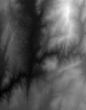
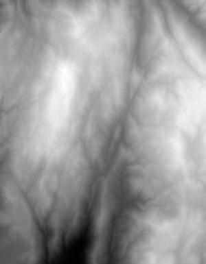
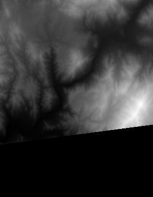
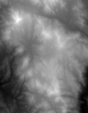
Index of /vdelivery/Datasets/Staged/Elevation/1m/Projects/CA_SanDiegoCo_2016/browse/
Index of /vdelivery/Datasets/Staged/Elevation/1m/Projects/CA_SanDiegoCo_2016/browse/
../
USGS_one_meter_x47y369_CA_SanDiegoCo_2016_thumb..> 23-Mar-2020 18:02                6036
USGS_one_meter_x47y370_CA_SanDiegoCo_2016_thumb..> 23-Mar-2020 18:02                4154
USGS_one_meter_x48y368_CA_SanDiegoCo_2016_thumb..> 23-Mar-2020 18:02                1046
USGS_one_meter_x48y369_CA_SanDiegoCo_2016_thumb..> 23-Mar-2020 18:02                8556
USGS_one_meter_x48y370_CA_SanDiegoCo_2016_thumb..> 23-Mar-2020 18:02                8496
USGS_one_meter_x49y365_CA_SanDiegoCo_2016_thumb..> 23-Mar-2020 18:02                 667
USGS_one_meter_x49y366_CA_SanDiegoCo_2016_thumb..> 23-Mar-2020 18:02                2306
USGS_one_meter_x49y367_CA_SanDiegoCo_2016_thumb..> 23-Mar-2020 18:02                2359
USGS_one_meter_x49y368_CA_SanDiegoCo_2016_thumb..> 23-Mar-2020 18:02                1536
USGS_one_meter_x49y369_CA_SanDiegoCo_2016_thumb..> 23-Mar-2020 18:02                5650
USGS_one_meter_x49y370_CA_SanDiegoCo_2016_thumb..> 23-Mar-2020 18:02                7792
USGS_one_meter_x50y361_CA_SanDiegoCo_2016_thumb..> 23-Mar-2020 18:02                3639
USGS_one_meter_x50y362_CA_SanDiegoCo_2016_thumb..> 23-Mar-2020 18:02                4148
USGS_one_meter_x50y364_CA_SanDiegoCo_2016_thumb..> 23-Mar-2020 18:02                5279
USGS_one_meter_x50y365_CA_SanDiegoCo_2016_thumb..> 23-Mar-2020 18:02                9970
USGS_one_meter_x50y366_CA_SanDiegoCo_2016_thumb..> 23-Mar-2020 18:02                7084
USGS_one_meter_x50y367_CA_SanDiegoCo_2016_thumb..> 23-Mar-2020 18:02                9284
USGS_one_meter_x50y368_CA_SanDiegoCo_2016_thumb..> 23-Mar-2020 18:02                6702
USGS_one_meter_x50y369_CA_SanDiegoCo_2016_thumb..> 23-Mar-2020 18:02                6225
USGS_one_meter_x50y370_CA_SanDiegoCo_2016_thumb..> 23-Mar-2020 18:02                7229
USGS_one_meter_x51y361_CA_SanDiegoCo_2016_thumb..> 23-Mar-2020 18:02                8124
USGS_one_meter_x51y362_CA_SanDiegoCo_2016_thumb..> 23-Mar-2020 18:02               10016
USGS_one_meter_x51y363_CA_SanDiegoCo_2016_thumb..> 23-Mar-2020 18:02                8165
USGS_one_meter_x51y364_CA_SanDiegoCo_2016_thumb..> 23-Mar-2020 18:02                9677
USGS_one_meter_x51y365_CA_SanDiegoCo_2016_thumb..> 23-Mar-2020 18:02                7751
USGS_one_meter_x51y366_CA_SanDiegoCo_2016_thumb..> 23-Mar-2020 18:02                7049
USGS_one_meter_x51y367_CA_SanDiegoCo_2016_thumb..> 23-Mar-2020 18:02                7298
USGS_one_meter_x51y368_CA_SanDiegoCo_2016_thumb..> 23-Mar-2020 18:02                7552
USGS_one_meter_x51y369_CA_SanDiegoCo_2016_thumb..> 23-Mar-2020 18:02                7492
USGS_one_meter_x51y370_CA_SanDiegoCo_2016_thumb..> 23-Mar-2020 18:02                3912
USGS_one_meter_x52y361_CA_SanDiegoCo_2016_thumb..> 23-Mar-2020 18:02                6569
USGS_one_meter_x52y362_CA_SanDiegoCo_2016_thumb..> 23-Mar-2020 18:02                8187
USGS_one_meter_x52y363_CA_SanDiegoCo_2016_thumb..> 23-Mar-2020 18:02                7795
USGS_one_meter_x52y364_CA_SanDiegoCo_2016_thumb..> 23-Mar-2020 18:02                6479
USGS_one_meter_x52y365_CA_SanDiegoCo_2016_thumb..> 23-Mar-2020 18:02                8139
USGS_one_meter_x52y366_CA_SanDiegoCo_2016_thumb..> 23-Mar-2020 18:02                8317
USGS_one_meter_x52y367_CA_SanDiegoCo_2016_thumb..> 23-Mar-2020 18:02                8026
USGS_one_meter_x52y368_CA_SanDiegoCo_2016_thumb..> 23-Mar-2020 18:02                7488
USGS_one_meter_x52y369_CA_SanDiegoCo_2016_thumb..> 23-Mar-2020 18:02                7135
USGS_one_meter_x52y370_CA_SanDiegoCo_2016_thumb..> 23-Mar-2020 18:02                3782
USGS_one_meter_x53y361_CA_SanDiegoCo_2016_thumb..> 23-Mar-2020 18:02                5689
USGS_one_meter_x53y362_CA_SanDiegoCo_2016_thumb..> 23-Mar-2020 18:02                7381
USGS_one_meter_x53y363_CA_SanDiegoCo_2016_thumb..> 23-Mar-2020 18:02                7650
USGS_one_meter_x53y364_CA_SanDiegoCo_2016_thumb..> 23-Mar-2020 18:02                7495
USGS_one_meter_x53y365_CA_SanDiegoCo_2016_thumb..> 23-Mar-2020 18:02                5819
USGS_one_meter_x53y366_CA_SanDiegoCo_2016_thumb..> 23-Mar-2020 18:02                7265
USGS_one_meter_x53y367_CA_SanDiegoCo_2016_thumb..> 23-Mar-2020 18:02                8623
USGS_one_meter_x53y368_CA_SanDiegoCo_2016_thumb..> 23-Mar-2020 18:02                7831
USGS_one_meter_x53y369_CA_SanDiegoCo_2016_thumb..> 23-Mar-2020 18:02                6741
USGS_one_meter_x53y370_CA_SanDiegoCo_2016_thumb..> 23-Mar-2020 18:02                6384
USGS_one_meter_x54y361_CA_SanDiegoCo_2016_thumb..> 23-Mar-2020 18:02                5240
USGS_one_meter_x54y362_CA_SanDiegoCo_2016_thumb..> 23-Mar-2020 18:02                6697
USGS_one_meter_x54y363_CA_SanDiegoCo_2016_thumb..> 23-Mar-2020 18:02                7531
USGS_one_meter_x54y364_CA_SanDiegoCo_2016_thumb..> 23-Mar-2020 18:02                8542
USGS_one_meter_x54y365_CA_SanDiegoCo_2016_thumb..> 23-Mar-2020 18:02                9828
USGS_one_meter_x54y366_CA_SanDiegoCo_2016_thumb..> 23-Mar-2020 18:02                4356
USGS_one_meter_x54y368_CA_SanDiegoCo_2016_thumb..> 23-Mar-2020 18:02                7043
USGS_one_meter_x54y369_CA_SanDiegoCo_2016_thumb..> 23-Mar-2020 18:02                5999
USGS_one_meter_x54y370_CA_SanDiegoCo_2016_thumb..> 23-Mar-2020 18:02                2324
USGS_one_meter_x55y361_CA_SanDiegoCo_2016_thumb..> 23-Mar-2020 18:02                5271
USGS_one_meter_x55y362_CA_SanDiegoCo_2016_thumb..> 23-Mar-2020 18:02                7743
USGS_one_meter_x55y363_CA_SanDiegoCo_2016_thumb..> 23-Mar-2020 18:02                8511
USGS_one_meter_x55y364_CA_SanDiegoCo_2016_thumb..> 23-Mar-2020 18:02                9957
USGS_one_meter_x55y365_CA_SanDiegoCo_2016_thumb..> 23-Mar-2020 18:02                1989
USGS_one_meter_x56y361_CA_SanDiegoCo_2016_thumb..> 23-Mar-2020 18:02                3126
USGS_one_meter_x56y362_CA_SanDiegoCo_2016_thumb..> 23-Mar-2020 18:02                6084
USGS_one_meter_x56y363_CA_SanDiegoCo_2016_thumb..> 23-Mar-2020 18:02                2250
USGS_one_meter_x56y364_CA_SanDiegoCo_2016_thumb..> 23-Mar-2020 18:02                 950