WARNING TO USERS OF THIS SYSTEM
This computer system, including all related equipment, networks, and network devices (including Internet access), is provided by the Department of the Interior (DOI) in accordance with the agency policy for official use and limited personal use.
All agency computer systems may be monitored for all lawful purposes,
including but not limited to, ensuring that use is authorized, for management of the system, to facilitate protection against unauthorized access, and to verify security procedures, survivability and operational security. Any information on this computer system may be examined, recorded, copied and used for authorized purposes at any time.
All information, including personal information, placed or sent over this system may be monitored, and users of this system are reminded that such monitoring does occur. Therefore, there should be no expectation of privacy with respect to use of this system.
By logging into this agency computer system, you acknowledge and consent to the monitoring of this system. Evidence of your use, authorized or
unauthorized, collected during monitoring may be used for civil, criminal, administrative, or other adverse action. Unauthorized or illegal use may subject you to prosecution.
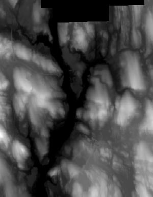
Index of /vdelivery/Datasets/Staged/Elevation/1m/Projects/CT_Statewide_C16/browse/
Index of /vdelivery/Datasets/Staged/Elevation/1m/Projects/CT_Statewide_C16/browse/
../
USGS_1M_18_x60y455_CT_Statewide_C16.jpg            17-Nov-2021 16:41                3060
USGS_1M_18_x60y456_CT_Statewide_C16.jpg            17-Nov-2021 16:41                3467
USGS_1M_18_x61y454_CT_Statewide_C16.jpg            17-Nov-2021 16:41                3022
USGS_1M_18_x61y455_CT_Statewide_C16.jpg            17-Nov-2021 16:41               10975
USGS_1M_18_x61y456_CT_Statewide_C16.jpg            17-Nov-2021 16:41               10260
USGS_1M_18_x62y454_CT_Statewide_C16.jpg            17-Nov-2021 16:41                 732
USGS_1M_18_x62y455_CT_Statewide_C16.jpg            17-Nov-2021 16:41                9041
USGS_1M_18_x62y456_CT_Statewide_C16.jpg            17-Nov-2021 16:41                9850
USGS_1M_18_x62y457_CT_Statewide_C16.jpg            17-Nov-2021 16:41                8679
USGS_1M_18_x62y458_CT_Statewide_C16.jpg            17-Nov-2021 16:41               11910
USGS_1M_18_x62y459_CT_Statewide_C16.jpg            17-Nov-2021 16:41               10040
USGS_1M_18_x62y460_CT_Statewide_C16.jpg            17-Nov-2021 16:41               10957
USGS_1M_18_x62y461_CT_Statewide_C16.jpg            17-Nov-2021 16:41                8677
USGS_1M_18_x62y462_CT_Statewide_C16.jpg            17-Nov-2021 16:41                8448
USGS_1M_18_x62y463_CT_Statewide_C16.jpg            17-Nov-2021 16:41                8086
USGS_1M_18_x62y464_CT_Statewide_C16.jpg            17-Nov-2021 16:41                6356
USGS_1M_18_x62y465_CT_Statewide_C16.jpg            17-Nov-2021 16:41                5931
USGS_1M_18_x62y466_CT_Statewide_C16.jpg            17-Nov-2021 16:41                4833
USGS_1M_18_x63y455_CT_Statewide_C16.jpg            17-Nov-2021 16:41                5055
USGS_1M_18_x63y456_CT_Statewide_C16.jpg            17-Nov-2021 16:41               11139
USGS_1M_18_x63y457_CT_Statewide_C16.jpg            17-Nov-2021 16:41               10683
USGS_1M_18_x63y458_CT_Statewide_C16.jpg            17-Nov-2021 16:41               12507
USGS_1M_18_x63y459_CT_Statewide_C16.jpg            17-Nov-2021 16:41               10900
USGS_1M_18_x63y460_CT_Statewide_C16.jpg            17-Nov-2021 16:41               12326
USGS_1M_18_x63y461_CT_Statewide_C16.jpg            17-Nov-2021 16:41               10444
USGS_1M_18_x63y462_CT_Statewide_C16.jpg            17-Nov-2021 16:41                9306
USGS_1M_18_x63y463_CT_Statewide_C16.jpg            17-Nov-2021 16:41                8989
USGS_1M_18_x63y464_CT_Statewide_C16.jpg            17-Nov-2021 16:41                9931
USGS_1M_18_x63y465_CT_Statewide_C16.jpg            17-Nov-2021 16:41                8853
USGS_1M_18_x63y466_CT_Statewide_C16.jpg            17-Nov-2021 16:41                5439
USGS_1M_18_x64y456_CT_Statewide_C16.jpg            17-Nov-2021 16:41                8023
USGS_1M_18_x64y457_CT_Statewide_C16.jpg            17-Nov-2021 16:41                9102
USGS_1M_18_x64y458_CT_Statewide_C16.jpg            17-Nov-2021 16:41               10801
USGS_1M_18_x64y459_CT_Statewide_C16.jpg            17-Nov-2021 16:41               11503
USGS_1M_18_x64y460_CT_Statewide_C16.jpg            17-Nov-2021 16:41               10616
USGS_1M_18_x64y461_CT_Statewide_C16.jpg            17-Nov-2021 16:41                9994
USGS_1M_18_x64y462_CT_Statewide_C16.jpg            17-Nov-2021 16:41                9353
USGS_1M_18_x64y463_CT_Statewide_C16.jpg            17-Nov-2021 16:41               10126
USGS_1M_18_x64y464_CT_Statewide_C16.jpg            17-Nov-2021 16:41                9078
USGS_1M_18_x64y465_CT_Statewide_C16.jpg            17-Nov-2021 16:41                8528
USGS_1M_18_x64y466_CT_Statewide_C16.jpg            17-Nov-2021 16:41                6288
USGS_1M_18_x65y456_CT_Statewide_C16.jpg            17-Nov-2021 16:41                5354
USGS_1M_18_x65y457_CT_Statewide_C16.jpg            17-Nov-2021 16:41                9485
USGS_1M_18_x65y458_CT_Statewide_C16.jpg            17-Nov-2021 16:41                9979
USGS_1M_18_x65y459_CT_Statewide_C16.jpg            17-Nov-2021 16:41               11163
USGS_1M_18_x65y460_CT_Statewide_C16.jpg            17-Nov-2021 16:41               10077
USGS_1M_18_x65y461_CT_Statewide_C16.jpg            17-Nov-2021 16:41               10177
USGS_1M_18_x65y462_CT_Statewide_C16.jpg            17-Nov-2021 16:41                9570
USGS_1M_18_x65y463_CT_Statewide_C16.jpg            17-Nov-2021 16:41                8957
USGS_1M_18_x65y464_CT_Statewide_C16.jpg            17-Nov-2021 16:41                9249
USGS_1M_18_x65y465_CT_Statewide_C16.jpg            17-Nov-2021 16:41                9460
USGS_1M_18_x65y466_CT_Statewide_C16.jpg            17-Nov-2021 16:41                7281
USGS_1M_18_x66y456_CT_Statewide_C16.jpg            17-Nov-2021 16:41                 733
USGS_1M_18_x66y457_CT_Statewide_C16.jpg            17-Nov-2021 16:41                9164
USGS_1M_18_x66y458_CT_Statewide_C16.jpg            17-Nov-2021 16:41               10335
USGS_1M_18_x66y459_CT_Statewide_C16.jpg            17-Nov-2021 16:41               10089
USGS_1M_18_x66y460_CT_Statewide_C16.jpg            17-Nov-2021 16:41               10333
USGS_1M_18_x66y461_CT_Statewide_C16.jpg            17-Nov-2021 16:41                9634
USGS_1M_18_x66y462_CT_Statewide_C16.jpg            17-Nov-2021 16:41               10615
USGS_1M_18_x66y463_CT_Statewide_C16.jpg            17-Nov-2021 16:41                9591
USGS_1M_18_x66y464_CT_Statewide_C16.jpg            17-Nov-2021 16:41                9369
USGS_1M_18_x66y465_CT_Statewide_C16.jpg            17-Nov-2021 16:41                9321
USGS_1M_18_x66y466_CT_Statewide_C16.jpg            17-Nov-2021 16:41                7984
USGS_1M_18_x67y457_CT_Statewide_C16.jpg            17-Nov-2021 16:41                3280
USGS_1M_18_x67y458_CT_Statewide_C16.jpg            17-Nov-2021 16:41                9597
USGS_1M_18_x67y459_CT_Statewide_C16.jpg            17-Nov-2021 16:41                8375
USGS_1M_18_x67y460_CT_Statewide_C16.jpg            17-Nov-2021 16:41                7777
USGS_1M_18_x67y461_CT_Statewide_C16.jpg            17-Nov-2021 16:41                7097
USGS_1M_18_x67y462_CT_Statewide_C16.jpg            17-Nov-2021 16:41                6548
USGS_1M_18_x67y463_CT_Statewide_C16.jpg            17-Nov-2021 16:41                7965
USGS_1M_18_x67y464_CT_Statewide_C16.jpg            17-Nov-2021 16:41                8349
USGS_1M_18_x67y465_CT_Statewide_C16.jpg            17-Nov-2021 16:41                8384
USGS_1M_18_x67y466_CT_Statewide_C16.jpg            17-Nov-2021 16:41                7186
USGS_1M_18_x68y457_CT_Statewide_C16.jpg            17-Nov-2021 16:41                3634
USGS_1M_18_x68y458_CT_Statewide_C16.jpg            17-Nov-2021 16:41               12986
USGS_1M_18_x68y459_CT_Statewide_C16.jpg            17-Nov-2021 16:41                8765
USGS_1M_18_x68y460_CT_Statewide_C16.jpg            17-Nov-2021 16:41                8040
USGS_1M_18_x68y461_CT_Statewide_C16.jpg            17-Nov-2021 16:41                8781
USGS_1M_18_x68y462_CT_Statewide_C16.jpg            17-Nov-2021 16:41                7745
USGS_1M_18_x68y463_CT_Statewide_C16.jpg            17-Nov-2021 16:41                7221
USGS_1M_18_x68y464_CT_Statewide_C16.jpg            17-Nov-2021 16:41                6674
USGS_1M_18_x68y465_CT_Statewide_C16.jpg            17-Nov-2021 16:41                8931
USGS_1M_18_x68y466_CT_Statewide_C16.jpg            17-Nov-2021 16:41                6482
USGS_1M_18_x69y457_CT_Statewide_C16.jpg            17-Nov-2021 16:41                2510
USGS_1M_18_x69y458_CT_Statewide_C16.jpg            17-Nov-2021 16:41               11031
USGS_1M_18_x69y459_CT_Statewide_C16.jpg            17-Nov-2021 16:41               11059
USGS_1M_18_x69y460_CT_Statewide_C16.jpg            17-Nov-2021 16:41               10370
USGS_1M_18_x69y461_CT_Statewide_C16.jpg            17-Nov-2021 16:41                9674
USGS_1M_18_x69y462_CT_Statewide_C16.jpg            17-Nov-2021 16:41               10738
USGS_1M_18_x69y463_CT_Statewide_C16.jpg            17-Nov-2021 16:41                8045
USGS_1M_18_x69y464_CT_Statewide_C16.jpg            17-Nov-2021 16:41               11249
USGS_1M_18_x69y465_CT_Statewide_C16.jpg            17-Nov-2021 16:41               12117
USGS_1M_18_x69y466_CT_Statewide_C16.jpg            17-Nov-2021 16:41                8281
USGS_1M_18_x70y457_CT_Statewide_C16.jpg            17-Nov-2021 16:41                1345
USGS_1M_18_x70y458_CT_Statewide_C16.jpg            17-Nov-2021 16:41               10984
USGS_1M_18_x70y459_CT_Statewide_C16.jpg            17-Nov-2021 16:41               10443
USGS_1M_18_x70y460_CT_Statewide_C16.jpg            17-Nov-2021 16:41               12393
USGS_1M_18_x70y461_CT_Statewide_C16.jpg            17-Nov-2021 16:41                9267
USGS_1M_18_x70y462_CT_Statewide_C16.jpg            17-Nov-2021 16:41                9338
USGS_1M_18_x70y463_CT_Statewide_C16.jpg            17-Nov-2021 16:41                7540
USGS_1M_18_x70y464_CT_Statewide_C16.jpg            17-Nov-2021 16:41                8327
USGS_1M_18_x70y465_CT_Statewide_C16.jpg            17-Nov-2021 16:41                8538
USGS_1M_18_x70y466_CT_Statewide_C16.jpg            17-Nov-2021 16:41                7225
USGS_1M_18_x71y457_CT_Statewide_C16.jpg            17-Nov-2021 16:41                1006
USGS_1M_18_x71y458_CT_Statewide_C16.jpg            17-Nov-2021 16:41               11192
USGS_1M_18_x71y459_CT_Statewide_C16.jpg            17-Nov-2021 16:41               13246
USGS_1M_18_x71y460_CT_Statewide_C16.jpg            17-Nov-2021 16:41               11165
USGS_1M_18_x71y461_CT_Statewide_C16.jpg            17-Nov-2021 16:41               10817
USGS_1M_18_x71y462_CT_Statewide_C16.jpg            17-Nov-2021 16:41                9364
USGS_1M_18_x71y463_CT_Statewide_C16.jpg            17-Nov-2021 16:41                3052
USGS_1M_18_x71y464_CT_Statewide_C16.jpg            17-Nov-2021 16:41                4667
USGS_1M_18_x71y465_CT_Statewide_C16.jpg            17-Nov-2021 16:41                5885
USGS_1M_18_x71y466_CT_Statewide_C16.jpg            17-Nov-2021 16:41                4901
USGS_1M_18_x72y458_CT_Statewide_C16.jpg            17-Nov-2021 16:41                9763
USGS_1M_18_x72y459_CT_Statewide_C16.jpg            17-Nov-2021 16:41               12873
USGS_1M_18_x72y460_CT_Statewide_C16.jpg            17-Nov-2021 16:41               11155
USGS_1M_18_x72y461_CT_Statewide_C16.jpg            17-Nov-2021 16:41               10960
USGS_1M_18_x72y462_CT_Statewide_C16.jpg            17-Nov-2021 16:41                5542
USGS_1M_18_x73y458_CT_Statewide_C16.jpg            17-Nov-2021 16:41                7003
USGS_1M_18_x73y459_CT_Statewide_C16.jpg            17-Nov-2021 16:41               12409
USGS_1M_18_x73y460_CT_Statewide_C16.jpg            17-Nov-2021 16:41               10380
USGS_1M_18_x73y461_CT_Statewide_C16.jpg            17-Nov-2021 16:41               10582
USGS_1M_18_x73y462_CT_Statewide_C16.jpg            17-Nov-2021 16:41                3999
USGS_1M_18_x73y466_CT_Statewide_C16.jpg            17-Nov-2021 16:41                2312
USGS_1M_18_x74y458_CT_Statewide_C16.jpg            17-Nov-2021 16:41                5593
USGS_1M_18_x74y459_CT_Statewide_C16.jpg            17-Nov-2021 16:41               11780
USGS_1M_18_x74y460_CT_Statewide_C16.jpg            17-Nov-2021 16:41               12993
USGS_1M_18_x74y461_CT_Statewide_C16.jpg            17-Nov-2021 16:41                3871
USGS_1M_18_x74y462_CT_Statewide_C16.jpg            17-Nov-2021 16:41                1436
USGS_1M_18_x74y463_CT_Statewide_C16.jpg            17-Nov-2021 16:41                2617
USGS_1M_18_x74y464_CT_Statewide_C16.jpg            17-Nov-2021 16:41                4313
USGS_1M_18_x74y465_CT_Statewide_C16.jpg            17-Nov-2021 16:41                4642
USGS_1M_18_x74y466_CT_Statewide_C16.jpg            17-Nov-2021 16:41                5920
USGS_1M_18_x75y458_CT_Statewide_C16.jpg            17-Nov-2021 16:41                2860
USGS_1M_18_x75y459_CT_Statewide_C16.jpg            17-Nov-2021 16:41               12381
USGS_1M_18_x75y460_CT_Statewide_C16.jpg            17-Nov-2021 16:41               11188
USGS_1M_18_x75y461_CT_Statewide_C16.jpg            17-Nov-2021 16:41               11053
USGS_1M_18_x75y462_CT_Statewide_C16.jpg            17-Nov-2021 16:41                9187
USGS_1M_18_x75y463_CT_Statewide_C16.jpg            17-Nov-2021 16:41               10820
USGS_1M_18_x75y464_CT_Statewide_C16.jpg            17-Nov-2021 16:41                9729
USGS_1M_18_x75y465_CT_Statewide_C16.jpg            17-Nov-2021 16:41               10055
USGS_1M_18_x75y466_CT_Statewide_C16.jpg            17-Nov-2021 16:41               11237
USGS_1M_18_x76y458_CT_Statewide_C16.jpg            17-Nov-2021 16:41                2787
USGS_1M_19_x23y458_CT_Statewide_C16.jpg            17-Nov-2021 16:41                6010
USGS_1M_19_x23y459_CT_Statewide_C16.jpg            17-Nov-2021 16:41               12578
USGS_1M_19_x23y460_CT_Statewide_C16.jpg            17-Nov-2021 16:41               10262
USGS_1M_19_x23y461_CT_Statewide_C16.jpg            17-Nov-2021 16:41               11042
USGS_1M_19_x23y462_CT_Statewide_C16.jpg            17-Nov-2021 16:41                5048
USGS_1M_19_x23y466_CT_Statewide_C16.jpg            17-Nov-2021 16:41                2510
USGS_1M_19_x24y458_CT_Statewide_C16.jpg            17-Nov-2021 16:41                4677
USGS_1M_19_x24y459_CT_Statewide_C16.jpg            17-Nov-2021 16:41               11487
USGS_1M_19_x24y460_CT_Statewide_C16.jpg            17-Nov-2021 16:41               13672
USGS_1M_19_x24y461_CT_Statewide_C16.jpg            17-Nov-2021 16:41                4788
USGS_1M_19_x24y462_CT_Statewide_C16.jpg            17-Nov-2021 16:41                 959
USGS_1M_19_x24y463_CT_Statewide_C16.jpg            17-Nov-2021 16:41                1352
USGS_1M_19_x24y464_CT_Statewide_C16.jpg            17-Nov-2021 16:41                2446
USGS_1M_19_x24y465_CT_Statewide_C16.jpg            17-Nov-2021 16:41                1728
USGS_1M_19_x24y466_CT_Statewide_C16.jpg            17-Nov-2021 16:41                3828
USGS_1M_19_x25y458_CT_Statewide_C16.jpg            17-Nov-2021 16:41                3362
USGS_1M_19_x25y459_CT_Statewide_C16.jpg            17-Nov-2021 16:41               11989
USGS_1M_19_x25y460_CT_Statewide_C16.jpg            17-Nov-2021 16:41               11199
USGS_1M_19_x25y461_CT_Statewide_C16.jpg            17-Nov-2021 16:41               10878
USGS_1M_19_x25y462_CT_Statewide_C16.jpg            17-Nov-2021 16:41                9478
USGS_1M_19_x25y463_CT_Statewide_C16.jpg            17-Nov-2021 16:41               10514
USGS_1M_19_x25y464_CT_Statewide_C16.jpg            17-Nov-2021 16:41                9947
USGS_1M_19_x25y465_CT_Statewide_C16.jpg            17-Nov-2021 16:41                9788
USGS_1M_19_x25y466_CT_Statewide_C16.jpg            17-Nov-2021 16:41                9071
USGS_1M_19_x26y458_CT_Statewide_C16.jpg            17-Nov-2021 16:41                2821
USGS_1M_19_x26y459_CT_Statewide_C16.jpg            17-Nov-2021 16:41                7855
USGS_1M_19_x26y460_CT_Statewide_C16.jpg            17-Nov-2021 16:41                9024
USGS_1M_19_x26y461_CT_Statewide_C16.jpg            17-Nov-2021 16:41               10514
USGS_1M_19_x26y462_CT_Statewide_C16.jpg            17-Nov-2021 16:41                9101
USGS_1M_19_x26y463_CT_Statewide_C16.jpg            17-Nov-2021 16:41                9136
USGS_1M_19_x26y464_CT_Statewide_C16.jpg            17-Nov-2021 16:41                8861
USGS_1M_19_x26y465_CT_Statewide_C16.jpg            17-Nov-2021 16:41                9712
USGS_1M_19_x26y466_CT_Statewide_C16.jpg            17-Nov-2021 16:41                8185