WARNING TO USERS OF THIS SYSTEM
This computer system, including all related equipment, networks, and network devices (including Internet access), is provided by the Department of the Interior (DOI) in accordance with the agency policy for official use and limited personal use.
All agency computer systems may be monitored for all lawful purposes,
including but not limited to, ensuring that use is authorized, for management of the system, to facilitate protection against unauthorized access, and to verify security procedures, survivability and operational security. Any information on this computer system may be examined, recorded, copied and used for authorized purposes at any time.
All information, including personal information, placed or sent over this system may be monitored, and users of this system are reminded that such monitoring does occur. Therefore, there should be no expectation of privacy with respect to use of this system.
By logging into this agency computer system, you acknowledge and consent to the monitoring of this system. Evidence of your use, authorized or
unauthorized, collected during monitoring may be used for civil, criminal, administrative, or other adverse action. Unauthorized or illegal use may subject you to prosecution.
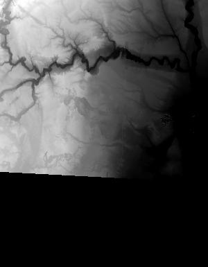
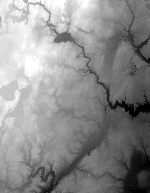
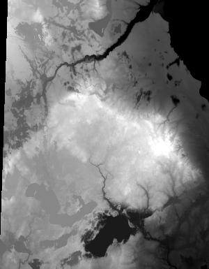
Index of /vdelivery/Datasets/Staged/Elevation/1m/Projects/MI_31Co_Iosco_2016/browse/
Index of /vdelivery/Datasets/Staged/Elevation/1m/Projects/MI_31Co_Iosco_2016/browse/
../
USGS_one_meter_x26y490_MI_31Co_Iosco_2016_thumb..> 23-Mar-2020 18:04                1146
USGS_one_meter_x26y491_MI_31Co_Iosco_2016_thumb..> 23-Mar-2020 18:04                3108
USGS_one_meter_x26y492_MI_31Co_Iosco_2016_thumb..> 23-Mar-2020 18:04                1793
USGS_one_meter_x26y493_MI_31Co_Iosco_2016_thumb..> 23-Mar-2020 18:04                 715
USGS_one_meter_x26y494_MI_31Co_Iosco_2016_thumb..> 23-Mar-2020 18:04                 845
USGS_one_meter_x27y490_MI_31Co_Iosco_2016_thumb..> 23-Mar-2020 18:04                8100
USGS_one_meter_x27y491_MI_31Co_Iosco_2016_thumb..> 23-Mar-2020 18:04               11139
USGS_one_meter_x27y492_MI_31Co_Iosco_2016_thumb..> 23-Mar-2020 18:04               12739
USGS_one_meter_x27y493_MI_31Co_Iosco_2016_thumb..> 23-Mar-2020 18:04               14822
USGS_one_meter_x27y494_MI_31Co_Iosco_2016_thumb..> 23-Mar-2020 18:04                3686
USGS_one_meter_x28y490_MI_31Co_Iosco_2016_thumb..> 23-Mar-2020 18:04                6981
USGS_one_meter_x28y491_MI_31Co_Iosco_2016_thumb..> 23-Mar-2020 18:04               10520
USGS_one_meter_x28y492_MI_31Co_Iosco_2016_thumb..> 23-Mar-2020 18:04               16255
USGS_one_meter_x28y493_MI_31Co_Iosco_2016_thumb..> 23-Mar-2020 18:04                9085
USGS_one_meter_x28y494_MI_31Co_Iosco_2016_thumb..> 23-Mar-2020 18:04                5623
USGS_one_meter_x29y490_MI_31Co_Iosco_2016_thumb..> 23-Mar-2020 18:04                6552
USGS_one_meter_x29y491_MI_31Co_Iosco_2016_thumb..> 23-Mar-2020 18:04                7106
USGS_one_meter_x29y492_MI_31Co_Iosco_2016_thumb..> 23-Mar-2020 18:04               11471
USGS_one_meter_x29y493_MI_31Co_Iosco_2016_thumb..> 23-Mar-2020 18:04               11921
USGS_one_meter_x29y494_MI_31Co_Iosco_2016_thumb..> 23-Mar-2020 18:04                3784
USGS_one_meter_x30y491_MI_31Co_Iosco_2016_thumb..> 23-Mar-2020 18:04                9118
USGS_one_meter_x30y492_MI_31Co_Iosco_2016_thumb..> 23-Mar-2020 18:04                4635
USGS_one_meter_x30y493_MI_31Co_Iosco_2016_thumb..> 23-Mar-2020 18:04                7466
USGS_one_meter_x30y494_MI_31Co_Iosco_2016_thumb..> 23-Mar-2020 18:04                3408
USGS_one_meter_x31y491_MI_31Co_Iosco_2016_thumb..> 23-Mar-2020 18:04                 626
USGS_one_meter_x31y492_MI_31Co_Iosco_2016_thumb..> 23-Mar-2020 18:04                8366
USGS_one_meter_x31y493_MI_31Co_Iosco_2016_thumb..> 23-Mar-2020 18:04               11122
USGS_one_meter_x31y494_MI_31Co_Iosco_2016_thumb..> 23-Mar-2020 18:04                1127
USGS_one_meter_x74y490_MI_31Co_Iosco_2016_thumb..> 23-Mar-2020 18:04                1101
USGS_one_meter_x74y491_MI_31Co_Iosco_2016_thumb..> 23-Mar-2020 18:04                4828
USGS_one_meter_x74y492_MI_31Co_Iosco_2016_thumb..> 23-Mar-2020 18:04                2848
USGS_one_meter_x74y493_MI_31Co_Iosco_2016_thumb..> 23-Mar-2020 18:04                7391
USGS_one_meter_x74y494_MI_31Co_Iosco_2016_thumb..> 23-Mar-2020 18:04                3116
USGS_one_meter_x75y490_MI_31Co_Iosco_2016_thumb..> 23-Mar-2020 18:04                6576