WARNING TO USERS OF THIS SYSTEM
This computer system, including all related equipment, networks, and network devices (including Internet access), is provided by the Department of the Interior (DOI) in accordance with the agency policy for official use and limited personal use.
All agency computer systems may be monitored for all lawful purposes,
including but not limited to, ensuring that use is authorized, for management of the system, to facilitate protection against unauthorized access, and to verify security procedures, survivability and operational security. Any information on this computer system may be examined, recorded, copied and used for authorized purposes at any time.
All information, including personal information, placed or sent over this system may be monitored, and users of this system are reminded that such monitoring does occur. Therefore, there should be no expectation of privacy with respect to use of this system.
By logging into this agency computer system, you acknowledge and consent to the monitoring of this system. Evidence of your use, authorized or
unauthorized, collected during monitoring may be used for civil, criminal, administrative, or other adverse action. Unauthorized or illegal use may subject you to prosecution.
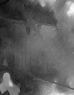
Index of /vdelivery/Datasets/Staged/Elevation/OPR/Projects/New_England_CMGP_SANDY_LiDAR/MA_NE_CMGP_Sandy_Z19_A2_2015/browse/
Index of /vdelivery/Datasets/Staged/Elevation/OPR/Projects/New_England_CMGP_SANDY_LiDAR/MA_NE_CMGP_Sandy_Z19_A2_2015/browse/
../
USGS_OPR_New_England_CMGP_SANDY_LiDAR_19TCG0908..> 05-Apr-2022 23:16 2923
USGS_OPR_New_England_CMGP_SANDY_LiDAR_19TCG1057..> 05-Apr-2022 23:20 730
USGS_OPR_New_England_CMGP_SANDY_LiDAR_19TCG1057..> 05-Apr-2022 22:58 1099
USGS_OPR_New_England_CMGP_SANDY_LiDAR_19TCG1058..> 05-Apr-2022 22:33 2938
USGS_OPR_New_England_CMGP_SANDY_LiDAR_19TCG1058..> 05-Apr-2022 23:16 8175
USGS_OPR_New_England_CMGP_SANDY_LiDAR_19TCG1058..> 05-Apr-2022 22:10 4307
USGS_OPR_New_England_CMGP_SANDY_LiDAR_19TCG1059..> 05-Apr-2022 23:01 1957
USGS_OPR_New_England_CMGP_SANDY_LiDAR_19TCG1207..> 05-Apr-2022 22:53 1718
USGS_OPR_New_England_CMGP_SANDY_LiDAR_19TCG1207..> 05-Apr-2022 23:23 7206
USGS_OPR_New_England_CMGP_SANDY_LiDAR_19TCG1207..> 05-Apr-2022 23:24 7737
USGS_OPR_New_England_CMGP_SANDY_LiDAR_19TCG1207..> 05-Apr-2022 23:03 7877
USGS_OPR_New_England_CMGP_SANDY_LiDAR_19TCG1207..> 05-Apr-2022 23:05 6021
USGS_OPR_New_England_CMGP_SANDY_LiDAR_19TCG1208..> 05-Apr-2022 22:33 9144
USGS_OPR_New_England_CMGP_SANDY_LiDAR_19TCG1208..> 05-Apr-2022 23:16 9086
USGS_OPR_New_England_CMGP_SANDY_LiDAR_19TCG1208..> 05-Apr-2022 22:10 7441
USGS_OPR_New_England_CMGP_SANDY_LiDAR_19TCG1208..> 05-Apr-2022 22:03 7136
USGS_OPR_New_England_CMGP_SANDY_LiDAR_19TCG1208..> 05-Apr-2022 22:39 5889
USGS_OPR_New_England_CMGP_SANDY_LiDAR_19TCG1208..> 05-Apr-2022 22:41 6757
USGS_OPR_New_England_CMGP_SANDY_LiDAR_19TCG1208..> 05-Apr-2022 23:25 6954
USGS_OPR_New_England_CMGP_SANDY_LiDAR_19TCG1209..> 05-Apr-2022 22:47 5660
USGS_OPR_New_England_CMGP_SANDY_LiDAR_19TCG1209..> 05-Apr-2022 22:49 7349
USGS_OPR_New_England_CMGP_SANDY_LiDAR_19TCG1209..> 05-Apr-2022 22:14 5608
USGS_OPR_New_England_CMGP_SANDY_LiDAR_19TCG1209..> 05-Apr-2022 22:55 6453
USGS_OPR_New_England_CMGP_SANDY_LiDAR_19TCG1209..> 05-Apr-2022 23:18 7005
USGS_OPR_New_England_CMGP_SANDY_LiDAR_19TCG1209..> 05-Apr-2022 22:23 6621
USGS_OPR_New_England_CMGP_SANDY_LiDAR_19TCG1209..> 05-Apr-2022 23:05 4934
USGS_OPR_New_England_CMGP_SANDY_LiDAR_19TCG1357..> 05-Apr-2022 22:53 2042
USGS_OPR_New_England_CMGP_SANDY_LiDAR_19TCG1357..> 05-Apr-2022 22:58 6129
USGS_OPR_New_England_CMGP_SANDY_LiDAR_19TCG1357..> 05-Apr-2022 22:21 7647
USGS_OPR_New_England_CMGP_SANDY_LiDAR_19TCG1357..> 05-Apr-2022 23:27 8171
USGS_OPR_New_England_CMGP_SANDY_LiDAR_19TCG1357..> 05-Apr-2022 23:06 6049
USGS_OPR_New_England_CMGP_SANDY_LiDAR_19TCG1358..> 05-Apr-2022 22:33 9188
USGS_OPR_New_England_CMGP_SANDY_LiDAR_19TCG1358..> 05-Apr-2022 23:16 8654
USGS_OPR_New_England_CMGP_SANDY_LiDAR_19TCG1358..> 05-Apr-2022 22:10 6806
USGS_OPR_New_England_CMGP_SANDY_LiDAR_19TCG1358..> 05-Apr-2022 22:03 6604
USGS_OPR_New_England_CMGP_SANDY_LiDAR_19TCG1358..> 05-Apr-2022 22:39 7795
USGS_OPR_New_England_CMGP_SANDY_LiDAR_19TCG1358..> 05-Apr-2022 22:41 7653
USGS_OPR_New_England_CMGP_SANDY_LiDAR_19TCG1358..> 05-Apr-2022 22:44 8992
USGS_OPR_New_England_CMGP_SANDY_LiDAR_19TCG1359..> 05-Apr-2022 22:48 10841
USGS_OPR_New_England_CMGP_SANDY_LiDAR_19TCG1359..> 05-Apr-2022 22:49 6839
USGS_OPR_New_England_CMGP_SANDY_LiDAR_19TCG1359..> 05-Apr-2022 22:14 5060
USGS_OPR_New_England_CMGP_SANDY_LiDAR_19TCG1359..> 05-Apr-2022 23:23 5782
USGS_OPR_New_England_CMGP_SANDY_LiDAR_19TCG1359..> 05-Apr-2022 22:17 6686
USGS_OPR_New_England_CMGP_SANDY_LiDAR_19TCG1359..> 05-Apr-2022 22:23 7781
USGS_OPR_New_England_CMGP_SANDY_LiDAR_19TCG1359..> 05-Apr-2022 23:05 7138
USGS_OPR_New_England_CMGP_SANDY_LiDAR_19TCG1507..> 05-Apr-2022 22:53 2163
USGS_OPR_New_England_CMGP_SANDY_LiDAR_19TCG1507..> 05-Apr-2022 22:58 7909
USGS_OPR_New_England_CMGP_SANDY_LiDAR_19TCG1507..> 05-Apr-2022 22:21 9096
USGS_OPR_New_England_CMGP_SANDY_LiDAR_19TCG1507..> 05-Apr-2022 23:03 7621
USGS_OPR_New_England_CMGP_SANDY_LiDAR_19TCG1507..> 05-Apr-2022 23:21 8452
USGS_OPR_New_England_CMGP_SANDY_LiDAR_19TCG1508..> 05-Apr-2022 22:33 7444
USGS_OPR_New_England_CMGP_SANDY_LiDAR_19TCG1508..> 05-Apr-2022 23:16 7603
USGS_OPR_New_England_CMGP_SANDY_LiDAR_19TCG1508..> 05-Apr-2022 22:10 5066
USGS_OPR_New_England_CMGP_SANDY_LiDAR_19TCG1508..> 05-Apr-2022 22:04 6238
USGS_OPR_New_England_CMGP_SANDY_LiDAR_19TCG1508..> 05-Apr-2022 23:19 9036
USGS_OPR_New_England_CMGP_SANDY_LiDAR_19TCG1508..> 05-Apr-2022 22:41 8431
USGS_OPR_New_England_CMGP_SANDY_LiDAR_19TCG1508..> 05-Apr-2022 22:46 7373
USGS_OPR_New_England_CMGP_SANDY_LiDAR_19TCG1509..> 05-Apr-2022 22:12 7934
USGS_OPR_New_England_CMGP_SANDY_LiDAR_19TCG1509..> 05-Apr-2022 22:49 7817
USGS_OPR_New_England_CMGP_SANDY_LiDAR_19TCG1509..> 05-Apr-2022 22:14 6346
USGS_OPR_New_England_CMGP_SANDY_LiDAR_19TCG1509..> 05-Apr-2022 22:55 6033
USGS_OPR_New_England_CMGP_SANDY_LiDAR_19TCG1509..> 05-Apr-2022 22:17 6926
USGS_OPR_New_England_CMGP_SANDY_LiDAR_19TCG1509..> 05-Apr-2022 22:23 7730
USGS_OPR_New_England_CMGP_SANDY_LiDAR_19TCG1509..> 05-Apr-2022 23:05 6588
USGS_OPR_New_England_CMGP_SANDY_LiDAR_19TCG1657..> 05-Apr-2022 22:53 2307
USGS_OPR_New_England_CMGP_SANDY_LiDAR_19TCG1657..> 05-Apr-2022 22:58 7347
USGS_OPR_New_England_CMGP_SANDY_LiDAR_19TCG1657..> 05-Apr-2022 22:21 6889
USGS_OPR_New_England_CMGP_SANDY_LiDAR_19TCG1657..> 05-Apr-2022 23:04 6238
USGS_OPR_New_England_CMGP_SANDY_LiDAR_19TCG1657..> 05-Apr-2022 23:06 6813
USGS_OPR_New_England_CMGP_SANDY_LiDAR_19TCG1658..> 05-Apr-2022 22:33 7252
USGS_OPR_New_England_CMGP_SANDY_LiDAR_19TCG1658..> 05-Apr-2022 23:17 8314
USGS_OPR_New_England_CMGP_SANDY_LiDAR_19TCG1658..> 05-Apr-2022 22:10 6158
USGS_OPR_New_England_CMGP_SANDY_LiDAR_19TCG1658..> 05-Apr-2022 23:27 5517
USGS_OPR_New_England_CMGP_SANDY_LiDAR_19TCG1658..> 05-Apr-2022 22:39 7658
USGS_OPR_New_England_CMGP_SANDY_LiDAR_19TCG1658..> 05-Apr-2022 22:43 8794
USGS_OPR_New_England_CMGP_SANDY_LiDAR_19TCG1658..> 05-Apr-2022 22:46 6583
USGS_OPR_New_England_CMGP_SANDY_LiDAR_19TCG1659..> 05-Apr-2022 22:12 6084
USGS_OPR_New_England_CMGP_SANDY_LiDAR_19TCG1659..> 05-Apr-2022 22:52 8008
USGS_OPR_New_England_CMGP_SANDY_LiDAR_19TCG1659..> 05-Apr-2022 22:15 7426
USGS_OPR_New_England_CMGP_SANDY_LiDAR_19TCG1659..> 05-Apr-2022 23:27 6438
USGS_OPR_New_England_CMGP_SANDY_LiDAR_19TCG1659..> 05-Apr-2022 22:18 7443
USGS_OPR_New_England_CMGP_SANDY_LiDAR_19TCG1659..> 05-Apr-2022 22:24 7921
USGS_OPR_New_England_CMGP_SANDY_LiDAR_19TCG1659..> 05-Apr-2022 23:20 6519
USGS_OPR_New_England_CMGP_SANDY_LiDAR_19TCG1807..> 05-Apr-2022 22:53 2397
USGS_OPR_New_England_CMGP_SANDY_LiDAR_19TCG1807..> 05-Apr-2022 22:58 6570
USGS_OPR_New_England_CMGP_SANDY_LiDAR_19TCG1807..> 05-Apr-2022 22:21 6321
USGS_OPR_New_England_CMGP_SANDY_LiDAR_19TCG1807..> 05-Apr-2022 23:04 8562
USGS_OPR_New_England_CMGP_SANDY_LiDAR_19TCG1807..> 05-Apr-2022 23:06 8908
USGS_OPR_New_England_CMGP_SANDY_LiDAR_19TCG1808..> 05-Apr-2022 23:24 8230
USGS_OPR_New_England_CMGP_SANDY_LiDAR_19TCG1808..> 05-Apr-2022 23:17 8829
USGS_OPR_New_England_CMGP_SANDY_LiDAR_19TCG1808..> 05-Apr-2022 22:10 7523
USGS_OPR_New_England_CMGP_SANDY_LiDAR_19TCG1808..> 05-Apr-2022 22:04 8398
USGS_OPR_New_England_CMGP_SANDY_LiDAR_19TCG1808..> 05-Apr-2022 22:07 7827
USGS_OPR_New_England_CMGP_SANDY_LiDAR_19TCG1808..> 05-Apr-2022 22:43 6458
USGS_OPR_New_England_CMGP_SANDY_LiDAR_19TCG1808..> 05-Apr-2022 22:46 7874
USGS_OPR_New_England_CMGP_SANDY_LiDAR_19TCG1809..> 05-Apr-2022 22:12 5828
USGS_OPR_New_England_CMGP_SANDY_LiDAR_19TCG1809..> 05-Apr-2022 22:52 7601
USGS_OPR_New_England_CMGP_SANDY_LiDAR_19TCG1809..> 05-Apr-2022 22:15 7841
USGS_OPR_New_England_CMGP_SANDY_LiDAR_19TCG1809..> 05-Apr-2022 22:55 5992
USGS_OPR_New_England_CMGP_SANDY_LiDAR_19TCG1809..> 05-Apr-2022 22:18 7317
USGS_OPR_New_England_CMGP_SANDY_LiDAR_19TCG1809..> 05-Apr-2022 22:24 7347
USGS_OPR_New_England_CMGP_SANDY_LiDAR_19TCG1809..> 05-Apr-2022 23:22 6331
USGS_OPR_New_England_CMGP_SANDY_LiDAR_19TCG1957..> 05-Apr-2022 23:20 3120
USGS_OPR_New_England_CMGP_SANDY_LiDAR_19TCG1957..> 05-Apr-2022 22:58 5978
USGS_OPR_New_England_CMGP_SANDY_LiDAR_19TCG1957..> 05-Apr-2022 22:21 6997
USGS_OPR_New_England_CMGP_SANDY_LiDAR_19TCG1957..> 05-Apr-2022 23:04 7894
USGS_OPR_New_England_CMGP_SANDY_LiDAR_19TCG1957..> 05-Apr-2022 23:28 7577
USGS_OPR_New_England_CMGP_SANDY_LiDAR_19TCG1958..> 05-Apr-2022 22:33 9282
USGS_OPR_New_England_CMGP_SANDY_LiDAR_19TCG1958..> 05-Apr-2022 23:17 9930
USGS_OPR_New_England_CMGP_SANDY_LiDAR_19TCG1958..> 05-Apr-2022 23:21 8300
USGS_OPR_New_England_CMGP_SANDY_LiDAR_19TCG1958..> 05-Apr-2022 23:21 5758
USGS_OPR_New_England_CMGP_SANDY_LiDAR_19TCG1958..> 05-Apr-2022 22:07 7761
USGS_OPR_New_England_CMGP_SANDY_LiDAR_19TCG1958..> 05-Apr-2022 22:43 8682
USGS_OPR_New_England_CMGP_SANDY_LiDAR_19TCG1958..> 05-Apr-2022 22:46 5710
USGS_OPR_New_England_CMGP_SANDY_LiDAR_19TCG1959..> 05-Apr-2022 22:12 5847
USGS_OPR_New_England_CMGP_SANDY_LiDAR_19TCG1959..> 05-Apr-2022 22:52 6116
USGS_OPR_New_England_CMGP_SANDY_LiDAR_19TCG1959..> 05-Apr-2022 22:15 5950
USGS_OPR_New_England_CMGP_SANDY_LiDAR_19TCG1959..> 05-Apr-2022 22:55 5557
USGS_OPR_New_England_CMGP_SANDY_LiDAR_19TCG1959..> 05-Apr-2022 22:18 5391
USGS_OPR_New_England_CMGP_SANDY_LiDAR_19TCG1959..> 05-Apr-2022 22:24 5426
USGS_OPR_New_England_CMGP_SANDY_LiDAR_19TCG1959..> 05-Apr-2022 22:25 7901
USGS_OPR_New_England_CMGP_SANDY_LiDAR_19TCG2107..> 05-Apr-2022 22:53 3404
USGS_OPR_New_England_CMGP_SANDY_LiDAR_19TCG2107..> 05-Apr-2022 22:58 6468
USGS_OPR_New_England_CMGP_SANDY_LiDAR_19TCG2107..> 05-Apr-2022 22:21 6875
USGS_OPR_New_England_CMGP_SANDY_LiDAR_19TCG2107..> 05-Apr-2022 23:04 6897
USGS_OPR_New_England_CMGP_SANDY_LiDAR_19TCG2107..> 05-Apr-2022 23:10 9713
USGS_OPR_New_England_CMGP_SANDY_LiDAR_19TCG2108..> 05-Apr-2022 22:33 9663
USGS_OPR_New_England_CMGP_SANDY_LiDAR_19TCG2108..> 05-Apr-2022 23:17 4544
USGS_OPR_New_England_CMGP_SANDY_LiDAR_19TCG2108..> 05-Apr-2022 22:02 7926
USGS_OPR_New_England_CMGP_SANDY_LiDAR_19TCG2108..> 05-Apr-2022 22:38 6428
USGS_OPR_New_England_CMGP_SANDY_LiDAR_19TCG2108..> 05-Apr-2022 22:08 8469
USGS_OPR_New_England_CMGP_SANDY_LiDAR_19TCG2108..> 05-Apr-2022 23:23 6600
USGS_OPR_New_England_CMGP_SANDY_LiDAR_19TCG2108..> 05-Apr-2022 23:24 5256
USGS_OPR_New_England_CMGP_SANDY_LiDAR_19TCG2109..> 05-Apr-2022 22:12 7002
USGS_OPR_New_England_CMGP_SANDY_LiDAR_19TCG2109..> 05-Apr-2022 22:52 5459
USGS_OPR_New_England_CMGP_SANDY_LiDAR_19TCG2109..> 05-Apr-2022 22:55 4878
USGS_OPR_New_England_CMGP_SANDY_LiDAR_19TCG2109..> 05-Apr-2022 22:55 5669
USGS_OPR_New_England_CMGP_SANDY_LiDAR_19TCG2109..> 05-Apr-2022 22:18 5281
USGS_OPR_New_England_CMGP_SANDY_LiDAR_19TCG2109..> 05-Apr-2022 22:24 5644
USGS_OPR_New_England_CMGP_SANDY_LiDAR_19TCG2109..> 05-Apr-2022 22:25 5574
USGS_OPR_New_England_CMGP_SANDY_LiDAR_19TCG2257..> 05-Apr-2022 22:53 3464
USGS_OPR_New_England_CMGP_SANDY_LiDAR_19TCG2257..> 05-Apr-2022 22:59 7884
USGS_OPR_New_England_CMGP_SANDY_LiDAR_19TCG2257..> 05-Apr-2022 22:22 4521
USGS_OPR_New_England_CMGP_SANDY_LiDAR_19TCG2257..> 05-Apr-2022 23:04 7038
USGS_OPR_New_England_CMGP_SANDY_LiDAR_19TCG2257..> 05-Apr-2022 23:10 7632
USGS_OPR_New_England_CMGP_SANDY_LiDAR_19TCG2258..> 05-Apr-2022 22:34 8943
USGS_OPR_New_England_CMGP_SANDY_LiDAR_19TCG2258..> 05-Apr-2022 23:17 7443
USGS_OPR_New_England_CMGP_SANDY_LiDAR_19TCG2258..> 05-Apr-2022 22:02 6260
USGS_OPR_New_England_CMGP_SANDY_LiDAR_19TCG2258..> 05-Apr-2022 22:38 7484
USGS_OPR_New_England_CMGP_SANDY_LiDAR_19TCG2258..> 05-Apr-2022 22:08 7713
USGS_OPR_New_England_CMGP_SANDY_LiDAR_19TCG2258..> 05-Apr-2022 22:43 5871
USGS_OPR_New_England_CMGP_SANDY_LiDAR_19TCG2258..> 05-Apr-2022 22:46 7900
USGS_OPR_New_England_CMGP_SANDY_LiDAR_19TCG2259..> 05-Apr-2022 22:12 5693
USGS_OPR_New_England_CMGP_SANDY_LiDAR_19TCG2259..> 05-Apr-2022 22:52 7508
USGS_OPR_New_England_CMGP_SANDY_LiDAR_19TCG2259..> 05-Apr-2022 22:16 8474
USGS_OPR_New_England_CMGP_SANDY_LiDAR_19TCG2259..> 05-Apr-2022 22:56 10147
USGS_OPR_New_England_CMGP_SANDY_LiDAR_19TCG2259..> 05-Apr-2022 22:18 6774
USGS_OPR_New_England_CMGP_SANDY_LiDAR_19TCG2259..> 05-Apr-2022 22:24 6359
USGS_OPR_New_England_CMGP_SANDY_LiDAR_19TCG2259..> 05-Apr-2022 22:25 6586
USGS_OPR_New_England_CMGP_SANDY_LiDAR_19TCG2407..> 05-Apr-2022 22:53 2391
USGS_OPR_New_England_CMGP_SANDY_LiDAR_19TCG2407..> 05-Apr-2022 23:28 3398
USGS_OPR_New_England_CMGP_SANDY_LiDAR_19TCG2407..> 05-Apr-2022 22:22 4449
USGS_OPR_New_England_CMGP_SANDY_LiDAR_19TCG2407..> 05-Apr-2022 23:23 5585
USGS_OPR_New_England_CMGP_SANDY_LiDAR_19TCG2407..> 05-Apr-2022 23:10 6907
USGS_OPR_New_England_CMGP_SANDY_LiDAR_19TCG2408..> 05-Apr-2022 23:23 9021
USGS_OPR_New_England_CMGP_SANDY_LiDAR_19TCG2408..> 05-Apr-2022 23:17 6669
USGS_OPR_New_England_CMGP_SANDY_LiDAR_19TCG2408..> 05-Apr-2022 22:02 6601
USGS_OPR_New_England_CMGP_SANDY_LiDAR_19TCG2408..> 05-Apr-2022 22:38 6615
USGS_OPR_New_England_CMGP_SANDY_LiDAR_19TCG2408..> 05-Apr-2022 22:08 5891
USGS_OPR_New_England_CMGP_SANDY_LiDAR_19TCG2408..> 05-Apr-2022 23:19 6590
USGS_OPR_New_England_CMGP_SANDY_LiDAR_19TCG2408..> 05-Apr-2022 22:46 6100
USGS_OPR_New_England_CMGP_SANDY_LiDAR_19TCG2409..> 05-Apr-2022 22:12 7474
USGS_OPR_New_England_CMGP_SANDY_LiDAR_19TCG2409..> 05-Apr-2022 23:18 6563
USGS_OPR_New_England_CMGP_SANDY_LiDAR_19TCG2409..> 05-Apr-2022 22:16 8500
USGS_OPR_New_England_CMGP_SANDY_LiDAR_19TCG2409..> 05-Apr-2022 22:56 8562
USGS_OPR_New_England_CMGP_SANDY_LiDAR_19TCG2409..> 05-Apr-2022 22:18 6457
USGS_OPR_New_England_CMGP_SANDY_LiDAR_19TCG2409..> 05-Apr-2022 22:24 7689
USGS_OPR_New_England_CMGP_SANDY_LiDAR_19TCG2409..> 05-Apr-2022 22:25 7064
USGS_OPR_New_England_CMGP_SANDY_LiDAR_19TCG2557..> 05-Apr-2022 22:53 2779
USGS_OPR_New_England_CMGP_SANDY_LiDAR_19TCG2557..> 05-Apr-2022 22:59 3995
USGS_OPR_New_England_CMGP_SANDY_LiDAR_19TCG2557..> 05-Apr-2022 22:22 5039
USGS_OPR_New_England_CMGP_SANDY_LiDAR_19TCG2557..> 05-Apr-2022 23:04 6729
USGS_OPR_New_England_CMGP_SANDY_LiDAR_19TCG2557..> 05-Apr-2022 23:26 5853
USGS_OPR_New_England_CMGP_SANDY_LiDAR_19TCG2558..> 05-Apr-2022 22:34 6150
USGS_OPR_New_England_CMGP_SANDY_LiDAR_19TCG2558..> 05-Apr-2022 23:17 7297
USGS_OPR_New_England_CMGP_SANDY_LiDAR_19TCG2558..> 05-Apr-2022 22:02 7493
USGS_OPR_New_England_CMGP_SANDY_LiDAR_19TCG2558..> 05-Apr-2022 22:38 7792
USGS_OPR_New_England_CMGP_SANDY_LiDAR_19TCG2558..> 05-Apr-2022 22:08 7263
USGS_OPR_New_England_CMGP_SANDY_LiDAR_19TCG2558..> 05-Apr-2022 23:28 6876
USGS_OPR_New_England_CMGP_SANDY_LiDAR_19TCG2558..> 05-Apr-2022 22:46 11553
USGS_OPR_New_England_CMGP_SANDY_LiDAR_19TCG2559..> 05-Apr-2022 22:12 9014
USGS_OPR_New_England_CMGP_SANDY_LiDAR_19TCG2559..> 05-Apr-2022 22:13 9103
USGS_OPR_New_England_CMGP_SANDY_LiDAR_19TCG2559..> 05-Apr-2022 22:17 5982
USGS_OPR_New_England_CMGP_SANDY_LiDAR_19TCG2559..> 05-Apr-2022 23:22 7058
USGS_OPR_New_England_CMGP_SANDY_LiDAR_19TCG2559..> 05-Apr-2022 22:18 5417
USGS_OPR_New_England_CMGP_SANDY_LiDAR_19TCG2559..> 05-Apr-2022 22:24 8685
USGS_OPR_New_England_CMGP_SANDY_LiDAR_19TCG2559..> 05-Apr-2022 22:25 8844
USGS_OPR_New_England_CMGP_SANDY_LiDAR_19TCG2707..> 05-Apr-2022 22:53 3961
USGS_OPR_New_England_CMGP_SANDY_LiDAR_19TCG2707..> 05-Apr-2022 22:59 6045
USGS_OPR_New_England_CMGP_SANDY_LiDAR_19TCG2707..> 05-Apr-2022 22:22 5453
USGS_OPR_New_England_CMGP_SANDY_LiDAR_19TCG2707..> 05-Apr-2022 23:04 7141
USGS_OPR_New_England_CMGP_SANDY_LiDAR_19TCG2707..> 05-Apr-2022 23:10 6706
USGS_OPR_New_England_CMGP_SANDY_LiDAR_19TCG2708..> 05-Apr-2022 22:34 8170
USGS_OPR_New_England_CMGP_SANDY_LiDAR_19TCG2708..> 05-Apr-2022 23:17 7939
USGS_OPR_New_England_CMGP_SANDY_LiDAR_19TCG2708..> 05-Apr-2022 22:02 6152
USGS_OPR_New_England_CMGP_SANDY_LiDAR_19TCG2708..> 05-Apr-2022 22:38 7623
USGS_OPR_New_England_CMGP_SANDY_LiDAR_19TCG2708..> 05-Apr-2022 22:08 7206
USGS_OPR_New_England_CMGP_SANDY_LiDAR_19TCG2708..> 05-Apr-2022 22:10 7802
USGS_OPR_New_England_CMGP_SANDY_LiDAR_19TCG2708..> 05-Apr-2022 22:46 8974
USGS_OPR_New_England_CMGP_SANDY_LiDAR_19TCG2709..> 05-Apr-2022 22:13 8884
USGS_OPR_New_England_CMGP_SANDY_LiDAR_19TCG2709..> 05-Apr-2022 22:14 7268
USGS_OPR_New_England_CMGP_SANDY_LiDAR_19TCG2709..> 05-Apr-2022 22:17 7246
USGS_OPR_New_England_CMGP_SANDY_LiDAR_19TCG2709..> 05-Apr-2022 23:00 6597
USGS_OPR_New_England_CMGP_SANDY_LiDAR_19TCG2709..> 05-Apr-2022 22:18 12409
USGS_OPR_New_England_CMGP_SANDY_LiDAR_19TCG2709..> 05-Apr-2022 22:24 4875
USGS_OPR_New_England_CMGP_SANDY_LiDAR_19TCG2709..> 05-Apr-2022 22:25 7143
USGS_OPR_New_England_CMGP_SANDY_LiDAR_19TCG2857..> 05-Apr-2022 22:54 4217
USGS_OPR_New_England_CMGP_SANDY_LiDAR_19TCG2857..> 05-Apr-2022 22:59 6249
USGS_OPR_New_England_CMGP_SANDY_LiDAR_19TCG2857..> 05-Apr-2022 22:22 5604
USGS_OPR_New_England_CMGP_SANDY_LiDAR_19TCG2857..> 05-Apr-2022 23:04 5012
USGS_OPR_New_England_CMGP_SANDY_LiDAR_19TCG2857..> 05-Apr-2022 23:10 6106
USGS_OPR_New_England_CMGP_SANDY_LiDAR_19TCG2858..> 05-Apr-2022 22:34 6590
USGS_OPR_New_England_CMGP_SANDY_LiDAR_19TCG2858..> 05-Apr-2022 22:08 7773
USGS_OPR_New_England_CMGP_SANDY_LiDAR_19TCG2858..> 05-Apr-2022 22:02 6430
USGS_OPR_New_England_CMGP_SANDY_LiDAR_19TCG2858..> 05-Apr-2022 22:38 6992
USGS_OPR_New_England_CMGP_SANDY_LiDAR_19TCG2858..> 05-Apr-2022 22:08 8735
USGS_OPR_New_England_CMGP_SANDY_LiDAR_19TCG2858..> 05-Apr-2022 22:10 6664
USGS_OPR_New_England_CMGP_SANDY_LiDAR_19TCG2858..> 05-Apr-2022 22:47 12013
USGS_OPR_New_England_CMGP_SANDY_LiDAR_19TCG2859..> 05-Apr-2022 22:13 5766
USGS_OPR_New_England_CMGP_SANDY_LiDAR_19TCG2859..> 05-Apr-2022 23:26 9286
USGS_OPR_New_England_CMGP_SANDY_LiDAR_19TCG2859..> 05-Apr-2022 22:17 6315
USGS_OPR_New_England_CMGP_SANDY_LiDAR_19TCG2859..> 05-Apr-2022 23:00 10468
USGS_OPR_New_England_CMGP_SANDY_LiDAR_19TCG2859..> 05-Apr-2022 22:18 9146
USGS_OPR_New_England_CMGP_SANDY_LiDAR_19TCG2859..> 05-Apr-2022 22:24 6412
USGS_OPR_New_England_CMGP_SANDY_LiDAR_19TCG2859..> 05-Apr-2022 22:25 6950
USGS_OPR_New_England_CMGP_SANDY_LiDAR_19TCG3007..> 05-Apr-2022 22:54 3124
USGS_OPR_New_England_CMGP_SANDY_LiDAR_19TCG3007..> 05-Apr-2022 22:59 5413
USGS_OPR_New_England_CMGP_SANDY_LiDAR_19TCG3007..> 05-Apr-2022 22:22 5658
USGS_OPR_New_England_CMGP_SANDY_LiDAR_19TCG3007..> 05-Apr-2022 22:28 7282
USGS_OPR_New_England_CMGP_SANDY_LiDAR_19TCG3007..> 05-Apr-2022 23:10 6101
USGS_OPR_New_England_CMGP_SANDY_LiDAR_19TCG3008..> 05-Apr-2022 22:34 7587
USGS_OPR_New_England_CMGP_SANDY_LiDAR_19TCG3008..> 05-Apr-2022 22:08 9280
USGS_OPR_New_England_CMGP_SANDY_LiDAR_19TCG3008..> 05-Apr-2022 22:02 7336
USGS_OPR_New_England_CMGP_SANDY_LiDAR_19TCG3008..> 05-Apr-2022 22:38 8167
USGS_OPR_New_England_CMGP_SANDY_LiDAR_19TCG3008..> 05-Apr-2022 22:08 6603
USGS_OPR_New_England_CMGP_SANDY_LiDAR_19TCG3008..> 05-Apr-2022 22:10 5164
USGS_OPR_New_England_CMGP_SANDY_LiDAR_19TCG3008..> 05-Apr-2022 23:26 7617
USGS_OPR_New_England_CMGP_SANDY_LiDAR_19TCG3009..> 05-Apr-2022 22:13 6349
USGS_OPR_New_England_CMGP_SANDY_LiDAR_19TCG3009..> 05-Apr-2022 22:14 7524
USGS_OPR_New_England_CMGP_SANDY_LiDAR_19TCG3009..> 05-Apr-2022 22:17 7091
USGS_OPR_New_England_CMGP_SANDY_LiDAR_19TCG3009..> 05-Apr-2022 23:00 7236
USGS_OPR_New_England_CMGP_SANDY_LiDAR_19TCG3009..> 05-Apr-2022 22:19 6317
USGS_OPR_New_England_CMGP_SANDY_LiDAR_19TCG3009..> 05-Apr-2022 23:26 6647
USGS_OPR_New_England_CMGP_SANDY_LiDAR_19TCG3009..> 05-Apr-2022 22:25 7421
USGS_OPR_New_England_CMGP_SANDY_LiDAR_19TCG3157..> 05-Apr-2022 22:54 5128
USGS_OPR_New_England_CMGP_SANDY_LiDAR_19TCG3157..> 05-Apr-2022 22:59 7635
USGS_OPR_New_England_CMGP_SANDY_LiDAR_19TCG3157..> 05-Apr-2022 22:22 7087
USGS_OPR_New_England_CMGP_SANDY_LiDAR_19TCG3157..> 05-Apr-2022 22:28 7056
USGS_OPR_New_England_CMGP_SANDY_LiDAR_19TCG3157..> 05-Apr-2022 23:10 6965
USGS_OPR_New_England_CMGP_SANDY_LiDAR_19TCG3158..> 05-Apr-2022 22:34 5689
USGS_OPR_New_England_CMGP_SANDY_LiDAR_19TCG3158..> 05-Apr-2022 22:08 9256
USGS_OPR_New_England_CMGP_SANDY_LiDAR_19TCG3158..> 05-Apr-2022 23:25 10234
USGS_OPR_New_England_CMGP_SANDY_LiDAR_19TCG3158..> 05-Apr-2022 22:38 6107
USGS_OPR_New_England_CMGP_SANDY_LiDAR_19TCG3158..> 05-Apr-2022 23:28 5914
USGS_OPR_New_England_CMGP_SANDY_LiDAR_19TCG3158..> 05-Apr-2022 22:10 3864
USGS_OPR_New_England_CMGP_SANDY_LiDAR_19TCG3158..> 05-Apr-2022 22:47 5274
USGS_OPR_New_England_CMGP_SANDY_LiDAR_19TCG3159..> 05-Apr-2022 22:13 3745
USGS_OPR_New_England_CMGP_SANDY_LiDAR_19TCG3159..> 05-Apr-2022 22:14 7225
USGS_OPR_New_England_CMGP_SANDY_LiDAR_19TCG3159..> 05-Apr-2022 22:17 7518
USGS_OPR_New_England_CMGP_SANDY_LiDAR_19TCG3159..> 05-Apr-2022 23:21 5481
USGS_OPR_New_England_CMGP_SANDY_LiDAR_19TCG3159..> 05-Apr-2022 22:23 6969
USGS_OPR_New_England_CMGP_SANDY_LiDAR_19TCG3159..> 05-Apr-2022 23:24 5273
USGS_OPR_New_England_CMGP_SANDY_LiDAR_19TCG3159..> 05-Apr-2022 22:26 6028
USGS_OPR_New_England_CMGP_SANDY_LiDAR_19TCG3307..> 05-Apr-2022 22:54 5104
USGS_OPR_New_England_CMGP_SANDY_LiDAR_19TCG3307..> 05-Apr-2022 22:59 6107
USGS_OPR_New_England_CMGP_SANDY_LiDAR_19TCG3307..> 05-Apr-2022 22:22 6980
USGS_OPR_New_England_CMGP_SANDY_LiDAR_19TCG3307..> 05-Apr-2022 22:28 7164
USGS_OPR_New_England_CMGP_SANDY_LiDAR_19TCG3307..> 05-Apr-2022 23:10 7854
USGS_OPR_New_England_CMGP_SANDY_LiDAR_19TCG3308..> 05-Apr-2022 22:34 7260
USGS_OPR_New_England_CMGP_SANDY_LiDAR_19TCG3308..> 05-Apr-2022 22:09 9892
USGS_OPR_New_England_CMGP_SANDY_LiDAR_19TCG3308..> 05-Apr-2022 22:02 5085
USGS_OPR_New_England_CMGP_SANDY_LiDAR_19TCG3308..> 05-Apr-2022 22:38 5737
USGS_OPR_New_England_CMGP_SANDY_LiDAR_19TCG3308..> 05-Apr-2022 22:40 4877
USGS_OPR_New_England_CMGP_SANDY_LiDAR_19TCG3308..> 05-Apr-2022 22:10 3453
USGS_OPR_New_England_CMGP_SANDY_LiDAR_19TCG3308..> 05-Apr-2022 22:47 4016
USGS_OPR_New_England_CMGP_SANDY_LiDAR_19TCG3309..> 05-Apr-2022 22:13 7997
USGS_OPR_New_England_CMGP_SANDY_LiDAR_19TCG3309..> 05-Apr-2022 22:14 6336
USGS_OPR_New_England_CMGP_SANDY_LiDAR_19TCG3309..> 05-Apr-2022 22:17 8392
USGS_OPR_New_England_CMGP_SANDY_LiDAR_19TCG3309..> 05-Apr-2022 23:00 6598
USGS_OPR_New_England_CMGP_SANDY_LiDAR_19TCG3309..> 05-Apr-2022 22:23 6569
USGS_OPR_New_England_CMGP_SANDY_LiDAR_19TCG3309..> 05-Apr-2022 22:25 6223
USGS_OPR_New_England_CMGP_SANDY_LiDAR_19TCG3309..> 05-Apr-2022 22:26 8543
USGS_OPR_New_England_CMGP_SANDY_LiDAR_19TCG3457..> 05-Apr-2022 22:54 5188
USGS_OPR_New_England_CMGP_SANDY_LiDAR_19TCG3457..> 05-Apr-2022 22:59 9883
USGS_OPR_New_England_CMGP_SANDY_LiDAR_19TCG3457..> 05-Apr-2022 22:22 8120
USGS_OPR_New_England_CMGP_SANDY_LiDAR_19TCG3457..> 05-Apr-2022 22:28 7181
USGS_OPR_New_England_CMGP_SANDY_LiDAR_19TCG3457..> 05-Apr-2022 23:10 8477
USGS_OPR_New_England_CMGP_SANDY_LiDAR_19TCG3458..> 05-Apr-2022 22:34 9129
USGS_OPR_New_England_CMGP_SANDY_LiDAR_19TCG3458..> 05-Apr-2022 22:09 5202
USGS_OPR_New_England_CMGP_SANDY_LiDAR_19TCG3458..> 05-Apr-2022 22:02 1366
USGS_OPR_New_England_CMGP_SANDY_LiDAR_19TCG3458..> 05-Apr-2022 22:39 4681
USGS_OPR_New_England_CMGP_SANDY_LiDAR_19TCG3458..> 05-Apr-2022 22:40 3431
USGS_OPR_New_England_CMGP_SANDY_LiDAR_19TCG3458..> 05-Apr-2022 23:23 985
USGS_OPR_New_England_CMGP_SANDY_LiDAR_19TCG3458..> 05-Apr-2022 22:47 1777
USGS_OPR_New_England_CMGP_SANDY_LiDAR_19TCG3459..> 05-Apr-2022 22:13 6882
USGS_OPR_New_England_CMGP_SANDY_LiDAR_19TCG3459..> 05-Apr-2022 22:14 7387
USGS_OPR_New_England_CMGP_SANDY_LiDAR_19TCG3459..> 05-Apr-2022 23:18 5900
USGS_OPR_New_England_CMGP_SANDY_LiDAR_19TCG3459..> 05-Apr-2022 23:00 6193
USGS_OPR_New_England_CMGP_SANDY_LiDAR_19TCG3459..> 05-Apr-2022 22:23 6545
USGS_OPR_New_England_CMGP_SANDY_LiDAR_19TCG3459..> 05-Apr-2022 23:05 6546
USGS_OPR_New_England_CMGP_SANDY_LiDAR_19TCG3459..> 05-Apr-2022 22:26 4961
USGS_OPR_New_England_CMGP_SANDY_LiDAR_19TCG3607..> 05-Apr-2022 22:54 5140
USGS_OPR_New_England_CMGP_SANDY_LiDAR_19TCG3607..> 05-Apr-2022 22:59 7335
USGS_OPR_New_England_CMGP_SANDY_LiDAR_19TCG3607..> 05-Apr-2022 22:23 7026
USGS_OPR_New_England_CMGP_SANDY_LiDAR_19TCG3607..> 05-Apr-2022 22:29 8610
USGS_OPR_New_England_CMGP_SANDY_LiDAR_19TCG3607..> 05-Apr-2022 23:11 7983
USGS_OPR_New_England_CMGP_SANDY_LiDAR_19TCG3608..> 05-Apr-2022 22:34 10245
USGS_OPR_New_England_CMGP_SANDY_LiDAR_19TCG3608..> 05-Apr-2022 22:09 667
USGS_OPR_New_England_CMGP_SANDY_LiDAR_19TCG3608..> 05-Apr-2022 22:03 667
USGS_OPR_New_England_CMGP_SANDY_LiDAR_19TCG3608..> 05-Apr-2022 23:25 1493
USGS_OPR_New_England_CMGP_SANDY_LiDAR_19TCG3608..> 05-Apr-2022 22:40 2466
USGS_OPR_New_England_CMGP_SANDY_LiDAR_19TCG3608..> 05-Apr-2022 22:11 2533
USGS_OPR_New_England_CMGP_SANDY_LiDAR_19TCG3608..> 05-Apr-2022 22:47 667
USGS_OPR_New_England_CMGP_SANDY_LiDAR_19TCG3609..> 05-Apr-2022 22:13 3663
USGS_OPR_New_England_CMGP_SANDY_LiDAR_19TCG3609..> 05-Apr-2022 22:14 7885
USGS_OPR_New_England_CMGP_SANDY_LiDAR_19TCG3609..> 05-Apr-2022 22:17 8012
USGS_OPR_New_England_CMGP_SANDY_LiDAR_19TCG3609..> 05-Apr-2022 23:00 5804
USGS_OPR_New_England_CMGP_SANDY_LiDAR_19TCG3609..> 05-Apr-2022 22:23 4501
USGS_OPR_New_England_CMGP_SANDY_LiDAR_19TCG3609..> 05-Apr-2022 23:05 9502
USGS_OPR_New_England_CMGP_SANDY_LiDAR_19TCG3609..> 05-Apr-2022 23:06 10920
USGS_OPR_New_England_CMGP_SANDY_LiDAR_19TCG3757..> 05-Apr-2022 22:54 6788
USGS_OPR_New_England_CMGP_SANDY_LiDAR_19TCG3757..> 05-Apr-2022 22:59 8758
USGS_OPR_New_England_CMGP_SANDY_LiDAR_19TCG3757..> 05-Apr-2022 22:23 7912
USGS_OPR_New_England_CMGP_SANDY_LiDAR_19TCG3757..> 05-Apr-2022 22:29 6563
USGS_OPR_New_England_CMGP_SANDY_LiDAR_19TCG3757..> 05-Apr-2022 23:11 8575
USGS_OPR_New_England_CMGP_SANDY_LiDAR_19TCG3758..> 05-Apr-2022 22:35 9350
USGS_OPR_New_England_CMGP_SANDY_LiDAR_19TCG3758..> 05-Apr-2022 22:09 3742
USGS_OPR_New_England_CMGP_SANDY_LiDAR_19TCG3758..> 05-Apr-2022 22:03 667
USGS_OPR_New_England_CMGP_SANDY_LiDAR_19TCG3758..> 05-Apr-2022 22:39 777
USGS_OPR_New_England_CMGP_SANDY_LiDAR_19TCG3758..> 05-Apr-2022 22:40 4833
USGS_OPR_New_England_CMGP_SANDY_LiDAR_19TCG3758..> 05-Apr-2022 22:11 3695
USGS_OPR_New_England_CMGP_SANDY_LiDAR_19TCG3758..> 05-Apr-2022 22:47 2720
USGS_OPR_New_England_CMGP_SANDY_LiDAR_19TCG3759..> 05-Apr-2022 23:24 5300
USGS_OPR_New_England_CMGP_SANDY_LiDAR_19TCG3759..> 05-Apr-2022 22:14 4995
USGS_OPR_New_England_CMGP_SANDY_LiDAR_19TCG3759..> 05-Apr-2022 22:55 3818
USGS_OPR_New_England_CMGP_SANDY_LiDAR_19TCG3759..> 05-Apr-2022 23:00 1043
USGS_OPR_New_England_CMGP_SANDY_LiDAR_19TCG3759..> 05-Apr-2022 23:05 735
USGS_OPR_New_England_CMGP_SANDY_LiDAR_19TCG3759..> 05-Apr-2022 23:06 8028
USGS_OPR_New_England_CMGP_SANDY_LiDAR_19TCG3907..> 05-Apr-2022 22:54 2289
USGS_OPR_New_England_CMGP_SANDY_LiDAR_19TCG3907..> 05-Apr-2022 23:00 4722
USGS_OPR_New_England_CMGP_SANDY_LiDAR_19TCG3907..> 05-Apr-2022 23:02 7953
USGS_OPR_New_England_CMGP_SANDY_LiDAR_19TCG3907..> 05-Apr-2022 22:29 7319
USGS_OPR_New_England_CMGP_SANDY_LiDAR_19TCG3907..> 05-Apr-2022 23:11 6415
USGS_OPR_New_England_CMGP_SANDY_LiDAR_19TCG3908..> 05-Apr-2022 22:35 3435
USGS_OPR_New_England_CMGP_SANDY_LiDAR_19TCG3908..> 05-Apr-2022 22:09 2197
USGS_OPR_New_England_CMGP_SANDY_LiDAR_19TCG3908..> 05-Apr-2022 22:03 4763
USGS_OPR_New_England_CMGP_SANDY_LiDAR_19TCG3908..> 05-Apr-2022 22:39 1147
USGS_OPR_New_England_CMGP_SANDY_LiDAR_19TCG3908..> 05-Apr-2022 22:40 1574
USGS_OPR_New_England_CMGP_SANDY_LiDAR_19TCG3908..> 05-Apr-2022 22:11 2637
USGS_OPR_New_England_CMGP_SANDY_LiDAR_19TCG3908..> 05-Apr-2022 22:47 1625
USGS_OPR_New_England_CMGP_SANDY_LiDAR_19TCG3909..> 05-Apr-2022 22:13 1130
USGS_OPR_New_England_CMGP_SANDY_LiDAR_19TCG3909..> 05-Apr-2022 23:06 2728
USGS_OPR_New_England_CMGP_SANDY_LiDAR_19TCG4057..> 05-Apr-2022 23:03 8243
USGS_OPR_New_England_CMGP_SANDY_LiDAR_19TCG4057..> 05-Apr-2022 22:29 10068
USGS_OPR_New_England_CMGP_SANDY_LiDAR_19TCG4057..> 05-Apr-2022 23:11 9757
USGS_OPR_New_England_CMGP_SANDY_LiDAR_19TCG4058..> 05-Apr-2022 23:15 4864
USGS_OPR_New_England_CMGP_SANDY_LiDAR_19TCG4058..> 05-Apr-2022 22:09 2680
USGS_OPR_New_England_CMGP_SANDY_LiDAR_19TCG4058..> 05-Apr-2022 22:03 1214
USGS_OPR_New_England_CMGP_SANDY_LiDAR_19TCG4058..> 05-Apr-2022 22:39 4165
USGS_OPR_New_England_CMGP_SANDY_LiDAR_19TCG4058..> 05-Apr-2022 22:40 2621
USGS_OPR_New_England_CMGP_SANDY_LiDAR_19TCG4058..> 05-Apr-2022 23:22 4476
USGS_OPR_New_England_CMGP_SANDY_LiDAR_19TCG4059..> 05-Apr-2022 22:23 1408
USGS_OPR_New_England_CMGP_SANDY_LiDAR_19TCG4059..> 05-Apr-2022 23:05 8133
USGS_OPR_New_England_CMGP_SANDY_LiDAR_19TCG4059..> 05-Apr-2022 23:23 4154
USGS_OPR_New_England_CMGP_SANDY_LiDAR_19TCG4207..> 05-Apr-2022 23:03 2334
USGS_OPR_New_England_CMGP_SANDY_LiDAR_19TCG4207..> 05-Apr-2022 22:29 8103
USGS_OPR_New_England_CMGP_SANDY_LiDAR_19TCG4207..> 05-Apr-2022 23:28 7171
USGS_OPR_New_England_CMGP_SANDY_LiDAR_19TCG4208..> 05-Apr-2022 23:15 6987
USGS_OPR_New_England_CMGP_SANDY_LiDAR_19TCG4208..> 05-Apr-2022 23:28 1857
USGS_OPR_New_England_CMGP_SANDY_LiDAR_19TCG4208..> 05-Apr-2022 22:03 667
USGS_OPR_New_England_CMGP_SANDY_LiDAR_19TCG4208..> 05-Apr-2022 23:22 5505
USGS_OPR_New_England_CMGP_SANDY_LiDAR_19TCG4208..> 05-Apr-2022 22:40 667
USGS_OPR_New_England_CMGP_SANDY_LiDAR_19TCG4208..> 05-Apr-2022 22:43 2839
USGS_OPR_New_England_CMGP_SANDY_LiDAR_19TCG4208..> 05-Apr-2022 22:47 667
USGS_OPR_New_England_CMGP_SANDY_LiDAR_19TCG4209..> 05-Apr-2022 23:26 2481
USGS_OPR_New_England_CMGP_SANDY_LiDAR_19TCG4209..> 05-Apr-2022 23:05 7270
USGS_OPR_New_England_CMGP_SANDY_LiDAR_19TCG4357..> 05-Apr-2022 23:21 3010
USGS_OPR_New_England_CMGP_SANDY_LiDAR_19TCG4357..> 05-Apr-2022 22:29 9703
USGS_OPR_New_England_CMGP_SANDY_LiDAR_19TCG4357..> 05-Apr-2022 23:11 7277
USGS_OPR_New_England_CMGP_SANDY_LiDAR_19TCG4358..> 05-Apr-2022 23:16 4507
USGS_OPR_New_England_CMGP_SANDY_LiDAR_19TCG4358..> 05-Apr-2022 22:09 3943
USGS_OPR_New_England_CMGP_SANDY_LiDAR_19TCG4358..> 05-Apr-2022 22:03 2667
USGS_OPR_New_England_CMGP_SANDY_LiDAR_19TCG4358..> 05-Apr-2022 23:28 6049
USGS_OPR_New_England_CMGP_SANDY_LiDAR_19TCG4358..> 05-Apr-2022 22:41 1042
USGS_OPR_New_England_CMGP_SANDY_LiDAR_19TCG4358..> 05-Apr-2022 23:19 2982
USGS_OPR_New_England_CMGP_SANDY_LiDAR_19TCG4358..> 05-Apr-2022 22:47 4481
USGS_OPR_New_England_CMGP_SANDY_LiDAR_19TCG4359..> 05-Apr-2022 22:13 1573
USGS_OPR_New_England_CMGP_SANDY_LiDAR_19TCG4359..> 05-Apr-2022 23:20 667
USGS_OPR_New_England_CMGP_SANDY_LiDAR_19TCG4359..> 05-Apr-2022 23:29 948
USGS_OPR_New_England_CMGP_SANDY_LiDAR_19TCG4507..> 05-Apr-2022 23:03 3248
USGS_OPR_New_England_CMGP_SANDY_LiDAR_19TCG4507..> 05-Apr-2022 23:24 9253
USGS_OPR_New_England_CMGP_SANDY_LiDAR_19TCG4507..> 05-Apr-2022 23:11 10960
USGS_OPR_New_England_CMGP_SANDY_LiDAR_19TCG4508..> 05-Apr-2022 23:16 9061
USGS_OPR_New_England_CMGP_SANDY_LiDAR_19TCG4508..> 05-Apr-2022 22:09 6682
USGS_OPR_New_England_CMGP_SANDY_LiDAR_19TCG4508..> 05-Apr-2022 22:03 3418
USGS_OPR_New_England_CMGP_SANDY_LiDAR_19TCG4508..> 05-Apr-2022 22:39 1436
USGS_OPR_New_England_CMGP_SANDY_LiDAR_19TCG4508..> 05-Apr-2022 22:41 667
USGS_OPR_New_England_CMGP_SANDY_LiDAR_19TCG4508..> 05-Apr-2022 22:43 1050
USGS_OPR_New_England_CMGP_SANDY_LiDAR_19TCG4508..> 05-Apr-2022 23:19 2285
USGS_OPR_New_England_CMGP_SANDY_LiDAR_19TCG4509..> 05-Apr-2022 22:49 926
USGS_OPR_New_England_CMGP_SANDY_LiDAR_19TCG4509..> 05-Apr-2022 22:14 1054
USGS_OPR_New_England_CMGP_SANDY_LiDAR_19TCG4657..> 05-Apr-2022 22:29 5342
USGS_OPR_New_England_CMGP_SANDY_LiDAR_19TCG4657..> 05-Apr-2022 23:11 10083
USGS_OPR_New_England_CMGP_SANDY_LiDAR_19TCG4658..> 05-Apr-2022 23:16 11161
USGS_OPR_New_England_CMGP_SANDY_LiDAR_19TCG4658..> 05-Apr-2022 22:09 2105
USGS_OPR_New_England_CMGP_SANDY_LiDAR_19TCG4807..> 05-Apr-2022 22:29 6149
USGS_OPR_New_England_CMGP_SANDY_LiDAR_19TCG4807..> 05-Apr-2022 23:11 11308
USGS_OPR_New_England_CMGP_SANDY_LiDAR_19TCG4808..> 05-Apr-2022 23:27 8986
USGS_OPR_New_England_CMGP_SANDY_LiDAR_19TCG4808..> 05-Apr-2022 23:25 667
USGS_OPR_New_England_CMGP_SANDY_LiDAR_19TCG4957..> 05-Apr-2022 23:03 3439
USGS_OPR_New_England_CMGP_SANDY_LiDAR_19TCG4957..> 05-Apr-2022 22:29 7774
USGS_OPR_New_England_CMGP_SANDY_LiDAR_19TCG4957..> 05-Apr-2022 23:24 10423
USGS_OPR_New_England_CMGP_SANDY_LiDAR_19TCG4958..> 05-Apr-2022 23:16 6012
USGS_OPR_New_England_CMGP_SANDY_LiDAR_19TCG4958..> 05-Apr-2022 22:09 971
USGS_OPR_New_England_CMGP_SANDY_LiDAR_19TCG5107..> 05-Apr-2022 23:03 7393
USGS_OPR_New_England_CMGP_SANDY_LiDAR_19TCG5107..> 05-Apr-2022 23:25 9524
USGS_OPR_New_England_CMGP_SANDY_LiDAR_19TCG5107..> 05-Apr-2022 23:11 10821
USGS_OPR_New_England_CMGP_SANDY_LiDAR_19TCG5108..> 05-Apr-2022 23:16 2087
USGS_OPR_New_England_CMGP_SANDY_LiDAR_19TCG5257..> 05-Apr-2022 23:00 3484
USGS_OPR_New_England_CMGP_SANDY_LiDAR_19TCG5257..> 05-Apr-2022 23:03 9226
USGS_OPR_New_England_CMGP_SANDY_LiDAR_19TCG5257..> 05-Apr-2022 23:28 9500
USGS_OPR_New_England_CMGP_SANDY_LiDAR_19TCG5257..> 05-Apr-2022 22:33 5243
USGS_OPR_New_England_CMGP_SANDY_LiDAR_19TCG5407..> 05-Apr-2022 22:51 2518
USGS_OPR_New_England_CMGP_SANDY_LiDAR_19TCG5407..> 05-Apr-2022 22:54 6273
USGS_OPR_New_England_CMGP_SANDY_LiDAR_19TCG5407..> 05-Apr-2022 22:21 8420
USGS_OPR_New_England_CMGP_SANDY_LiDAR_19TCG5407..> 05-Apr-2022 23:03 6982
USGS_OPR_New_England_CMGP_SANDY_LiDAR_19TCG5407..> 05-Apr-2022 22:30 7315
USGS_OPR_New_England_CMGP_SANDY_LiDAR_19TCG5407..> 05-Apr-2022 22:33 4967
USGS_OPR_New_England_CMGP_SANDY_LiDAR_19TCG5408..> 05-Apr-2022 23:21 691
USGS_OPR_New_England_CMGP_SANDY_LiDAR_19TCG5557..> 05-Apr-2022 22:51 8885
USGS_OPR_New_England_CMGP_SANDY_LiDAR_19TCG5557..> 05-Apr-2022 23:20 7363
USGS_OPR_New_England_CMGP_SANDY_LiDAR_19TCG5557..> 05-Apr-2022 22:21 7204
USGS_OPR_New_England_CMGP_SANDY_LiDAR_19TCG5557..> 05-Apr-2022 23:03 3075
USGS_OPR_New_England_CMGP_SANDY_LiDAR_19TCG5707..> 05-Apr-2022 22:51 8348
USGS_OPR_New_England_CMGP_SANDY_LiDAR_19TCG5707..> 05-Apr-2022 22:55 9087
USGS_OPR_New_England_CMGP_SANDY_LiDAR_19TCG5707..> 05-Apr-2022 22:21 4679
USGS_OPR_New_England_CMGP_SANDY_LiDAR_19TCG5857..> 05-Apr-2022 22:58 1082
USGS_OPR_New_England_CMGP_SANDY_LiDAR_19TCG5857..> 05-Apr-2022 22:21 667
USGS_OPR_New_England_CMGP_SANDY_LiDAR_19TCH1200..> 05-Apr-2022 23:06 5242
USGS_OPR_New_England_CMGP_SANDY_LiDAR_19TCH1200..> 05-Apr-2022 23:12 4481
USGS_OPR_New_England_CMGP_SANDY_LiDAR_19TCH1200..> 05-Apr-2022 22:35 5078
USGS_OPR_New_England_CMGP_SANDY_LiDAR_19TCH1200..> 05-Apr-2022 23:18 4348
USGS_OPR_New_England_CMGP_SANDY_LiDAR_19TCH1350..> 05-Apr-2022 23:06 7530
USGS_OPR_New_England_CMGP_SANDY_LiDAR_19TCH1350..> 05-Apr-2022 23:12 6018
USGS_OPR_New_England_CMGP_SANDY_LiDAR_19TCH1350..> 05-Apr-2022 22:35 6782
USGS_OPR_New_England_CMGP_SANDY_LiDAR_19TCH1350..> 05-Apr-2022 23:18 5270
USGS_OPR_New_England_CMGP_SANDY_LiDAR_19TCH1500..> 05-Apr-2022 23:06 7185
USGS_OPR_New_England_CMGP_SANDY_LiDAR_19TCH1500..> 05-Apr-2022 23:12 5309
USGS_OPR_New_England_CMGP_SANDY_LiDAR_19TCH1500..> 05-Apr-2022 22:35 6738
USGS_OPR_New_England_CMGP_SANDY_LiDAR_19TCH1500..> 05-Apr-2022 23:19 6865
USGS_OPR_New_England_CMGP_SANDY_LiDAR_19TCH1650..> 05-Apr-2022 23:06 6422
USGS_OPR_New_England_CMGP_SANDY_LiDAR_19TCH1650..> 05-Apr-2022 23:12 5502
USGS_OPR_New_England_CMGP_SANDY_LiDAR_19TCH1650..> 05-Apr-2022 22:35 7838
USGS_OPR_New_England_CMGP_SANDY_LiDAR_19TCH1650..> 05-Apr-2022 23:22 5984
USGS_OPR_New_England_CMGP_SANDY_LiDAR_19TCH1800..> 05-Apr-2022 23:07 8789
USGS_OPR_New_England_CMGP_SANDY_LiDAR_19TCH1800..> 05-Apr-2022 23:12 8318
USGS_OPR_New_England_CMGP_SANDY_LiDAR_19TCH1800..> 05-Apr-2022 22:35 8376
USGS_OPR_New_England_CMGP_SANDY_LiDAR_19TCH1800..> 05-Apr-2022 22:36 6080
USGS_OPR_New_England_CMGP_SANDY_LiDAR_19TCH1800..> 05-Apr-2022 22:01 7155
USGS_OPR_New_England_CMGP_SANDY_LiDAR_19TCH1800..> 05-Apr-2022 22:04 8236
USGS_OPR_New_England_CMGP_SANDY_LiDAR_19TCH1801..> 05-Apr-2022 22:05 7344
USGS_OPR_New_England_CMGP_SANDY_LiDAR_19TCH1801..> 05-Apr-2022 22:06 8920
USGS_OPR_New_England_CMGP_SANDY_LiDAR_19TCH1801..> 05-Apr-2022 22:41 1540
USGS_OPR_New_England_CMGP_SANDY_LiDAR_19TCH1950..> 05-Apr-2022 23:07 7279
USGS_OPR_New_England_CMGP_SANDY_LiDAR_19TCH1950..> 05-Apr-2022 23:12 5970
USGS_OPR_New_England_CMGP_SANDY_LiDAR_19TCH1950..> 05-Apr-2022 22:35 6268
USGS_OPR_New_England_CMGP_SANDY_LiDAR_19TCH1950..> 05-Apr-2022 22:36 6589
USGS_OPR_New_England_CMGP_SANDY_LiDAR_19TCH1950..> 05-Apr-2022 22:01 7670
USGS_OPR_New_England_CMGP_SANDY_LiDAR_19TCH1950..> 05-Apr-2022 22:04 9005
USGS_OPR_New_England_CMGP_SANDY_LiDAR_19TCH1951..> 05-Apr-2022 22:05 7299
USGS_OPR_New_England_CMGP_SANDY_LiDAR_19TCH1951..> 05-Apr-2022 22:06 9601
USGS_OPR_New_England_CMGP_SANDY_LiDAR_19TCH1951..> 05-Apr-2022 22:41 1462
USGS_OPR_New_England_CMGP_SANDY_LiDAR_19TCH2100..> 05-Apr-2022 23:07 6493
USGS_OPR_New_England_CMGP_SANDY_LiDAR_19TCH2100..> 05-Apr-2022 23:20 7127
USGS_OPR_New_England_CMGP_SANDY_LiDAR_19TCH2100..> 05-Apr-2022 22:36 7443
USGS_OPR_New_England_CMGP_SANDY_LiDAR_19TCH2100..> 05-Apr-2022 22:36 5141
USGS_OPR_New_England_CMGP_SANDY_LiDAR_19TCH2100..> 05-Apr-2022 22:01 6113
USGS_OPR_New_England_CMGP_SANDY_LiDAR_19TCH2100..> 05-Apr-2022 22:04 7479
USGS_OPR_New_England_CMGP_SANDY_LiDAR_19TCH2101..> 05-Apr-2022 22:05 7392
USGS_OPR_New_England_CMGP_SANDY_LiDAR_19TCH2101..> 05-Apr-2022 22:06 10049
USGS_OPR_New_England_CMGP_SANDY_LiDAR_19TCH2101..> 05-Apr-2022 22:41 718
USGS_OPR_New_England_CMGP_SANDY_LiDAR_19TCH2250..> 05-Apr-2022 23:07 6411
USGS_OPR_New_England_CMGP_SANDY_LiDAR_19TCH2250..> 05-Apr-2022 23:12 5823
USGS_OPR_New_England_CMGP_SANDY_LiDAR_19TCH2250..> 05-Apr-2022 22:36 6992
USGS_OPR_New_England_CMGP_SANDY_LiDAR_19TCH2250..> 05-Apr-2022 22:36 7801
USGS_OPR_New_England_CMGP_SANDY_LiDAR_19TCH2250..> 05-Apr-2022 22:01 8298
USGS_OPR_New_England_CMGP_SANDY_LiDAR_19TCH2250..> 05-Apr-2022 22:04 7991
USGS_OPR_New_England_CMGP_SANDY_LiDAR_19TCH2251..> 05-Apr-2022 22:05 8423
USGS_OPR_New_England_CMGP_SANDY_LiDAR_19TCH2251..> 05-Apr-2022 22:06 9791
USGS_OPR_New_England_CMGP_SANDY_LiDAR_19TCH2400..> 05-Apr-2022 23:21 6763
USGS_OPR_New_England_CMGP_SANDY_LiDAR_19TCH2400..> 05-Apr-2022 23:12 5247
USGS_OPR_New_England_CMGP_SANDY_LiDAR_19TCH2400..> 05-Apr-2022 23:13 5854
USGS_OPR_New_England_CMGP_SANDY_LiDAR_19TCH2400..> 05-Apr-2022 22:36 6782
USGS_OPR_New_England_CMGP_SANDY_LiDAR_19TCH2400..> 05-Apr-2022 22:01 7204
USGS_OPR_New_England_CMGP_SANDY_LiDAR_19TCH2400..> 05-Apr-2022 22:04 6916
USGS_OPR_New_England_CMGP_SANDY_LiDAR_19TCH2401..> 05-Apr-2022 22:06 9561
USGS_OPR_New_England_CMGP_SANDY_LiDAR_19TCH2401..> 05-Apr-2022 22:06 10342
USGS_OPR_New_England_CMGP_SANDY_LiDAR_19TCH2401..> 05-Apr-2022 22:41 4746
USGS_OPR_New_England_CMGP_SANDY_LiDAR_19TCH2550..> 05-Apr-2022 23:26 9078
USGS_OPR_New_England_CMGP_SANDY_LiDAR_19TCH2550..> 05-Apr-2022 23:13 6931
USGS_OPR_New_England_CMGP_SANDY_LiDAR_19TCH2550..> 05-Apr-2022 23:13 7862
USGS_OPR_New_England_CMGP_SANDY_LiDAR_19TCH2550..> 05-Apr-2022 22:36 7533
USGS_OPR_New_England_CMGP_SANDY_LiDAR_19TCH2550..> 05-Apr-2022 22:01 8907
USGS_OPR_New_England_CMGP_SANDY_LiDAR_19TCH2550..> 05-Apr-2022 22:04 7498
USGS_OPR_New_England_CMGP_SANDY_LiDAR_19TCH2551..> 05-Apr-2022 23:24 7840
USGS_OPR_New_England_CMGP_SANDY_LiDAR_19TCH2551..> 05-Apr-2022 22:06 10197
USGS_OPR_New_England_CMGP_SANDY_LiDAR_19TCH2551..> 05-Apr-2022 23:19 8816
USGS_OPR_New_England_CMGP_SANDY_LiDAR_19TCH2551..> 05-Apr-2022 22:44 1547
USGS_OPR_New_England_CMGP_SANDY_LiDAR_19TCH2700..> 05-Apr-2022 23:07 6973
USGS_OPR_New_England_CMGP_SANDY_LiDAR_19TCH2700..> 05-Apr-2022 23:18 7169
USGS_OPR_New_England_CMGP_SANDY_LiDAR_19TCH2700..> 05-Apr-2022 23:13 7115
USGS_OPR_New_England_CMGP_SANDY_LiDAR_19TCH2700..> 05-Apr-2022 22:37 6180
USGS_OPR_New_England_CMGP_SANDY_LiDAR_19TCH2700..> 05-Apr-2022 22:01 8718
USGS_OPR_New_England_CMGP_SANDY_LiDAR_19TCH2700..> 05-Apr-2022 22:04 7234
USGS_OPR_New_England_CMGP_SANDY_LiDAR_19TCH2701..> 05-Apr-2022 23:19 7592
USGS_OPR_New_England_CMGP_SANDY_LiDAR_19TCH2701..> 05-Apr-2022 22:07 9597
USGS_OPR_New_England_CMGP_SANDY_LiDAR_19TCH2701..> 05-Apr-2022 22:42 7169
USGS_OPR_New_England_CMGP_SANDY_LiDAR_19TCH2701..> 05-Apr-2022 22:44 3268
USGS_OPR_New_England_CMGP_SANDY_LiDAR_19TCH2850..> 05-Apr-2022 23:07 6302
USGS_OPR_New_England_CMGP_SANDY_LiDAR_19TCH2850..> 05-Apr-2022 22:30 7410
USGS_OPR_New_England_CMGP_SANDY_LiDAR_19TCH2850..> 05-Apr-2022 23:13 8025
USGS_OPR_New_England_CMGP_SANDY_LiDAR_19TCH2850..> 05-Apr-2022 22:37 8084
USGS_OPR_New_England_CMGP_SANDY_LiDAR_19TCH2850..> 05-Apr-2022 22:01 5487
USGS_OPR_New_England_CMGP_SANDY_LiDAR_19TCH2850..> 05-Apr-2022 22:05 6121
USGS_OPR_New_England_CMGP_SANDY_LiDAR_19TCH2851..> 05-Apr-2022 22:39 8379
USGS_OPR_New_England_CMGP_SANDY_LiDAR_19TCH2851..> 05-Apr-2022 22:07 5737
USGS_OPR_New_England_CMGP_SANDY_LiDAR_19TCH2851..> 05-Apr-2022 22:42 2815
USGS_OPR_New_England_CMGP_SANDY_LiDAR_19TCH3000..> 05-Apr-2022 22:30 7191
USGS_OPR_New_England_CMGP_SANDY_LiDAR_19TCH3000..> 05-Apr-2022 22:30 7934
USGS_OPR_New_England_CMGP_SANDY_LiDAR_19TCH3000..> 05-Apr-2022 23:13 8792
USGS_OPR_New_England_CMGP_SANDY_LiDAR_19TCH3000..> 05-Apr-2022 22:37 6299
USGS_OPR_New_England_CMGP_SANDY_LiDAR_19TCH3001..> 05-Apr-2022 22:42 1343
USGS_OPR_New_England_CMGP_SANDY_LiDAR_19TCH3150..> 05-Apr-2022 23:07 9253
USGS_OPR_New_England_CMGP_SANDY_LiDAR_19TCH3150..> 05-Apr-2022 22:30 8801
USGS_OPR_New_England_CMGP_SANDY_LiDAR_19TCH3150..> 05-Apr-2022 23:13 7750
USGS_OPR_New_England_CMGP_SANDY_LiDAR_19TCH3150..> 05-Apr-2022 22:37 6084
USGS_OPR_New_England_CMGP_SANDY_LiDAR_19TCH3300..> 05-Apr-2022 23:07 7527
USGS_OPR_New_England_CMGP_SANDY_LiDAR_19TCH3300..> 05-Apr-2022 22:30 8205
USGS_OPR_New_England_CMGP_SANDY_LiDAR_19TCH3300..> 05-Apr-2022 23:27 7332
USGS_OPR_New_England_CMGP_SANDY_LiDAR_19TCH3300..> 05-Apr-2022 22:37 4726
USGS_OPR_New_England_CMGP_SANDY_LiDAR_19TCH3450..> 05-Apr-2022 23:07 7681
USGS_OPR_New_England_CMGP_SANDY_LiDAR_19TCH3450..> 05-Apr-2022 22:30 7430
USGS_OPR_New_England_CMGP_SANDY_LiDAR_19TCH3450..> 05-Apr-2022 23:13 6729
USGS_OPR_New_England_CMGP_SANDY_LiDAR_19TCH3450..> 05-Apr-2022 22:37 5605
USGS_OPR_New_England_CMGP_SANDY_LiDAR_19TCH3600..> 05-Apr-2022 23:07 7244
USGS_OPR_New_England_CMGP_SANDY_LiDAR_19TCH3600..> 05-Apr-2022 22:30 7638
USGS_OPR_New_England_CMGP_SANDY_LiDAR_19TCH3600..> 05-Apr-2022 23:13 6905
USGS_OPR_New_England_CMGP_SANDY_LiDAR_19TCH3600..> 05-Apr-2022 22:00 5521
USGS_OPR_New_England_CMGP_SANDY_LiDAR_19TCH3750..> 05-Apr-2022 23:08 7855
USGS_OPR_New_England_CMGP_SANDY_LiDAR_19TCH3750..> 05-Apr-2022 22:30 4308
USGS_OPR_New_England_CMGP_SANDY_LiDAR_19TCH3750..> 05-Apr-2022 23:13 7064
USGS_OPR_New_England_CMGP_SANDY_LiDAR_19TCH3750..> 05-Apr-2022 22:00 4225
USGS_OPR_New_England_CMGP_SANDY_LiDAR_19TCH3900..> 05-Apr-2022 23:12 5801
USGS_OPR_New_England_CMGP_SANDY_LiDAR_19TCH3900..> 05-Apr-2022 22:31 5625
USGS_OPR_New_England_CMGP_SANDY_LiDAR_19TCH3900..> 05-Apr-2022 23:14 6312
USGS_OPR_New_England_CMGP_SANDY_LiDAR_19TCH3900..> 05-Apr-2022 22:00 4770
USGS_OPR_New_England_CMGP_SANDY_LiDAR_19TCH3901..> 05-Apr-2022 22:39 897
USGS_OPR_New_England_CMGP_SANDY_LiDAR_19TCH3901..> 05-Apr-2022 22:07 4465
USGS_OPR_New_England_CMGP_SANDY_LiDAR_19TCH3901..> 05-Apr-2022 22:42 8315
USGS_OPR_New_England_CMGP_SANDY_LiDAR_19TCH3901..> 05-Apr-2022 22:44 6211
USGS_OPR_New_England_CMGP_SANDY_LiDAR_19TCH4050..> 05-Apr-2022 23:12 4191
USGS_OPR_New_England_CMGP_SANDY_LiDAR_19TCH4050..> 05-Apr-2022 22:31 7917
USGS_OPR_New_England_CMGP_SANDY_LiDAR_19TCH4050..> 05-Apr-2022 23:17 7572
USGS_OPR_New_England_CMGP_SANDY_LiDAR_19TCH4050..> 05-Apr-2022 22:00 7320
USGS_OPR_New_England_CMGP_SANDY_LiDAR_19TCH4050..> 05-Apr-2022 22:05 3461
USGS_OPR_New_England_CMGP_SANDY_LiDAR_19TCH4051..> 05-Apr-2022 22:40 7838
USGS_OPR_New_England_CMGP_SANDY_LiDAR_19TCH4051..> 05-Apr-2022 23:27 7730
USGS_OPR_New_England_CMGP_SANDY_LiDAR_19TCH4051..> 05-Apr-2022 22:42 10788
USGS_OPR_New_England_CMGP_SANDY_LiDAR_19TCH4051..> 05-Apr-2022 23:22 6664
USGS_OPR_New_England_CMGP_SANDY_LiDAR_19TCH4051..> 05-Apr-2022 22:45 7355
USGS_OPR_New_England_CMGP_SANDY_LiDAR_19TCH4200..> 05-Apr-2022 22:35 5345
USGS_OPR_New_England_CMGP_SANDY_LiDAR_19TCH4200..> 05-Apr-2022 23:21 7722
USGS_OPR_New_England_CMGP_SANDY_LiDAR_19TCH4200..> 05-Apr-2022 22:00 7091
USGS_OPR_New_England_CMGP_SANDY_LiDAR_19TCH4200..> 05-Apr-2022 22:01 9998
USGS_OPR_New_England_CMGP_SANDY_LiDAR_19TCH4200..> 05-Apr-2022 22:05 9928
USGS_OPR_New_England_CMGP_SANDY_LiDAR_19TCH4201..> 05-Apr-2022 22:40 7471
USGS_OPR_New_England_CMGP_SANDY_LiDAR_19TCH4201..> 05-Apr-2022 22:07 9090
USGS_OPR_New_England_CMGP_SANDY_LiDAR_19TCH4201..> 05-Apr-2022 22:42 5867
USGS_OPR_New_England_CMGP_SANDY_LiDAR_19TCH4201..> 05-Apr-2022 22:44 6070
USGS_OPR_New_England_CMGP_SANDY_LiDAR_19TCH4201..> 05-Apr-2022 22:45 5804
USGS_OPR_New_England_CMGP_SANDY_LiDAR_19TCH4350..> 05-Apr-2022 22:35 7731
USGS_OPR_New_England_CMGP_SANDY_LiDAR_19TCH4350..> 05-Apr-2022 23:18 7537
USGS_OPR_New_England_CMGP_SANDY_LiDAR_19TCH4350..> 05-Apr-2022 22:00 10294
USGS_OPR_New_England_CMGP_SANDY_LiDAR_19TCH4350..> 05-Apr-2022 22:01 9039
USGS_OPR_New_England_CMGP_SANDY_LiDAR_19TCH4350..> 05-Apr-2022 22:05 6727
USGS_OPR_New_England_CMGP_SANDY_LiDAR_19TCH4351..> 05-Apr-2022 22:40 8419
USGS_OPR_New_England_CMGP_SANDY_LiDAR_19TCH4351..> 05-Apr-2022 22:07 9639
USGS_OPR_New_England_CMGP_SANDY_LiDAR_19TCH4351..> 05-Apr-2022 23:28 7789
USGS_OPR_New_England_CMGP_SANDY_LiDAR_19TCH4351..> 05-Apr-2022 22:44 7099
USGS_OPR_New_England_CMGP_SANDY_LiDAR_19TCH4351..> 05-Apr-2022 22:48 6767
USGS_OPR_New_England_CMGP_SANDY_LiDAR_19TCH4500..> 05-Apr-2022 23:27 1061
USGS_OPR_New_England_CMGP_SANDY_LiDAR_19TCH4500..> 05-Apr-2022 23:18 7344
USGS_OPR_New_England_CMGP_SANDY_LiDAR_19TCH4500..> 05-Apr-2022 22:00 8419
USGS_OPR_New_England_CMGP_SANDY_LiDAR_19TCH4500..> 05-Apr-2022 22:01 7060
USGS_OPR_New_England_CMGP_SANDY_LiDAR_19TCH4500..> 05-Apr-2022 22:05 5849
USGS_OPR_New_England_CMGP_SANDY_LiDAR_19TCH4501..> 05-Apr-2022 22:06 7679
USGS_OPR_New_England_CMGP_SANDY_LiDAR_19TCH4501..> 05-Apr-2022 22:07 8029
USGS_OPR_New_England_CMGP_SANDY_LiDAR_19TCH4501..> 05-Apr-2022 22:42 6354
USGS_OPR_New_England_CMGP_SANDY_LiDAR_19TCH4501..> 05-Apr-2022 22:44 6385
USGS_OPR_New_England_CMGP_SANDY_LiDAR_19TCH4501..> 05-Apr-2022 22:48 8089
USGS_OPR_New_England_CMGP_SANDY_LiDAR_19TCH4503..> 05-Apr-2022 23:25 1015
USGS_OPR_New_England_CMGP_SANDY_LiDAR_19TCH4504..> 05-Apr-2022 23:02 4600
USGS_OPR_New_England_CMGP_SANDY_LiDAR_19TCH4504..> 05-Apr-2022 22:26 6469
USGS_OPR_New_England_CMGP_SANDY_LiDAR_19TCH4504..> 05-Apr-2022 22:27 1377
USGS_OPR_New_England_CMGP_SANDY_LiDAR_19TCH4650..> 05-Apr-2022 23:18 1600
USGS_OPR_New_England_CMGP_SANDY_LiDAR_19TCH4650..> 05-Apr-2022 22:00 8710
USGS_OPR_New_England_CMGP_SANDY_LiDAR_19TCH4650..> 05-Apr-2022 22:02 10227
USGS_OPR_New_England_CMGP_SANDY_LiDAR_19TCH4650..> 05-Apr-2022 23:23 6324
USGS_OPR_New_England_CMGP_SANDY_LiDAR_19TCH4651..> 05-Apr-2022 22:06 3748
USGS_OPR_New_England_CMGP_SANDY_LiDAR_19TCH4651..> 05-Apr-2022 22:07 6900
USGS_OPR_New_England_CMGP_SANDY_LiDAR_19TCH4651..> 05-Apr-2022 22:42 8918
USGS_OPR_New_England_CMGP_SANDY_LiDAR_19TCH4651..> 05-Apr-2022 23:27 10456
USGS_OPR_New_England_CMGP_SANDY_LiDAR_19TCH4651..> 05-Apr-2022 22:48 7600
USGS_OPR_New_England_CMGP_SANDY_LiDAR_19TCH4652..> 05-Apr-2022 22:57 806
USGS_OPR_New_England_CMGP_SANDY_LiDAR_19TCH4652..> 05-Apr-2022 22:19 4691
USGS_OPR_New_England_CMGP_SANDY_LiDAR_19TCH4652..> 05-Apr-2022 22:19 4505
USGS_OPR_New_England_CMGP_SANDY_LiDAR_19TCH4653..> 05-Apr-2022 23:25 2010
USGS_OPR_New_England_CMGP_SANDY_LiDAR_19TCH4653..> 05-Apr-2022 23:21 2951
USGS_OPR_New_England_CMGP_SANDY_LiDAR_19TCH4653..> 05-Apr-2022 23:02 10041
USGS_OPR_New_England_CMGP_SANDY_LiDAR_19TCH4654..> 05-Apr-2022 23:02 8624
USGS_OPR_New_England_CMGP_SANDY_LiDAR_19TCH4654..> 05-Apr-2022 22:26 9606
USGS_OPR_New_England_CMGP_SANDY_LiDAR_19TCH4654..> 05-Apr-2022 22:27 10261
USGS_OPR_New_England_CMGP_SANDY_LiDAR_19TCH4654..> 05-Apr-2022 22:27 1505
USGS_OPR_New_England_CMGP_SANDY_LiDAR_19TCH4654..> 05-Apr-2022 23:08 1860
USGS_OPR_New_England_CMGP_SANDY_LiDAR_19TCH4655..> 05-Apr-2022 23:08 1601
USGS_OPR_New_England_CMGP_SANDY_LiDAR_19TCH4800..> 05-Apr-2022 23:18 667
USGS_OPR_New_England_CMGP_SANDY_LiDAR_19TCH4800..> 05-Apr-2022 22:00 7997
USGS_OPR_New_England_CMGP_SANDY_LiDAR_19TCH4800..> 05-Apr-2022 22:02 8060
USGS_OPR_New_England_CMGP_SANDY_LiDAR_19TCH4800..> 05-Apr-2022 22:05 3837
USGS_OPR_New_England_CMGP_SANDY_LiDAR_19TCH4801..> 05-Apr-2022 22:07 5168
USGS_OPR_New_England_CMGP_SANDY_LiDAR_19TCH4801..> 05-Apr-2022 22:42 9185
USGS_OPR_New_England_CMGP_SANDY_LiDAR_19TCH4801..> 05-Apr-2022 22:44 9707
USGS_OPR_New_England_CMGP_SANDY_LiDAR_19TCH4801..> 05-Apr-2022 22:48 6732
USGS_OPR_New_England_CMGP_SANDY_LiDAR_19TCH4802..> 05-Apr-2022 22:52 1022
USGS_OPR_New_England_CMGP_SANDY_LiDAR_19TCH4802..> 05-Apr-2022 22:57 5666
USGS_OPR_New_England_CMGP_SANDY_LiDAR_19TCH4802..> 05-Apr-2022 22:19 6096
USGS_OPR_New_England_CMGP_SANDY_LiDAR_19TCH4802..> 05-Apr-2022 22:19 7751
USGS_OPR_New_England_CMGP_SANDY_LiDAR_19TCH4803..> 05-Apr-2022 22:20 8730
USGS_OPR_New_England_CMGP_SANDY_LiDAR_19TCH4803..> 05-Apr-2022 23:22 11855
USGS_OPR_New_England_CMGP_SANDY_LiDAR_19TCH4803..> 05-Apr-2022 23:01 8213
USGS_OPR_New_England_CMGP_SANDY_LiDAR_19TCH4803..> 05-Apr-2022 23:01 5215
USGS_OPR_New_England_CMGP_SANDY_LiDAR_19TCH4803..> 05-Apr-2022 23:02 5745
USGS_OPR_New_England_CMGP_SANDY_LiDAR_19TCH4803..> 05-Apr-2022 23:02 7077
USGS_OPR_New_England_CMGP_SANDY_LiDAR_19TCH4804..> 05-Apr-2022 22:26 5852
USGS_OPR_New_England_CMGP_SANDY_LiDAR_19TCH4804..> 05-Apr-2022 22:26 5828
USGS_OPR_New_England_CMGP_SANDY_LiDAR_19TCH4804..> 05-Apr-2022 22:27 11656
USGS_OPR_New_England_CMGP_SANDY_LiDAR_19TCH4804..> 05-Apr-2022 22:27 8116
USGS_OPR_New_England_CMGP_SANDY_LiDAR_19TCH4804..> 05-Apr-2022 22:28 6427
USGS_OPR_New_England_CMGP_SANDY_LiDAR_19TCH4804..> 05-Apr-2022 22:28 7840
USGS_OPR_New_England_CMGP_SANDY_LiDAR_19TCH4804..> 05-Apr-2022 23:08 8751
USGS_OPR_New_England_CMGP_SANDY_LiDAR_19TCH4805..> 05-Apr-2022 23:22 9647
USGS_OPR_New_England_CMGP_SANDY_LiDAR_19TCH4805..> 05-Apr-2022 23:09 9901
USGS_OPR_New_England_CMGP_SANDY_LiDAR_19TCH4805..> 05-Apr-2022 23:09 9037
USGS_OPR_New_England_CMGP_SANDY_LiDAR_19TCH4950..> 05-Apr-2022 22:04 1089
USGS_OPR_New_England_CMGP_SANDY_LiDAR_19TCH4951..> 05-Apr-2022 22:41 3670
USGS_OPR_New_England_CMGP_SANDY_LiDAR_19TCH4951..> 05-Apr-2022 22:42 9114
USGS_OPR_New_England_CMGP_SANDY_LiDAR_19TCH4951..> 05-Apr-2022 22:44 10813
USGS_OPR_New_England_CMGP_SANDY_LiDAR_19TCH4951..> 05-Apr-2022 22:48 3582
USGS_OPR_New_England_CMGP_SANDY_LiDAR_19TCH4952..> 05-Apr-2022 22:15 3422
USGS_OPR_New_England_CMGP_SANDY_LiDAR_19TCH4952..> 05-Apr-2022 22:56 5710
USGS_OPR_New_England_CMGP_SANDY_LiDAR_19TCH4952..> 05-Apr-2022 22:57 7084
USGS_OPR_New_England_CMGP_SANDY_LiDAR_19TCH4952..> 05-Apr-2022 22:19 5589
USGS_OPR_New_England_CMGP_SANDY_LiDAR_19TCH4952..> 05-Apr-2022 22:19 18054
USGS_OPR_New_England_CMGP_SANDY_LiDAR_19TCH4953..> 05-Apr-2022 22:20 24973
USGS_OPR_New_England_CMGP_SANDY_LiDAR_19TCH4953..> 05-Apr-2022 22:20 14791
USGS_OPR_New_England_CMGP_SANDY_LiDAR_19TCH4953..> 05-Apr-2022 23:01 13774
USGS_OPR_New_England_CMGP_SANDY_LiDAR_19TCH4953..> 05-Apr-2022 23:01 9694
USGS_OPR_New_England_CMGP_SANDY_LiDAR_19TCH4953..> 05-Apr-2022 23:02 6220
USGS_OPR_New_England_CMGP_SANDY_LiDAR_19TCH4953..> 05-Apr-2022 21:59 9623
USGS_OPR_New_England_CMGP_SANDY_LiDAR_19TCH4954..> 05-Apr-2022 22:26 14430
USGS_OPR_New_England_CMGP_SANDY_LiDAR_19TCH4954..> 05-Apr-2022 21:59 5212
USGS_OPR_New_England_CMGP_SANDY_LiDAR_19TCH4954..> 05-Apr-2022 22:27 12310
USGS_OPR_New_England_CMGP_SANDY_LiDAR_19TCH4954..> 05-Apr-2022 22:27 7007
USGS_OPR_New_England_CMGP_SANDY_LiDAR_19TCH4954..> 05-Apr-2022 22:28 10639
USGS_OPR_New_England_CMGP_SANDY_LiDAR_19TCH4954..> 05-Apr-2022 23:08 14444
USGS_OPR_New_England_CMGP_SANDY_LiDAR_19TCH4954..> 05-Apr-2022 23:20 16459
USGS_OPR_New_England_CMGP_SANDY_LiDAR_19TCH4955..> 05-Apr-2022 23:08 14483
USGS_OPR_New_England_CMGP_SANDY_LiDAR_19TCH4955..> 05-Apr-2022 23:09 20954
USGS_OPR_New_England_CMGP_SANDY_LiDAR_19TCH4955..> 05-Apr-2022 23:09 10927
USGS_OPR_New_England_CMGP_SANDY_LiDAR_19TCH4955..> 05-Apr-2022 23:09 1172
USGS_OPR_New_England_CMGP_SANDY_LiDAR_19TCH5101..> 05-Apr-2022 22:41 761
USGS_OPR_New_England_CMGP_SANDY_LiDAR_19TCH5101..> 05-Apr-2022 23:26 7531
USGS_OPR_New_England_CMGP_SANDY_LiDAR_19TCH5101..> 05-Apr-2022 23:25 8916
USGS_OPR_New_England_CMGP_SANDY_LiDAR_19TCH5101..> 05-Apr-2022 22:48 2549
USGS_OPR_New_England_CMGP_SANDY_LiDAR_19TCH5102..> 05-Apr-2022 22:51 5249
USGS_OPR_New_England_CMGP_SANDY_LiDAR_19TCH5102..> 05-Apr-2022 22:16 9013
USGS_OPR_New_England_CMGP_SANDY_LiDAR_19TCH5102..> 05-Apr-2022 22:56 6071
USGS_OPR_New_England_CMGP_SANDY_LiDAR_19TCH5102..> 05-Apr-2022 22:57 8883
USGS_OPR_New_England_CMGP_SANDY_LiDAR_19TCH5102..> 05-Apr-2022 22:19 6734
USGS_OPR_New_England_CMGP_SANDY_LiDAR_19TCH5102..> 05-Apr-2022 22:20 7139
USGS_OPR_New_England_CMGP_SANDY_LiDAR_19TCH5103..> 05-Apr-2022 22:20 13115
USGS_OPR_New_England_CMGP_SANDY_LiDAR_19TCH5103..> 05-Apr-2022 23:26 11517
USGS_OPR_New_England_CMGP_SANDY_LiDAR_19TCH5103..> 05-Apr-2022 23:01 11721
USGS_OPR_New_England_CMGP_SANDY_LiDAR_19TCH5103..> 05-Apr-2022 23:01 9601
USGS_OPR_New_England_CMGP_SANDY_LiDAR_19TCH5103..> 05-Apr-2022 23:23 9291
USGS_OPR_New_England_CMGP_SANDY_LiDAR_19TCH5103..> 05-Apr-2022 23:02 11808
USGS_OPR_New_England_CMGP_SANDY_LiDAR_19TCH5104..> 05-Apr-2022 22:26 10756
USGS_OPR_New_England_CMGP_SANDY_LiDAR_19TCH5104..> 05-Apr-2022 22:27 8241
USGS_OPR_New_England_CMGP_SANDY_LiDAR_19TCH5104..> 05-Apr-2022 22:27 7495
USGS_OPR_New_England_CMGP_SANDY_LiDAR_19TCH5104..> 05-Apr-2022 22:28 5522
USGS_OPR_New_England_CMGP_SANDY_LiDAR_19TCH5104..> 05-Apr-2022 22:28 5934
USGS_OPR_New_England_CMGP_SANDY_LiDAR_19TCH5104..> 05-Apr-2022 23:08 8502
USGS_OPR_New_England_CMGP_SANDY_LiDAR_19TCH5104..> 05-Apr-2022 23:08 9026
USGS_OPR_New_England_CMGP_SANDY_LiDAR_19TCH5105..> 05-Apr-2022 23:08 9546
USGS_OPR_New_England_CMGP_SANDY_LiDAR_19TCH5105..> 05-Apr-2022 23:09 14840
USGS_OPR_New_England_CMGP_SANDY_LiDAR_19TCH5105..> 05-Apr-2022 23:09 8741
USGS_OPR_New_England_CMGP_SANDY_LiDAR_19TCH5105..> 05-Apr-2022 23:09 8821
USGS_OPR_New_England_CMGP_SANDY_LiDAR_19TCH5105..> 05-Apr-2022 22:31 5083
USGS_OPR_New_England_CMGP_SANDY_LiDAR_19TCH5105..> 05-Apr-2022 22:31 832
USGS_OPR_New_England_CMGP_SANDY_LiDAR_19TCH5251..> 05-Apr-2022 22:43 5878
USGS_OPR_New_England_CMGP_SANDY_LiDAR_19TCH5251..> 05-Apr-2022 23:19 7988
USGS_OPR_New_England_CMGP_SANDY_LiDAR_19TCH5251..> 05-Apr-2022 22:48 5575
USGS_OPR_New_England_CMGP_SANDY_LiDAR_19TCH5252..> 05-Apr-2022 22:51 6512
USGS_OPR_New_England_CMGP_SANDY_LiDAR_19TCH5252..> 05-Apr-2022 22:16 5920
USGS_OPR_New_England_CMGP_SANDY_LiDAR_19TCH5252..> 05-Apr-2022 23:20 6964
USGS_OPR_New_England_CMGP_SANDY_LiDAR_19TCH5252..> 05-Apr-2022 22:57 5905
USGS_OPR_New_England_CMGP_SANDY_LiDAR_19TCH5252..> 05-Apr-2022 22:19 6633
USGS_OPR_New_England_CMGP_SANDY_LiDAR_19TCH5252..> 05-Apr-2022 22:20 5743
USGS_OPR_New_England_CMGP_SANDY_LiDAR_19TCH5253..> 05-Apr-2022 22:20 12362
USGS_OPR_New_England_CMGP_SANDY_LiDAR_19TCH5253..> 05-Apr-2022 22:25 10086
USGS_OPR_New_England_CMGP_SANDY_LiDAR_19TCH5253..> 05-Apr-2022 23:01 7488
USGS_OPR_New_England_CMGP_SANDY_LiDAR_19TCH5253..> 05-Apr-2022 23:01 5772
USGS_OPR_New_England_CMGP_SANDY_LiDAR_19TCH5253..> 05-Apr-2022 23:02 1952
USGS_OPR_New_England_CMGP_SANDY_LiDAR_19TCH5254..> 05-Apr-2022 22:27 788
USGS_OPR_New_England_CMGP_SANDY_LiDAR_19TCH5255..> 05-Apr-2022 23:09 667
USGS_OPR_New_England_CMGP_SANDY_LiDAR_19TCH5255..> 05-Apr-2022 23:29 3209
USGS_OPR_New_England_CMGP_SANDY_LiDAR_19TCH5255..> 05-Apr-2022 23:09 7008
USGS_OPR_New_England_CMGP_SANDY_LiDAR_19TCH5255..> 05-Apr-2022 23:27 6916
USGS_OPR_New_England_CMGP_SANDY_LiDAR_19TCH5255..> 05-Apr-2022 22:31 7945
USGS_OPR_New_England_CMGP_SANDY_LiDAR_19TCH5255..> 05-Apr-2022 22:31 8524
USGS_OPR_New_England_CMGP_SANDY_LiDAR_19TCH5255..> 05-Apr-2022 22:32 4643
USGS_OPR_New_England_CMGP_SANDY_LiDAR_19TCH5257..> 05-Apr-2022 23:15 2231
USGS_OPR_New_England_CMGP_SANDY_LiDAR_19TCH5401..> 05-Apr-2022 22:43 7940
USGS_OPR_New_England_CMGP_SANDY_LiDAR_19TCH5401..> 05-Apr-2022 22:45 9934
USGS_OPR_New_England_CMGP_SANDY_LiDAR_19TCH5401..> 05-Apr-2022 22:48 7113
USGS_OPR_New_England_CMGP_SANDY_LiDAR_19TCH5402..> 05-Apr-2022 22:50 2592
USGS_OPR_New_England_CMGP_SANDY_LiDAR_19TCH5402..> 05-Apr-2022 23:22 10104
USGS_OPR_New_England_CMGP_SANDY_LiDAR_19TCH5402..> 05-Apr-2022 22:16 9230
USGS_OPR_New_England_CMGP_SANDY_LiDAR_19TCH5402..> 05-Apr-2022 22:56 6657
USGS_OPR_New_England_CMGP_SANDY_LiDAR_19TCH5402..> 05-Apr-2022 22:57 6307
USGS_OPR_New_England_CMGP_SANDY_LiDAR_19TCH5402..> 05-Apr-2022 22:19 3431
USGS_OPR_New_England_CMGP_SANDY_LiDAR_19TCH5402..> 05-Apr-2022 22:20 7327
USGS_OPR_New_England_CMGP_SANDY_LiDAR_19TCH5403..> 05-Apr-2022 22:20 4686
USGS_OPR_New_England_CMGP_SANDY_LiDAR_19TCH5403..> 05-Apr-2022 23:01 667
USGS_OPR_New_England_CMGP_SANDY_LiDAR_19TCH5405..> 05-Apr-2022 23:26 2379
USGS_OPR_New_England_CMGP_SANDY_LiDAR_19TCH5405..> 05-Apr-2022 22:31 6055
USGS_OPR_New_England_CMGP_SANDY_LiDAR_19TCH5405..> 05-Apr-2022 22:31 7722
USGS_OPR_New_England_CMGP_SANDY_LiDAR_19TCH5405..> 05-Apr-2022 22:32 7754
USGS_OPR_New_England_CMGP_SANDY_LiDAR_19TCH5406..> 05-Apr-2022 22:32 8333
USGS_OPR_New_England_CMGP_SANDY_LiDAR_19TCH5406..> 05-Apr-2022 22:32 3451
USGS_OPR_New_England_CMGP_SANDY_LiDAR_19TCH5406..> 05-Apr-2022 23:22 4708
USGS_OPR_New_England_CMGP_SANDY_LiDAR_19TCH5406..> 05-Apr-2022 23:14 8473
USGS_OPR_New_England_CMGP_SANDY_LiDAR_19TCH5406..> 05-Apr-2022 23:14 10274
USGS_OPR_New_England_CMGP_SANDY_LiDAR_19TCH5407..> 05-Apr-2022 23:21 10334
USGS_OPR_New_England_CMGP_SANDY_LiDAR_19TCH5407..> 05-Apr-2022 23:15 8515
USGS_OPR_New_England_CMGP_SANDY_LiDAR_19TCH5407..> 05-Apr-2022 22:37 2280
USGS_OPR_New_England_CMGP_SANDY_LiDAR_19TCH5551..> 05-Apr-2022 23:19 922
USGS_OPR_New_England_CMGP_SANDY_LiDAR_19TCH5551..> 05-Apr-2022 22:45 8905
USGS_OPR_New_England_CMGP_SANDY_LiDAR_19TCH5551..> 05-Apr-2022 22:49 9037
USGS_OPR_New_England_CMGP_SANDY_LiDAR_19TCH5552..> 05-Apr-2022 22:50 5058
USGS_OPR_New_England_CMGP_SANDY_LiDAR_19TCH5552..> 05-Apr-2022 22:51 8881
USGS_OPR_New_England_CMGP_SANDY_LiDAR_19TCH5552..> 05-Apr-2022 22:16 7057
USGS_OPR_New_England_CMGP_SANDY_LiDAR_19TCH5552..> 05-Apr-2022 22:56 6479
USGS_OPR_New_England_CMGP_SANDY_LiDAR_19TCH5552..> 05-Apr-2022 23:20 6932
USGS_OPR_New_England_CMGP_SANDY_LiDAR_19TCH5555..> 05-Apr-2022 22:31 827
USGS_OPR_New_England_CMGP_SANDY_LiDAR_19TCH5555..> 05-Apr-2022 22:31 5190
USGS_OPR_New_England_CMGP_SANDY_LiDAR_19TCH5555..> 05-Apr-2022 22:32 6410
USGS_OPR_New_England_CMGP_SANDY_LiDAR_19TCH5556..> 05-Apr-2022 22:32 8008
USGS_OPR_New_England_CMGP_SANDY_LiDAR_19TCH5556..> 05-Apr-2022 22:32 6487
USGS_OPR_New_England_CMGP_SANDY_LiDAR_19TCH5556..> 05-Apr-2022 22:32 8378
USGS_OPR_New_England_CMGP_SANDY_LiDAR_19TCH5556..> 05-Apr-2022 23:14 7516
USGS_OPR_New_England_CMGP_SANDY_LiDAR_19TCH5556..> 05-Apr-2022 23:14 8655
USGS_OPR_New_England_CMGP_SANDY_LiDAR_19TCH5556..> 05-Apr-2022 23:15 9040
USGS_OPR_New_England_CMGP_SANDY_LiDAR_19TCH5557..> 05-Apr-2022 23:15 10157
USGS_OPR_New_England_CMGP_SANDY_LiDAR_19TCH5557..> 05-Apr-2022 22:37 7123
USGS_OPR_New_England_CMGP_SANDY_LiDAR_19TCH5701..> 05-Apr-2022 22:45 6904
USGS_OPR_New_England_CMGP_SANDY_LiDAR_19TCH5701..> 05-Apr-2022 22:49 9295
USGS_OPR_New_England_CMGP_SANDY_LiDAR_19TCH5702..> 05-Apr-2022 22:50 7466
USGS_OPR_New_England_CMGP_SANDY_LiDAR_19TCH5702..> 05-Apr-2022 22:51 9113
USGS_OPR_New_England_CMGP_SANDY_LiDAR_19TCH5702..> 05-Apr-2022 22:16 10709
USGS_OPR_New_England_CMGP_SANDY_LiDAR_19TCH5702..> 05-Apr-2022 21:59 9460
USGS_OPR_New_England_CMGP_SANDY_LiDAR_19TCH5702..> 05-Apr-2022 22:57 1887
USGS_OPR_New_England_CMGP_SANDY_LiDAR_19TCH5706..> 05-Apr-2022 22:32 5945
USGS_OPR_New_England_CMGP_SANDY_LiDAR_19TCH5706..> 05-Apr-2022 21:59 8025
USGS_OPR_New_England_CMGP_SANDY_LiDAR_19TCH5706..> 05-Apr-2022 21:59 8648
USGS_OPR_New_England_CMGP_SANDY_LiDAR_19TCH5706..> 05-Apr-2022 23:25 9645
USGS_OPR_New_England_CMGP_SANDY_LiDAR_19TCH5706..> 05-Apr-2022 23:14 12969
USGS_OPR_New_England_CMGP_SANDY_LiDAR_19TCH5706..> 05-Apr-2022 22:00 9597
USGS_OPR_New_England_CMGP_SANDY_LiDAR_19TCH5707..> 05-Apr-2022 23:15 8437
USGS_OPR_New_England_CMGP_SANDY_LiDAR_19TCH5851..> 05-Apr-2022 22:45 6119
USGS_OPR_New_England_CMGP_SANDY_LiDAR_19TCH5851..> 05-Apr-2022 22:49 8075
USGS_OPR_New_England_CMGP_SANDY_LiDAR_19TCH5851..> 05-Apr-2022 22:11 4714
USGS_OPR_New_England_CMGP_SANDY_LiDAR_19TCH5851..> 05-Apr-2022 22:12 5021
USGS_OPR_New_England_CMGP_SANDY_LiDAR_19TCH5852..> 05-Apr-2022 22:50 9373
USGS_OPR_New_England_CMGP_SANDY_LiDAR_19TCH5852..> 05-Apr-2022 23:26 9578
USGS_OPR_New_England_CMGP_SANDY_LiDAR_19TCH5852..> 05-Apr-2022 22:16 8271
USGS_OPR_New_England_CMGP_SANDY_LiDAR_19TCH5852..> 05-Apr-2022 22:56 2656
USGS_OPR_New_England_CMGP_SANDY_LiDAR_19TCH5856..> 05-Apr-2022 22:32 1945
USGS_OPR_New_England_CMGP_SANDY_LiDAR_19TCH5856..> 05-Apr-2022 22:32 6049
USGS_OPR_New_England_CMGP_SANDY_LiDAR_19TCH5856..> 05-Apr-2022 23:14 9130
USGS_OPR_New_England_CMGP_SANDY_LiDAR_19TCH5856..> 05-Apr-2022 23:14 9746
USGS_OPR_New_England_CMGP_SANDY_LiDAR_19TCH5856..> 05-Apr-2022 23:25 12049
USGS_OPR_New_England_CMGP_SANDY_LiDAR_19TCH5857..> 05-Apr-2022 23:15 4322
USGS_OPR_New_England_CMGP_SANDY_LiDAR_19TCH6001..> 05-Apr-2022 22:45 4379
USGS_OPR_New_England_CMGP_SANDY_LiDAR_19TCH6001..> 05-Apr-2022 22:49 6877
USGS_OPR_New_England_CMGP_SANDY_LiDAR_19TCH6001..> 05-Apr-2022 22:11 7979
USGS_OPR_New_England_CMGP_SANDY_LiDAR_19TCH6001..> 05-Apr-2022 22:49 9469
USGS_OPR_New_England_CMGP_SANDY_LiDAR_19TCH6002..> 05-Apr-2022 22:50 8454
USGS_OPR_New_England_CMGP_SANDY_LiDAR_19TCH6002..> 05-Apr-2022 22:15 8693
USGS_OPR_New_England_CMGP_SANDY_LiDAR_19TCH6002..> 05-Apr-2022 23:24 5411
USGS_OPR_New_England_CMGP_SANDY_LiDAR_19TCH6006..> 05-Apr-2022 23:14 4519
USGS_OPR_New_England_CMGP_SANDY_LiDAR_19TCH6006..> 05-Apr-2022 23:14 4216
USGS_OPR_New_England_CMGP_SANDY_LiDAR_19TCH6006..> 05-Apr-2022 23:15 6784
USGS_OPR_New_England_CMGP_SANDY_LiDAR_19TCH6007..> 05-Apr-2022 23:15 3373
USGS_OPR_New_England_CMGP_SANDY_LiDAR_19TCH6151..> 05-Apr-2022 22:45 1101
USGS_OPR_New_England_CMGP_SANDY_LiDAR_19TCH6151..> 05-Apr-2022 23:19 4025
USGS_OPR_New_England_CMGP_SANDY_LiDAR_19TCH6151..> 05-Apr-2022 22:11 6071
USGS_OPR_New_England_CMGP_SANDY_LiDAR_19TCH6151..> 05-Apr-2022 22:50 9045
USGS_OPR_New_England_CMGP_SANDY_LiDAR_19TCH6152..> 05-Apr-2022 23:20 9826
USGS_OPR_New_England_CMGP_SANDY_LiDAR_19TCH6152..> 05-Apr-2022 22:15 10077
USGS_OPR_New_England_CMGP_SANDY_LiDAR_19TCH6152..> 05-Apr-2022 22:16 7935
USGS_OPR_New_England_CMGP_SANDY_LiDAR_19TCH6152..> 05-Apr-2022 22:56 2270
USGS_OPR_New_England_CMGP_SANDY_LiDAR_19TCH6301..> 05-Apr-2022 22:45 4077
USGS_OPR_New_England_CMGP_SANDY_LiDAR_19TCH6301..> 05-Apr-2022 22:11 5599
USGS_OPR_New_England_CMGP_SANDY_LiDAR_19TCH6301..> 05-Apr-2022 22:11 7266
USGS_OPR_New_England_CMGP_SANDY_LiDAR_19TCH6301..> 05-Apr-2022 22:50 7375
USGS_OPR_New_England_CMGP_SANDY_LiDAR_19TCH6302..> 05-Apr-2022 22:50 8177
USGS_OPR_New_England_CMGP_SANDY_LiDAR_19TCH6302..> 05-Apr-2022 23:28 7831
USGS_OPR_New_England_CMGP_SANDY_LiDAR_19TCH6302..> 05-Apr-2022 22:16 9573
USGS_OPR_New_England_CMGP_SANDY_LiDAR_19TCH6302..> 05-Apr-2022 22:56 8636
USGS_OPR_New_England_CMGP_SANDY_LiDAR_19TCH6302..> 05-Apr-2022 22:57 2113
USGS_OPR_New_England_CMGP_SANDY_LiDAR_19TCH6451..> 05-Apr-2022 22:45 723
USGS_OPR_New_England_CMGP_SANDY_LiDAR_19TCH6451..> 05-Apr-2022 22:11 5020
USGS_OPR_New_England_CMGP_SANDY_LiDAR_19TCH6451..> 05-Apr-2022 22:11 8175
USGS_OPR_New_England_CMGP_SANDY_LiDAR_19TCH6451..> 05-Apr-2022 22:50 7845
USGS_OPR_New_England_CMGP_SANDY_LiDAR_19TCH6452..> 05-Apr-2022 22:51 7624
USGS_OPR_New_England_CMGP_SANDY_LiDAR_19TCH6452..> 05-Apr-2022 22:15 8801
USGS_OPR_New_England_CMGP_SANDY_LiDAR_19TCH6452..> 05-Apr-2022 22:16 9862
USGS_OPR_New_England_CMGP_SANDY_LiDAR_19TCH6452..> 05-Apr-2022 22:57 9262
USGS_OPR_New_England_CMGP_SANDY_LiDAR_19TCH6452..> 05-Apr-2022 22:58 7724
USGS_OPR_New_England_CMGP_SANDY_LiDAR_19TCH6601..> 05-Apr-2022 22:11 2108
USGS_OPR_New_England_CMGP_SANDY_LiDAR_19TCH6601..> 05-Apr-2022 22:50 4883
USGS_OPR_New_England_CMGP_SANDY_LiDAR_19TCH6602..> 05-Apr-2022 22:51 8374
USGS_OPR_New_England_CMGP_SANDY_LiDAR_19TCH6602..> 05-Apr-2022 22:15 9211
USGS_OPR_New_England_CMGP_SANDY_LiDAR_19TCH6602..> 05-Apr-2022 22:52 6546
USGS_OPR_New_England_CMGP_SANDY_LiDAR_19TCH6602..> 05-Apr-2022 22:57 7343
USGS_OPR_New_England_CMGP_SANDY_LiDAR_19TCH6602..> 05-Apr-2022 22:58 7789
USGS_OPR_New_England_CMGP_SANDY_LiDAR_19TCH6602..> 05-Apr-2022 22:19 801
USGS_OPR_New_England_CMGP_SANDY_LiDAR_19TCH6752..> 05-Apr-2022 22:51 5027
USGS_OPR_New_England_CMGP_SANDY_LiDAR_19TCH6752..> 05-Apr-2022 22:15 9286
USGS_OPR_New_England_CMGP_SANDY_LiDAR_19TCH6752..> 05-Apr-2022 22:52 5564
USGS_OPR_New_England_CMGP_SANDY_LiDAR_19TCH6902..> 05-Apr-2022 23:24 2594
USGS_OPR_New_England_CMGP_SANDY_LiDAR_19TCH6902..> 05-Apr-2022 22:15 4563
USGS_OPR_New_England_CMGP_SANDY_LiDAR_19TCH6902..> 05-Apr-2022 22:52 4677
USGS_OPR_New_England_CMGP_SANDY_LiDAR_Sandy_Pat..> 05-Apr-2022 22:37 7372
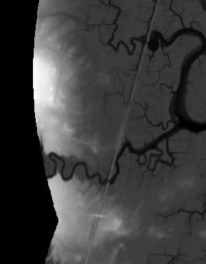
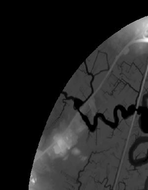
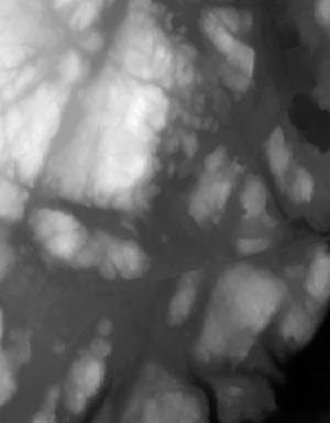
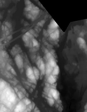