WARNING TO USERS OF THIS SYSTEM
This computer system, including all related equipment, networks, and network devices (including Internet access), is provided by the Department of the Interior (DOI) in accordance with the agency policy for official use and limited personal use.
All agency computer systems may be monitored for all lawful purposes,
including but not limited to, ensuring that use is authorized, for management of the system, to facilitate protection against unauthorized access, and to verify security procedures, survivability and operational security. Any information on this computer system may be examined, recorded, copied and used for authorized purposes at any time.
All information, including personal information, placed or sent over this system may be monitored, and users of this system are reminded that such monitoring does occur. Therefore, there should be no expectation of privacy with respect to use of this system.
By logging into this agency computer system, you acknowledge and consent to the monitoring of this system. Evidence of your use, authorized or
unauthorized, collected during monitoring may be used for civil, criminal, administrative, or other adverse action. Unauthorized or illegal use may subject you to prosecution.
 Name Last modified Size Description
![[PARENTDIR]](/icons/back.gif) Parent Directory -
Parent Directory -
![[IMG]](/icons/image2.gif) USGS_OPR_Wisconsin_2_County_Lidar_151.jpg 2022-04-21 16:38 667
USGS_OPR_Wisconsin_2_County_Lidar_683.jpg 2022-04-21 16:48 667
USGS_OPR_Wisconsin_2_County_Lidar_891.jpg 2022-04-21 16:41 667
USGS_OPR_Wisconsin_2_County_Lidar_375.jpg 2022-04-21 16:27 1.3K
USGS_OPR_Wisconsin_2_County_Lidar_492.jpg 2022-04-21 16:58 1.8K
USGS_OPR_Wisconsin_2_County_Lidar_727.jpg 2022-04-21 16:48 2.7K
USGS_OPR_Wisconsin_2_County_Lidar_684.jpg 2022-04-21 16:48 2.9K
USGS_OPR_Wisconsin_2_County_Lidar_465.jpg 2022-04-21 16:25 3.0K
USGS_OPR_Wisconsin_2_County_Lidar_637.jpg 2022-04-21 16:36 3.0K
USGS_OPR_Wisconsin_2_County_Lidar_811.jpg 2022-04-21 16:46 3.2K
USGS_OPR_Wisconsin_2_County_Lidar_137.jpg 2022-04-21 16:39 3.4K
USGS_OPR_Wisconsin_2_County_Lidar_871.jpg 2022-04-21 16:41 3.5K
USGS_OPR_Wisconsin_2_County_Lidar_589.jpg 2022-04-21 16:57 3.6K
USGS_OPR_Wisconsin_2_County_Lidar_910.jpg 2022-04-21 16:36 3.6K
USGS_OPR_Wisconsin_2_County_Lidar_619.jpg 2022-04-21 16:25 3.6K
USGS_OPR_Wisconsin_2_County_Lidar_686.jpg 2022-04-21 16:58 3.7K
USGS_OPR_Wisconsin_2_County_Lidar_21.jpg 2022-04-21 16:27 3.7K
USGS_OPR_Wisconsin_2_County_Lidar_548.jpg 2022-04-21 16:55 3.7K
USGS_OPR_Wisconsin_2_County_Lidar_595.jpg 2022-04-21 16:42 3.9K
USGS_OPR_Wisconsin_2_County_Lidar_282.jpg 2022-04-21 16:53 4.0K
USGS_OPR_Wisconsin_2_County_Lidar_18.jpg 2022-04-21 16:57 4.1K
USGS_OPR_Wisconsin_2_County_Lidar_501.jpg 2022-04-21 16:42 4.1K
USGS_OPR_Wisconsin_2_County_Lidar_663.jpg 2022-04-21 16:58 4.2K
USGS_OPR_Wisconsin_2_County_Lidar_443.jpg 2022-04-21 16:29 4.2K
USGS_OPR_Wisconsin_2_County_Lidar_616.jpg 2022-04-21 16:33 4.2K
USGS_OPR_Wisconsin_2_County_Lidar_106.jpg 2022-04-21 16:25 4.2K
USGS_OPR_Wisconsin_2_County_Lidar_504.jpg 2022-04-21 16:57 4.2K
USGS_OPR_Wisconsin_2_County_Lidar_496.jpg 2022-04-21 16:29 4.2K
USGS_OPR_Wisconsin_2_County_Lidar_909.jpg 2022-04-21 16:41 4.3K
USGS_OPR_Wisconsin_2_County_Lidar_667.jpg 2022-04-21 16:32 4.3K
USGS_OPR_Wisconsin_2_County_Lidar_225.jpg 2022-04-21 16:29 4.4K
USGS_OPR_Wisconsin_2_County_Lidar_525.jpg 2022-04-21 16:43 4.4K
USGS_OPR_Wisconsin_2_County_Lidar_601.jpg 2022-04-21 16:56 4.4K
USGS_OPR_Wisconsin_2_County_Lidar_383.jpg 2022-04-21 16:37 4.5K
USGS_OPR_Wisconsin_2_County_Lidar_892.jpg 2022-04-21 16:47 4.5K
USGS_OPR_Wisconsin_2_County_Lidar_668.jpg 2022-04-21 16:36 4.5K
USGS_OPR_Wisconsin_2_County_Lidar_499.jpg 2022-04-21 16:29 4.5K
USGS_OPR_Wisconsin_2_County_Lidar_246.jpg 2022-04-21 16:58 4.5K
USGS_OPR_Wisconsin_2_County_Lidar_48.jpg 2022-04-21 16:29 4.5K
USGS_OPR_Wisconsin_2_County_Lidar_93.jpg 2022-04-21 16:28 4.5K
USGS_OPR_Wisconsin_2_County_Lidar_77.jpg 2022-04-21 16:27 4.6K
USGS_OPR_Wisconsin_2_County_Lidar_198.jpg 2022-04-21 16:58 4.6K
USGS_OPR_Wisconsin_2_County_Lidar_890.jpg 2022-04-21 16:46 4.6K
USGS_OPR_Wisconsin_2_County_Lidar_410.jpg 2022-04-21 16:51 4.6K
USGS_OPR_Wisconsin_2_County_Lidar_495.jpg 2022-04-21 16:35 4.6K
USGS_OPR_Wisconsin_2_County_Lidar_34.jpg 2022-04-21 16:54 4.6K
USGS_OPR_Wisconsin_2_County_Lidar_645.jpg 2022-04-21 16:31 4.6K
USGS_OPR_Wisconsin_2_County_Lidar_357.jpg 2022-04-21 16:45 4.6K
USGS_OPR_Wisconsin_2_County_Lidar_851.jpg 2022-04-21 16:27 4.6K
USGS_OPR_Wisconsin_2_County_Lidar_17.jpg 2022-04-21 16:39 4.7K
USGS_OPR_Wisconsin_2_County_Lidar_574.jpg 2022-04-21 16:32 4.7K
USGS_OPR_Wisconsin_2_County_Lidar_787.jpg 2022-04-21 16:58 4.7K
USGS_OPR_Wisconsin_2_County_Lidar_68.jpg 2022-04-21 16:26 4.7K
USGS_OPR_Wisconsin_2_County_Lidar_671.jpg 2022-04-21 16:58 4.7K
USGS_OPR_Wisconsin_2_County_Lidar_440.jpg 2022-04-21 16:33 4.7K
USGS_OPR_Wisconsin_2_County_Lidar_447.jpg 2022-04-21 16:58 4.7K
USGS_OPR_Wisconsin_2_County_Lidar_552.jpg 2022-04-21 16:41 4.7K
USGS_OPR_Wisconsin_2_County_Lidar_567.jpg 2022-04-21 16:27 4.7K
USGS_OPR_Wisconsin_2_County_Lidar_390.jpg 2022-04-21 16:45 4.7K
USGS_OPR_Wisconsin_2_County_Lidar_660.jpg 2022-04-21 16:49 4.8K
USGS_OPR_Wisconsin_2_County_Lidar_517.jpg 2022-04-21 16:34 4.8K
USGS_OPR_Wisconsin_2_County_Lidar_7.jpg 2022-04-21 16:43 4.8K
USGS_OPR_Wisconsin_2_County_Lidar_472.jpg 2022-04-21 16:42 4.8K
USGS_OPR_Wisconsin_2_County_Lidar_452.jpg 2022-04-21 16:58 4.8K
USGS_OPR_Wisconsin_2_County_Lidar_670.jpg 2022-04-21 16:35 4.8K
USGS_OPR_Wisconsin_2_County_Lidar_28.jpg 2022-04-21 16:36 4.8K
USGS_OPR_Wisconsin_2_County_Lidar_502.jpg 2022-04-21 16:28 4.8K
USGS_OPR_Wisconsin_2_County_Lidar_128.jpg 2022-04-21 16:38 4.8K
USGS_OPR_Wisconsin_2_County_Lidar_159.jpg 2022-04-21 16:38 4.9K
USGS_OPR_Wisconsin_2_County_Lidar_446.jpg 2022-04-21 16:52 4.9K
USGS_OPR_Wisconsin_2_County_Lidar_822.jpg 2022-04-21 16:32 4.9K
USGS_OPR_Wisconsin_2_County_Lidar_469.jpg 2022-04-21 16:51 4.9K
USGS_OPR_Wisconsin_2_County_Lidar_572.jpg 2022-04-21 16:55 4.9K
USGS_OPR_Wisconsin_2_County_Lidar_385.jpg 2022-04-21 16:42 4.9K
USGS_OPR_Wisconsin_2_County_Lidar_618.jpg 2022-04-21 16:34 4.9K
USGS_OPR_Wisconsin_2_County_Lidar_417.jpg 2022-04-21 16:51 4.9K
USGS_OPR_Wisconsin_2_County_Lidar_414.jpg 2022-04-21 16:51 4.9K
USGS_OPR_Wisconsin_2_County_Lidar_15.jpg 2022-04-21 16:38 4.9K
USGS_OPR_Wisconsin_2_County_Lidar_455.jpg 2022-04-21 16:51 4.9K
USGS_OPR_Wisconsin_2_County_Lidar_475.jpg 2022-04-21 16:52 4.9K
USGS_OPR_Wisconsin_2_County_Lidar_474.jpg 2022-04-21 16:29 4.9K
USGS_OPR_Wisconsin_2_County_Lidar_393.jpg 2022-04-21 16:46 5.0K
USGS_OPR_Wisconsin_2_County_Lidar_255.jpg 2022-04-21 16:40 5.0K
USGS_OPR_Wisconsin_2_County_Lidar_644.jpg 2022-04-21 16:41 5.0K
USGS_OPR_Wisconsin_2_County_Lidar_344.jpg 2022-04-21 16:54 5.0K
USGS_OPR_Wisconsin_2_County_Lidar_457.jpg 2022-04-21 16:51 5.0K
USGS_OPR_Wisconsin_2_County_Lidar_500.jpg 2022-04-21 16:40 5.0K
USGS_OPR_Wisconsin_2_County_Lidar_69.jpg 2022-04-21 16:36 5.0K
USGS_OPR_Wisconsin_2_County_Lidar_11.jpg 2022-04-21 16:38 5.0K
USGS_OPR_Wisconsin_2_County_Lidar_445.jpg 2022-04-21 16:40 5.0K
USGS_OPR_Wisconsin_2_County_Lidar_314.jpg 2022-04-21 16:47 5.0K
USGS_OPR_Wisconsin_2_County_Lidar_52.jpg 2022-04-21 16:50 5.0K
USGS_OPR_Wisconsin_2_County_Lidar_468.jpg 2022-04-21 16:26 5.1K
USGS_OPR_Wisconsin_2_County_Lidar_593.jpg 2022-04-21 16:56 5.1K
USGS_OPR_Wisconsin_2_County_Lidar_283.jpg 2022-04-21 16:53 5.1K
USGS_OPR_Wisconsin_2_County_Lidar_160.jpg 2022-04-21 16:38 5.1K
USGS_OPR_Wisconsin_2_County_Lidar_571.jpg 2022-04-21 16:28 5.1K
USGS_OPR_Wisconsin_2_County_Lidar_33.jpg 2022-04-21 16:32 5.1K
USGS_OPR_Wisconsin_2_County_Lidar_763.jpg 2022-04-21 16:48 5.1K
USGS_OPR_Wisconsin_2_County_Lidar_184.jpg 2022-04-21 16:25 5.1K
USGS_OPR_Wisconsin_2_County_Lidar_747.jpg 2022-04-21 16:26 5.1K
USGS_OPR_Wisconsin_2_County_Lidar_221.jpg 2022-04-21 16:30 5.1K
USGS_OPR_Wisconsin_2_County_Lidar_503.jpg 2022-04-21 16:57 5.1K
USGS_OPR_Wisconsin_2_County_Lidar_551.jpg 2022-04-21 16:55 5.1K
USGS_OPR_Wisconsin_2_County_Lidar_695.jpg 2022-04-21 16:36 5.1K
USGS_OPR_Wisconsin_2_County_Lidar_20.jpg 2022-04-21 16:43 5.2K
USGS_OPR_Wisconsin_2_County_Lidar_862.jpg 2022-04-21 16:44 5.2K
USGS_OPR_Wisconsin_2_County_Lidar_622.jpg 2022-04-21 16:49 5.2K
USGS_OPR_Wisconsin_2_County_Lidar_138.jpg 2022-04-21 16:39 5.2K
USGS_OPR_Wisconsin_2_County_Lidar_170.jpg 2022-04-21 16:38 5.2K
USGS_OPR_Wisconsin_2_County_Lidar_387.jpg 2022-04-21 16:56 5.2K
USGS_OPR_Wisconsin_2_County_Lidar_264.jpg 2022-04-21 16:37 5.2K
USGS_OPR_Wisconsin_2_County_Lidar_353.jpg 2022-04-21 16:45 5.2K
USGS_OPR_Wisconsin_2_County_Lidar_258.jpg 2022-04-21 16:27 5.2K
USGS_OPR_Wisconsin_2_County_Lidar_623.jpg 2022-04-21 16:50 5.2K
USGS_OPR_Wisconsin_2_County_Lidar_600.jpg 2022-04-21 16:49 5.2K
USGS_OPR_Wisconsin_2_County_Lidar_229.jpg 2022-04-21 16:27 5.2K
USGS_OPR_Wisconsin_2_County_Lidar_740.jpg 2022-04-21 16:27 5.2K
USGS_OPR_Wisconsin_2_County_Lidar_325.jpg 2022-04-21 16:53 5.2K
USGS_OPR_Wisconsin_2_County_Lidar_690.jpg 2022-04-21 16:39 5.2K
USGS_OPR_Wisconsin_2_County_Lidar_627.jpg 2022-04-21 16:50 5.3K
USGS_OPR_Wisconsin_2_County_Lidar_769.jpg 2022-04-21 16:47 5.3K
USGS_OPR_Wisconsin_2_County_Lidar_471.jpg 2022-04-21 16:35 5.3K
USGS_OPR_Wisconsin_2_County_Lidar_116.jpg 2022-04-21 16:31 5.3K
USGS_OPR_Wisconsin_2_County_Lidar_624.jpg 2022-04-21 16:49 5.3K
USGS_OPR_Wisconsin_2_County_Lidar_386.jpg 2022-04-21 16:52 5.3K
USGS_OPR_Wisconsin_2_County_Lidar_230.jpg 2022-04-21 16:42 5.3K
USGS_OPR_Wisconsin_2_County_Lidar_131.jpg 2022-04-21 16:39 5.3K
USGS_OPR_Wisconsin_2_County_Lidar_444.jpg 2022-04-21 16:51 5.3K
USGS_OPR_Wisconsin_2_County_Lidar_728.jpg 2022-04-21 16:48 5.3K
USGS_OPR_Wisconsin_2_County_Lidar_54.jpg 2022-04-21 16:28 5.3K
USGS_OPR_Wisconsin_2_County_Lidar_51.jpg 2022-04-21 16:27 5.3K
USGS_OPR_Wisconsin_2_County_Lidar_185.jpg 2022-04-21 16:37 5.3K
USGS_OPR_Wisconsin_2_County_Lidar_202.jpg 2022-04-21 16:52 5.3K
USGS_OPR_Wisconsin_2_County_Lidar_219.jpg 2022-04-21 16:37 5.3K
USGS_OPR_Wisconsin_2_County_Lidar_808.jpg 2022-04-21 16:46 5.3K
USGS_OPR_Wisconsin_2_County_Lidar_689.jpg 2022-04-21 16:50 5.3K
USGS_OPR_Wisconsin_2_County_Lidar_454.jpg 2022-04-21 16:35 5.3K
USGS_OPR_Wisconsin_2_County_Lidar_749.jpg 2022-04-21 16:27 5.4K
USGS_OPR_Wisconsin_2_County_Lidar_648.jpg 2022-04-21 16:25 5.4K
USGS_OPR_Wisconsin_2_County_Lidar_166.jpg 2022-04-21 16:38 5.4K
USGS_OPR_Wisconsin_2_County_Lidar_41.jpg 2022-04-21 16:29 5.4K
USGS_OPR_Wisconsin_2_County_Lidar_576.jpg 2022-04-21 16:55 5.4K
USGS_OPR_Wisconsin_2_County_Lidar_335.jpg 2022-04-21 16:54 5.4K
USGS_OPR_Wisconsin_2_County_Lidar_231.jpg 2022-04-21 16:42 5.4K
USGS_OPR_Wisconsin_2_County_Lidar_661.jpg 2022-04-21 16:49 5.4K
USGS_OPR_Wisconsin_2_County_Lidar_719.jpg 2022-04-21 16:44 5.4K
USGS_OPR_Wisconsin_2_County_Lidar_427.jpg 2022-04-21 16:31 5.4K
USGS_OPR_Wisconsin_2_County_Lidar_359.jpg 2022-04-21 16:45 5.4K
USGS_OPR_Wisconsin_2_County_Lidar_315.jpg 2022-04-21 16:48 5.4K
USGS_OPR_Wisconsin_2_County_Lidar_885.jpg 2022-04-21 16:45 5.4K
USGS_OPR_Wisconsin_2_County_Lidar_750.jpg 2022-04-21 16:29 5.4K
USGS_OPR_Wisconsin_2_County_Lidar_397.jpg 2022-04-21 16:45 5.4K
USGS_OPR_Wisconsin_2_County_Lidar_265.jpg 2022-04-21 16:39 5.4K
USGS_OPR_Wisconsin_2_County_Lidar_50.jpg 2022-04-21 16:32 5.4K
USGS_OPR_Wisconsin_2_County_Lidar_707.jpg 2022-04-21 16:40 5.4K
USGS_OPR_Wisconsin_2_County_Lidar_549.jpg 2022-04-21 16:56 5.4K
USGS_OPR_Wisconsin_2_County_Lidar_640.jpg 2022-04-21 16:48 5.4K
USGS_OPR_Wisconsin_2_County_Lidar_477.jpg 2022-04-21 16:26 5.5K
USGS_OPR_Wisconsin_2_County_Lidar_562.jpg 2022-04-21 16:33 5.5K
USGS_OPR_Wisconsin_2_County_Lidar_514.jpg 2022-04-21 16:26 5.5K
USGS_OPR_Wisconsin_2_County_Lidar_191.jpg 2022-04-21 16:44 5.5K
USGS_OPR_Wisconsin_2_County_Lidar_718.jpg 2022-04-21 16:27 5.5K
USGS_OPR_Wisconsin_2_County_Lidar_729.jpg 2022-04-21 16:42 5.5K
USGS_OPR_Wisconsin_2_County_Lidar_647.jpg 2022-04-21 16:25 5.5K
USGS_OPR_Wisconsin_2_County_Lidar_56.jpg 2022-04-21 16:55 5.5K
USGS_OPR_Wisconsin_2_County_Lidar_129.jpg 2022-04-21 16:39 5.5K
USGS_OPR_Wisconsin_2_County_Lidar_428.jpg 2022-04-21 16:35 5.5K
USGS_OPR_Wisconsin_2_County_Lidar_321.jpg 2022-04-21 16:53 5.5K
USGS_OPR_Wisconsin_2_County_Lidar_480.jpg 2022-04-21 16:50 5.5K
USGS_OPR_Wisconsin_2_County_Lidar_278.jpg 2022-04-21 16:48 5.5K
USGS_OPR_Wisconsin_2_County_Lidar_288.jpg 2022-04-21 16:52 5.5K
USGS_OPR_Wisconsin_2_County_Lidar_766.jpg 2022-04-21 16:43 5.5K
USGS_OPR_Wisconsin_2_County_Lidar_329.jpg 2022-04-21 16:54 5.5K
USGS_OPR_Wisconsin_2_County_Lidar_263.jpg 2022-04-21 16:34 5.6K
USGS_OPR_Wisconsin_2_County_Lidar_805.jpg 2022-04-21 16:26 5.6K
USGS_OPR_Wisconsin_2_County_Lidar_521.jpg 2022-04-21 16:50 5.6K
USGS_OPR_Wisconsin_2_County_Lidar_13.jpg 2022-04-21 16:39 5.6K
USGS_OPR_Wisconsin_2_County_Lidar_153.jpg 2022-04-21 16:44 5.6K
USGS_OPR_Wisconsin_2_County_Lidar_767.jpg 2022-04-21 16:34 5.6K
USGS_OPR_Wisconsin_2_County_Lidar_285.jpg 2022-04-21 16:52 5.6K
USGS_OPR_Wisconsin_2_County_Lidar_550.jpg 2022-04-21 16:55 5.6K
USGS_OPR_Wisconsin_2_County_Lidar_351.jpg 2022-04-21 16:45 5.6K
USGS_OPR_Wisconsin_2_County_Lidar_711.jpg 2022-04-21 16:28 5.6K
USGS_OPR_Wisconsin_2_County_Lidar_643.jpg 2022-04-21 16:48 5.6K
USGS_OPR_Wisconsin_2_County_Lidar_782.jpg 2022-04-21 16:33 5.6K
USGS_OPR_Wisconsin_2_County_Lidar_420.jpg 2022-04-21 16:28 5.6K
USGS_OPR_Wisconsin_2_County_Lidar_31.jpg 2022-04-21 16:48 5.6K
USGS_OPR_Wisconsin_2_County_Lidar_206.jpg 2022-04-21 16:34 5.6K
USGS_OPR_Wisconsin_2_County_Lidar_450.jpg 2022-04-21 16:31 5.6K
USGS_OPR_Wisconsin_2_County_Lidar_223.jpg 2022-04-21 16:40 5.6K
USGS_OPR_Wisconsin_2_County_Lidar_63.jpg 2022-04-21 16:31 5.6K
USGS_OPR_Wisconsin_2_County_Lidar_762.jpg 2022-04-21 16:47 5.6K
USGS_OPR_Wisconsin_2_County_Lidar_72.jpg 2022-04-21 16:33 5.6K
USGS_OPR_Wisconsin_2_County_Lidar_705.jpg 2022-04-21 16:27 5.6K
USGS_OPR_Wisconsin_2_County_Lidar_286.jpg 2022-04-21 16:25 5.6K
USGS_OPR_Wisconsin_2_County_Lidar_422.jpg 2022-04-21 16:28 5.6K
USGS_OPR_Wisconsin_2_County_Lidar_682.jpg 2022-04-21 16:48 5.6K
USGS_OPR_Wisconsin_2_County_Lidar_256.jpg 2022-04-21 16:52 5.6K
USGS_OPR_Wisconsin_2_County_Lidar_281.jpg 2022-04-21 16:37 5.6K
USGS_OPR_Wisconsin_2_County_Lidar_326.jpg 2022-04-21 16:54 5.7K
USGS_OPR_Wisconsin_2_County_Lidar_696.jpg 2022-04-21 16:49 5.7K
USGS_OPR_Wisconsin_2_County_Lidar_898.jpg 2022-04-21 16:47 5.7K
USGS_OPR_Wisconsin_2_County_Lidar_209.jpg 2022-04-21 16:52 5.7K
USGS_OPR_Wisconsin_2_County_Lidar_712.jpg 2022-04-21 16:43 5.7K
USGS_OPR_Wisconsin_2_County_Lidar_649.jpg 2022-04-21 16:48 5.7K
USGS_OPR_Wisconsin_2_County_Lidar_470.jpg 2022-04-21 16:29 5.7K
USGS_OPR_Wisconsin_2_County_Lidar_426.jpg 2022-04-21 16:31 5.7K
USGS_OPR_Wisconsin_2_County_Lidar_98.jpg 2022-04-21 16:27 5.7K
USGS_OPR_Wisconsin_2_County_Lidar_603.jpg 2022-04-21 16:56 5.7K
USGS_OPR_Wisconsin_2_County_Lidar_527.jpg 2022-04-21 16:30 5.7K
USGS_OPR_Wisconsin_2_County_Lidar_168.jpg 2022-04-21 16:33 5.7K
USGS_OPR_Wisconsin_2_County_Lidar_669.jpg 2022-04-21 16:40 5.7K
USGS_OPR_Wisconsin_2_County_Lidar_765.jpg 2022-04-21 16:47 5.7K
USGS_OPR_Wisconsin_2_County_Lidar_192.jpg 2022-04-21 16:38 5.7K
USGS_OPR_Wisconsin_2_County_Lidar_327.jpg 2022-04-21 16:54 5.7K
USGS_OPR_Wisconsin_2_County_Lidar_409.jpg 2022-04-21 16:32 5.7K
USGS_OPR_Wisconsin_2_County_Lidar_529.jpg 2022-04-21 16:50 5.7K
USGS_OPR_Wisconsin_2_County_Lidar_350.jpg 2022-04-21 16:45 5.7K
USGS_OPR_Wisconsin_2_County_Lidar_786.jpg 2022-04-21 16:31 5.7K
USGS_OPR_Wisconsin_2_County_Lidar_328.jpg 2022-04-21 16:54 5.7K
USGS_OPR_Wisconsin_2_County_Lidar_169.jpg 2022-04-21 16:44 5.7K
USGS_OPR_Wisconsin_2_County_Lidar_666.jpg 2022-04-21 16:49 5.7K
USGS_OPR_Wisconsin_2_County_Lidar_577.jpg 2022-04-21 16:55 5.8K
USGS_OPR_Wisconsin_2_County_Lidar_167.jpg 2022-04-21 16:58 5.8K
USGS_OPR_Wisconsin_2_County_Lidar_324.jpg 2022-04-21 16:53 5.8K
USGS_OPR_Wisconsin_2_County_Lidar_722.jpg 2022-04-21 16:48 5.8K
USGS_OPR_Wisconsin_2_County_Lidar_702.jpg 2022-04-21 16:31 5.8K
USGS_OPR_Wisconsin_2_County_Lidar_19.jpg 2022-04-21 16:38 5.8K
USGS_OPR_Wisconsin_2_County_Lidar_360.jpg 2022-04-21 16:54 5.8K
USGS_OPR_Wisconsin_2_County_Lidar_897.jpg 2022-04-21 16:47 5.8K
USGS_OPR_Wisconsin_2_County_Lidar_217.jpg 2022-04-21 16:33 5.8K
USGS_OPR_Wisconsin_2_County_Lidar_16.jpg 2022-04-21 16:38 5.8K
USGS_OPR_Wisconsin_2_County_Lidar_242.jpg 2022-04-21 16:37 5.8K
USGS_OPR_Wisconsin_2_County_Lidar_742.jpg 2022-04-21 16:43 5.8K
USGS_OPR_Wisconsin_2_County_Lidar_320.jpg 2022-04-21 16:53 5.8K
USGS_OPR_Wisconsin_2_County_Lidar_388.jpg 2022-04-21 16:42 5.8K
USGS_OPR_Wisconsin_2_County_Lidar_592.jpg 2022-04-21 16:56 5.8K
USGS_OPR_Wisconsin_2_County_Lidar_216.jpg 2022-04-21 16:27 5.8K
USGS_OPR_Wisconsin_2_County_Lidar_307.jpg 2022-04-21 16:35 5.8K
USGS_OPR_Wisconsin_2_County_Lidar_270.jpg 2022-04-21 16:27 5.8K
USGS_OPR_Wisconsin_2_County_Lidar_6.jpg 2022-04-21 16:48 5.8K
USGS_OPR_Wisconsin_2_County_Lidar_35.jpg 2022-04-21 16:28 5.8K
USGS_OPR_Wisconsin_2_County_Lidar_251.jpg 2022-04-21 16:30 5.8K
USGS_OPR_Wisconsin_2_County_Lidar_363.jpg 2022-04-21 16:26 5.8K
USGS_OPR_Wisconsin_2_County_Lidar_376.jpg 2022-04-21 16:29 5.8K
USGS_OPR_Wisconsin_2_County_Lidar_12.jpg 2022-04-21 16:38 5.8K
USGS_OPR_Wisconsin_2_County_Lidar_889.jpg 2022-04-21 16:45 5.9K
USGS_OPR_Wisconsin_2_County_Lidar_29.jpg 2022-04-21 16:27 5.9K
USGS_OPR_Wisconsin_2_County_Lidar_561.jpg 2022-04-21 16:50 5.9K
USGS_OPR_Wisconsin_2_County_Lidar_269.jpg 2022-04-21 16:42 5.9K
USGS_OPR_Wisconsin_2_County_Lidar_621.jpg 2022-04-21 16:49 5.9K
USGS_OPR_Wisconsin_2_County_Lidar_894.jpg 2022-04-21 16:46 5.9K
USGS_OPR_Wisconsin_2_County_Lidar_394.jpg 2022-04-21 16:45 5.9K
USGS_OPR_Wisconsin_2_County_Lidar_505.jpg 2022-04-21 16:35 5.9K
USGS_OPR_Wisconsin_2_County_Lidar_250.jpg 2022-04-21 16:37 5.9K
USGS_OPR_Wisconsin_2_County_Lidar_901.jpg 2022-04-21 16:30 5.9K
USGS_OPR_Wisconsin_2_County_Lidar_692.jpg 2022-04-21 16:43 5.9K
USGS_OPR_Wisconsin_2_County_Lidar_356.jpg 2022-04-21 16:30 5.9K
USGS_OPR_Wisconsin_2_County_Lidar_615.jpg 2022-04-21 16:36 5.9K
USGS_OPR_Wisconsin_2_County_Lidar_795.jpg 2022-04-21 16:28 5.9K
USGS_OPR_Wisconsin_2_County_Lidar_372.jpg 2022-04-21 16:30 5.9K
USGS_OPR_Wisconsin_2_County_Lidar_491.jpg 2022-04-21 16:36 5.9K
USGS_OPR_Wisconsin_2_County_Lidar_724.jpg 2022-04-21 16:57 5.9K
USGS_OPR_Wisconsin_2_County_Lidar_424.jpg 2022-04-21 16:52 5.9K
USGS_OPR_Wisconsin_2_County_Lidar_478.jpg 2022-04-21 16:51 5.9K
USGS_OPR_Wisconsin_2_County_Lidar_895.jpg 2022-04-21 16:47 5.9K
USGS_OPR_Wisconsin_2_County_Lidar_14.jpg 2022-04-21 16:57 5.9K
USGS_OPR_Wisconsin_2_County_Lidar_42.jpg 2022-04-21 16:30 5.9K
USGS_OPR_Wisconsin_2_County_Lidar_809.jpg 2022-04-21 16:33 5.9K
USGS_OPR_Wisconsin_2_County_Lidar_526.jpg 2022-04-21 16:35 5.9K
USGS_OPR_Wisconsin_2_County_Lidar_448.jpg 2022-04-21 16:51 5.9K
USGS_OPR_Wisconsin_2_County_Lidar_312.jpg 2022-04-21 16:56 5.9K
USGS_OPR_Wisconsin_2_County_Lidar_38.jpg 2022-04-21 16:42 5.9K
USGS_OPR_Wisconsin_2_County_Lidar_613.jpg 2022-04-21 16:28 5.9K
USGS_OPR_Wisconsin_2_County_Lidar_814.jpg 2022-04-21 16:47 5.9K
USGS_OPR_Wisconsin_2_County_Lidar_30.jpg 2022-04-21 16:42 5.9K
USGS_OPR_Wisconsin_2_County_Lidar_655.jpg 2022-04-21 16:49 6.0K
USGS_OPR_Wisconsin_2_County_Lidar_39.jpg 2022-04-21 16:57 6.0K
USGS_OPR_Wisconsin_2_County_Lidar_781.jpg 2022-04-21 16:43 6.0K
USGS_OPR_Wisconsin_2_County_Lidar_83.jpg 2022-04-21 16:41 6.0K
USGS_OPR_Wisconsin_2_County_Lidar_743.jpg 2022-04-21 16:43 6.0K
USGS_OPR_Wisconsin_2_County_Lidar_872.jpg 2022-04-21 16:41 6.0K
USGS_OPR_Wisconsin_2_County_Lidar_123.jpg 2022-04-21 16:38 6.0K
USGS_OPR_Wisconsin_2_County_Lidar_674.jpg 2022-04-21 16:35 6.0K
USGS_OPR_Wisconsin_2_County_Lidar_569.jpg 2022-04-21 16:55 6.0K
USGS_OPR_Wisconsin_2_County_Lidar_509.jpg 2022-04-21 16:31 6.0K
USGS_OPR_Wisconsin_2_County_Lidar_62.jpg 2022-04-21 16:36 6.0K
USGS_OPR_Wisconsin_2_County_Lidar_556.jpg 2022-04-21 16:55 6.0K
USGS_OPR_Wisconsin_2_County_Lidar_528.jpg 2022-04-21 16:25 6.0K
USGS_OPR_Wisconsin_2_County_Lidar_90.jpg 2022-04-21 16:37 6.0K
USGS_OPR_Wisconsin_2_County_Lidar_165.jpg 2022-04-21 16:39 6.0K
USGS_OPR_Wisconsin_2_County_Lidar_659.jpg 2022-04-21 16:57 6.0K
USGS_OPR_Wisconsin_2_County_Lidar_507.jpg 2022-04-21 16:40 6.0K
USGS_OPR_Wisconsin_2_County_Lidar_257.jpg 2022-04-21 16:57 6.0K
USGS_OPR_Wisconsin_2_County_Lidar_591.jpg 2022-04-21 16:56 6.0K
USGS_OPR_Wisconsin_2_County_Lidar_419.jpg 2022-04-21 16:31 6.0K
USGS_OPR_Wisconsin_2_County_Lidar_834.jpg 2022-04-21 16:41 6.0K
USGS_OPR_Wisconsin_2_County_Lidar_233.jpg 2022-04-21 16:29 6.0K
USGS_OPR_Wisconsin_2_County_Lidar_92.jpg 2022-04-21 16:30 6.0K
USGS_OPR_Wisconsin_2_County_Lidar_261.jpg 2022-04-21 16:25 6.0K
USGS_OPR_Wisconsin_2_County_Lidar_788.jpg 2022-04-21 16:26 6.0K
USGS_OPR_Wisconsin_2_County_Lidar_294.jpg 2022-04-21 16:53 6.0K
USGS_OPR_Wisconsin_2_County_Lidar_177.jpg 2022-04-21 16:39 6.0K
USGS_OPR_Wisconsin_2_County_Lidar_55.jpg 2022-04-21 16:26 6.0K
USGS_OPR_Wisconsin_2_County_Lidar_395.jpg 2022-04-21 16:45 6.0K
USGS_OPR_Wisconsin_2_County_Lidar_650.jpg 2022-04-21 16:32 6.0K
USGS_OPR_Wisconsin_2_County_Lidar_136.jpg 2022-04-21 16:44 6.1K
USGS_OPR_Wisconsin_2_County_Lidar_841.jpg 2022-04-21 16:34 6.1K
USGS_OPR_Wisconsin_2_County_Lidar_553.jpg 2022-04-21 16:32 6.1K
USGS_OPR_Wisconsin_2_County_Lidar_651.jpg 2022-04-21 16:36 6.1K
USGS_OPR_Wisconsin_2_County_Lidar_189.jpg 2022-04-21 16:37 6.1K
USGS_OPR_Wisconsin_2_County_Lidar_680.jpg 2022-04-21 16:50 6.1K
USGS_OPR_Wisconsin_2_County_Lidar_389.jpg 2022-04-21 16:37 6.1K
USGS_OPR_Wisconsin_2_County_Lidar_76.jpg 2022-04-21 16:31 6.1K
USGS_OPR_Wisconsin_2_County_Lidar_284.jpg 2022-04-21 16:27 6.1K
USGS_OPR_Wisconsin_2_County_Lidar_157.jpg 2022-04-21 16:26 6.1K
USGS_OPR_Wisconsin_2_County_Lidar_456.jpg 2022-04-21 16:27 6.1K
USGS_OPR_Wisconsin_2_County_Lidar_665.jpg 2022-04-21 16:31 6.1K
USGS_OPR_Wisconsin_2_County_Lidar_9.jpg 2022-04-21 16:34 6.1K
USGS_OPR_Wisconsin_2_County_Lidar_84.jpg 2022-04-21 16:47 6.1K
USGS_OPR_Wisconsin_2_County_Lidar_476.jpg 2022-04-21 16:27 6.1K
USGS_OPR_Wisconsin_2_County_Lidar_121.jpg 2022-04-21 16:38 6.1K
USGS_OPR_Wisconsin_2_County_Lidar_798.jpg 2022-04-21 16:30 6.1K
USGS_OPR_Wisconsin_2_County_Lidar_541.jpg 2022-04-21 16:34 6.1K
USGS_OPR_Wisconsin_2_County_Lidar_262.jpg 2022-04-21 16:58 6.1K
USGS_OPR_Wisconsin_2_County_Lidar_524.jpg 2022-04-21 16:32 6.1K
USGS_OPR_Wisconsin_2_County_Lidar_780.jpg 2022-04-21 16:28 6.1K
USGS_OPR_Wisconsin_2_County_Lidar_49.jpg 2022-04-21 16:33 6.1K
USGS_OPR_Wisconsin_2_County_Lidar_842.jpg 2022-04-21 16:47 6.2K
USGS_OPR_Wisconsin_2_County_Lidar_760.jpg 2022-04-21 16:29 6.2K
USGS_OPR_Wisconsin_2_County_Lidar_268.jpg 2022-04-21 16:57 6.2K
USGS_OPR_Wisconsin_2_County_Lidar_27.jpg 2022-04-21 16:37 6.2K
USGS_OPR_Wisconsin_2_County_Lidar_299.jpg 2022-04-21 16:53 6.2K
USGS_OPR_Wisconsin_2_County_Lidar_745.jpg 2022-04-21 16:30 6.2K
USGS_OPR_Wisconsin_2_County_Lidar_194.jpg 2022-04-21 16:38 6.2K
USGS_OPR_Wisconsin_2_County_Lidar_797.jpg 2022-04-21 16:33 6.2K
USGS_OPR_Wisconsin_2_County_Lidar_306.jpg 2022-04-21 16:53 6.2K
USGS_OPR_Wisconsin_2_County_Lidar_631.jpg 2022-04-21 16:36 6.2K
USGS_OPR_Wisconsin_2_County_Lidar_746.jpg 2022-04-21 16:26 6.2K
USGS_OPR_Wisconsin_2_County_Lidar_295.jpg 2022-04-21 16:34 6.2K
USGS_OPR_Wisconsin_2_County_Lidar_485.jpg 2022-04-21 16:50 6.2K
USGS_OPR_Wisconsin_2_County_Lidar_554.jpg 2022-04-21 16:36 6.2K
USGS_OPR_Wisconsin_2_County_Lidar_156.jpg 2022-04-21 16:44 6.2K
USGS_OPR_Wisconsin_2_County_Lidar_861.jpg 2022-04-21 16:47 6.2K
USGS_OPR_Wisconsin_2_County_Lidar_536.jpg 2022-04-21 16:54 6.2K
USGS_OPR_Wisconsin_2_County_Lidar_865.jpg 2022-04-21 16:33 6.2K
USGS_OPR_Wisconsin_2_County_Lidar_883.jpg 2022-04-21 16:45 6.2K
USGS_OPR_Wisconsin_2_County_Lidar_290.jpg 2022-04-21 16:32 6.2K
USGS_OPR_Wisconsin_2_County_Lidar_544.jpg 2022-04-21 16:32 6.2K
USGS_OPR_Wisconsin_2_County_Lidar_361.jpg 2022-04-21 16:54 6.2K
USGS_OPR_Wisconsin_2_County_Lidar_902.jpg 2022-04-21 16:32 6.2K
USGS_OPR_Wisconsin_2_County_Lidar_847.jpg 2022-04-21 16:46 6.2K
USGS_OPR_Wisconsin_2_County_Lidar_513.jpg 2022-04-21 16:37 6.2K
USGS_OPR_Wisconsin_2_County_Lidar_118.jpg 2022-04-21 16:38 6.2K
USGS_OPR_Wisconsin_2_County_Lidar_869.jpg 2022-04-21 16:44 6.2K
USGS_OPR_Wisconsin_2_County_Lidar_249.jpg 2022-04-21 16:30 6.2K
USGS_OPR_Wisconsin_2_County_Lidar_578.jpg 2022-04-21 16:39 6.2K
USGS_OPR_Wisconsin_2_County_Lidar_658.jpg 2022-04-21 16:33 6.3K
USGS_OPR_Wisconsin_2_County_Lidar_296.jpg 2022-04-21 16:25 6.3K
USGS_OPR_Wisconsin_2_County_Lidar_796.jpg 2022-04-21 16:26 6.3K
USGS_OPR_Wisconsin_2_County_Lidar_304.jpg 2022-04-21 16:31 6.3K
USGS_OPR_Wisconsin_2_County_Lidar_793.jpg 2022-04-21 16:56 6.3K
USGS_OPR_Wisconsin_2_County_Lidar_874.jpg 2022-04-21 16:41 6.3K
USGS_OPR_Wisconsin_2_County_Lidar_754.jpg 2022-04-21 16:28 6.3K
USGS_OPR_Wisconsin_2_County_Lidar_770.jpg 2022-04-21 16:29 6.3K
USGS_OPR_Wisconsin_2_County_Lidar_439.jpg 2022-04-21 16:52 6.3K
USGS_OPR_Wisconsin_2_County_Lidar_590.jpg 2022-04-21 16:32 6.3K
USGS_OPR_Wisconsin_2_County_Lidar_40.jpg 2022-04-21 16:57 6.3K
USGS_OPR_Wisconsin_2_County_Lidar_564.jpg 2022-04-21 16:26 6.3K
USGS_OPR_Wisconsin_2_County_Lidar_112.jpg 2022-04-21 16:30 6.3K
USGS_OPR_Wisconsin_2_County_Lidar_245.jpg 2022-04-21 16:32 6.3K
USGS_OPR_Wisconsin_2_County_Lidar_117.jpg 2022-04-21 16:53 6.3K
USGS_OPR_Wisconsin_2_County_Lidar_384.jpg 2022-04-21 16:25 6.3K
USGS_OPR_Wisconsin_2_County_Lidar_135.jpg 2022-04-21 16:44 6.3K
USGS_OPR_Wisconsin_2_County_Lidar_791.jpg 2022-04-21 16:43 6.3K
USGS_OPR_Wisconsin_2_County_Lidar_887.jpg 2022-04-21 16:45 6.3K
USGS_OPR_Wisconsin_2_County_Lidar_199.jpg 2022-04-21 16:38 6.3K
USGS_OPR_Wisconsin_2_County_Lidar_881.jpg 2022-04-21 16:45 6.3K
USGS_OPR_Wisconsin_2_County_Lidar_904.jpg 2022-04-21 16:29 6.3K
USGS_OPR_Wisconsin_2_County_Lidar_10.jpg 2022-04-21 16:33 6.3K
USGS_OPR_Wisconsin_2_County_Lidar_473.jpg 2022-04-21 16:28 6.3K
USGS_OPR_Wisconsin_2_County_Lidar_80.jpg 2022-04-21 16:46 6.3K
USGS_OPR_Wisconsin_2_County_Lidar_657.jpg 2022-04-21 16:32 6.3K
USGS_OPR_Wisconsin_2_County_Lidar_802.jpg 2022-04-21 16:42 6.3K
USGS_OPR_Wisconsin_2_County_Lidar_234.jpg 2022-04-21 16:50 6.3K
USGS_OPR_Wisconsin_2_County_Lidar_200.jpg 2022-04-21 16:29 6.3K
USGS_OPR_Wisconsin_2_County_Lidar_568.jpg 2022-04-21 16:55 6.4K
USGS_OPR_Wisconsin_2_County_Lidar_91.jpg 2022-04-21 16:34 6.4K
USGS_OPR_Wisconsin_2_County_Lidar_183.jpg 2022-04-21 16:44 6.4K
USGS_OPR_Wisconsin_2_County_Lidar_882.jpg 2022-04-21 16:57 6.4K
USGS_OPR_Wisconsin_2_County_Lidar_362.jpg 2022-04-21 16:32 6.4K
USGS_OPR_Wisconsin_2_County_Lidar_358.jpg 2022-04-21 16:45 6.4K
USGS_OPR_Wisconsin_2_County_Lidar_783.jpg 2022-04-21 16:30 6.4K
USGS_OPR_Wisconsin_2_County_Lidar_145.jpg 2022-04-21 16:37 6.4K
USGS_OPR_Wisconsin_2_County_Lidar_370.jpg 2022-04-21 16:27 6.4K
USGS_OPR_Wisconsin_2_County_Lidar_287.jpg 2022-04-21 16:30 6.4K
USGS_OPR_Wisconsin_2_County_Lidar_352.jpg 2022-04-21 16:45 6.4K
USGS_OPR_Wisconsin_2_County_Lidar_331.jpg 2022-04-21 16:54 6.4K
USGS_OPR_Wisconsin_2_County_Lidar_416.jpg 2022-04-21 16:33 6.4K
USGS_OPR_Wisconsin_2_County_Lidar_700.jpg 2022-04-21 16:34 6.4K
USGS_OPR_Wisconsin_2_County_Lidar_158.jpg 2022-04-21 16:44 6.4K
USGS_OPR_Wisconsin_2_County_Lidar_819.jpg 2022-04-21 16:47 6.4K
USGS_OPR_Wisconsin_2_County_Lidar_171.jpg 2022-04-21 16:38 6.4K
USGS_OPR_Wisconsin_2_County_Lidar_481.jpg 2022-04-21 16:50 6.4K
USGS_OPR_Wisconsin_2_County_Lidar_691.jpg 2022-04-21 16:49 6.4K
USGS_OPR_Wisconsin_2_County_Lidar_563.jpg 2022-04-21 16:50 6.4K
USGS_OPR_Wisconsin_2_County_Lidar_713.jpg 2022-04-21 16:28 6.4K
USGS_OPR_Wisconsin_2_County_Lidar_880.jpg 2022-04-21 16:45 6.4K
USGS_OPR_Wisconsin_2_County_Lidar_441.jpg 2022-04-21 16:50 6.4K
USGS_OPR_Wisconsin_2_County_Lidar_271.jpg 2022-04-21 16:48 6.4K
USGS_OPR_Wisconsin_2_County_Lidar_2.jpg 2022-04-21 16:32 6.4K
USGS_OPR_Wisconsin_2_County_Lidar_218.jpg 2022-04-21 16:26 6.4K
USGS_OPR_Wisconsin_2_County_Lidar_785.jpg 2022-04-21 16:43 6.4K
USGS_OPR_Wisconsin_2_County_Lidar_415.jpg 2022-04-21 16:26 6.5K
USGS_OPR_Wisconsin_2_County_Lidar_115.jpg 2022-04-21 16:40 6.5K
USGS_OPR_Wisconsin_2_County_Lidar_89.jpg 2022-04-21 16:46 6.5K
USGS_OPR_Wisconsin_2_County_Lidar_308.jpg 2022-04-21 16:53 6.5K
USGS_OPR_Wisconsin_2_County_Lidar_570.jpg 2022-04-21 16:58 6.5K
USGS_OPR_Wisconsin_2_County_Lidar_836.jpg 2022-04-21 16:46 6.5K
USGS_OPR_Wisconsin_2_County_Lidar_755.jpg 2022-04-21 16:30 6.5K
USGS_OPR_Wisconsin_2_County_Lidar_337.jpg 2022-04-21 16:54 6.5K
USGS_OPR_Wisconsin_2_County_Lidar_818.jpg 2022-04-21 16:30 6.5K
USGS_OPR_Wisconsin_2_County_Lidar_679.jpg 2022-04-21 16:26 6.5K
USGS_OPR_Wisconsin_2_County_Lidar_575.jpg 2022-04-21 16:33 6.5K
USGS_OPR_Wisconsin_2_County_Lidar_47.jpg 2022-04-21 16:27 6.5K
USGS_OPR_Wisconsin_2_County_Lidar_530.jpg 2022-04-21 16:26 6.5K
USGS_OPR_Wisconsin_2_County_Lidar_8.jpg 2022-04-21 16:31 6.5K
USGS_OPR_Wisconsin_2_County_Lidar_140.jpg 2022-04-21 16:37 6.5K
USGS_OPR_Wisconsin_2_County_Lidar_413.jpg 2022-04-21 16:32 6.5K
USGS_OPR_Wisconsin_2_County_Lidar_487.jpg 2022-04-21 16:51 6.5K
USGS_OPR_Wisconsin_2_County_Lidar_75.jpg 2022-04-21 16:28 6.5K
USGS_OPR_Wisconsin_2_County_Lidar_332.jpg 2022-04-21 16:54 6.5K
USGS_OPR_Wisconsin_2_County_Lidar_479.jpg 2022-04-21 16:51 6.5K
USGS_OPR_Wisconsin_2_County_Lidar_596.jpg 2022-04-21 16:26 6.5K
USGS_OPR_Wisconsin_2_County_Lidar_382.jpg 2022-04-21 16:28 6.5K
USGS_OPR_Wisconsin_2_County_Lidar_449.jpg 2022-04-21 16:51 6.6K
USGS_OPR_Wisconsin_2_County_Lidar_364.jpg 2022-04-21 16:39 6.6K
USGS_OPR_Wisconsin_2_County_Lidar_309.jpg 2022-04-21 16:53 6.6K
USGS_OPR_Wisconsin_2_County_Lidar_400.jpg 2022-04-21 16:58 6.6K
USGS_OPR_Wisconsin_2_County_Lidar_95.jpg 2022-04-21 16:37 6.6K
USGS_OPR_Wisconsin_2_County_Lidar_377.jpg 2022-04-21 16:36 6.6K
USGS_OPR_Wisconsin_2_County_Lidar_66.jpg 2022-04-21 16:49 6.6K
USGS_OPR_Wisconsin_2_County_Lidar_483.jpg 2022-04-21 16:27 6.6K
USGS_OPR_Wisconsin_2_County_Lidar_833.jpg 2022-04-21 16:41 6.6K
USGS_OPR_Wisconsin_2_County_Lidar_143.jpg 2022-04-21 16:44 6.6K
USGS_OPR_Wisconsin_2_County_Lidar_43.jpg 2022-04-21 16:35 6.6K
USGS_OPR_Wisconsin_2_County_Lidar_694.jpg 2022-04-21 16:49 6.6K
USGS_OPR_Wisconsin_2_County_Lidar_204.jpg 2022-04-21 16:52 6.6K
USGS_OPR_Wisconsin_2_County_Lidar_598.jpg 2022-04-21 16:56 6.6K
USGS_OPR_Wisconsin_2_County_Lidar_757.jpg 2022-04-21 16:33 6.6K
USGS_OPR_Wisconsin_2_County_Lidar_629.jpg 2022-04-21 16:30 6.6K
USGS_OPR_Wisconsin_2_County_Lidar_318.jpg 2022-04-21 16:53 6.6K
USGS_OPR_Wisconsin_2_County_Lidar_675.jpg 2022-04-21 16:31 6.6K
USGS_OPR_Wisconsin_2_County_Lidar_186.jpg 2022-04-21 16:37 6.6K
USGS_OPR_Wisconsin_2_County_Lidar_646.jpg 2022-04-21 16:25 6.7K
USGS_OPR_Wisconsin_2_County_Lidar_723.jpg 2022-04-21 16:28 6.7K
USGS_OPR_Wisconsin_2_County_Lidar_201.jpg 2022-04-21 16:29 6.7K
USGS_OPR_Wisconsin_2_County_Lidar_522.jpg 2022-04-21 16:35 6.7K
USGS_OPR_Wisconsin_2_County_Lidar_810.jpg 2022-04-21 16:26 6.7K
USGS_OPR_Wisconsin_2_County_Lidar_274.jpg 2022-04-21 16:48 6.7K
USGS_OPR_Wisconsin_2_County_Lidar_566.jpg 2022-04-21 16:33 6.7K
USGS_OPR_Wisconsin_2_County_Lidar_815.jpg 2022-04-21 16:31 6.7K
USGS_OPR_Wisconsin_2_County_Lidar_380.jpg 2022-04-21 16:32 6.7K
USGS_OPR_Wisconsin_2_County_Lidar_300.jpg 2022-04-21 16:42 6.7K
USGS_OPR_Wisconsin_2_County_Lidar_771.jpg 2022-04-21 16:29 6.7K
USGS_OPR_Wisconsin_2_County_Lidar_442.jpg 2022-04-21 16:50 6.7K
USGS_OPR_Wisconsin_2_County_Lidar_111.jpg 2022-04-21 16:52 6.7K
USGS_OPR_Wisconsin_2_County_Lidar_761.jpg 2022-04-21 16:25 6.7K
USGS_OPR_Wisconsin_2_County_Lidar_266.jpg 2022-04-21 16:27 6.7K
USGS_OPR_Wisconsin_2_County_Lidar_888.jpg 2022-04-21 16:47 6.7K
USGS_OPR_Wisconsin_2_County_Lidar_313.jpg 2022-04-21 16:53 6.7K
USGS_OPR_Wisconsin_2_County_Lidar_803.jpg 2022-04-21 16:46 6.7K
USGS_OPR_Wisconsin_2_County_Lidar_697.jpg 2022-04-21 16:49 6.7K
USGS_OPR_Wisconsin_2_County_Lidar_775.jpg 2022-04-21 16:51 6.7K
USGS_OPR_Wisconsin_2_County_Lidar_237.jpg 2022-04-21 16:50 6.7K
USGS_OPR_Wisconsin_2_County_Lidar_817.jpg 2022-04-21 16:28 6.7K
USGS_OPR_Wisconsin_2_County_Lidar_104.jpg 2022-04-21 16:38 6.8K
USGS_OPR_Wisconsin_2_County_Lidar_203.jpg 2022-04-21 16:27 6.8K
USGS_OPR_Wisconsin_2_County_Lidar_436.jpg 2022-04-21 16:34 6.8K
USGS_OPR_Wisconsin_2_County_Lidar_330.jpg 2022-04-21 16:54 6.8K
USGS_OPR_Wisconsin_2_County_Lidar_127.jpg 2022-04-21 16:53 6.8K
USGS_OPR_Wisconsin_2_County_Lidar_396.jpg 2022-04-21 16:45 6.8K
USGS_OPR_Wisconsin_2_County_Lidar_291.jpg 2022-04-21 16:28 6.8K
USGS_OPR_Wisconsin_2_County_Lidar_391.jpg 2022-04-21 16:45 6.8K
USGS_OPR_Wisconsin_2_County_Lidar_82.jpg 2022-04-21 16:31 6.8K
USGS_OPR_Wisconsin_2_County_Lidar_884.jpg 2022-04-21 16:45 6.8K
USGS_OPR_Wisconsin_2_County_Lidar_175.jpg 2022-04-21 16:44 6.8K
USGS_OPR_Wisconsin_2_County_Lidar_365.jpg 2022-04-21 16:26 6.8K
USGS_OPR_Wisconsin_2_County_Lidar_555.jpg 2022-04-21 16:55 6.8K
USGS_OPR_Wisconsin_2_County_Lidar_878.jpg 2022-04-21 16:46 6.8K
USGS_OPR_Wisconsin_2_County_Lidar_664.jpg 2022-04-21 16:50 6.8K
USGS_OPR_Wisconsin_2_County_Lidar_907.jpg 2022-04-21 16:32 6.8K
USGS_OPR_Wisconsin_2_County_Lidar_831.jpg 2022-04-21 16:58 6.8K
USGS_OPR_Wisconsin_2_County_Lidar_142.jpg 2022-04-21 16:44 6.8K
USGS_OPR_Wisconsin_2_County_Lidar_134.jpg 2022-04-21 16:38 6.8K
USGS_OPR_Wisconsin_2_County_Lidar_709.jpg 2022-04-21 16:43 6.8K
USGS_OPR_Wisconsin_2_County_Lidar_155.jpg 2022-04-21 16:38 6.8K
USGS_OPR_Wisconsin_2_County_Lidar_725.jpg 2022-04-21 16:43 6.8K
USGS_OPR_Wisconsin_2_County_Lidar_74.jpg 2022-04-21 16:30 6.8K
USGS_OPR_Wisconsin_2_County_Lidar_316.jpg 2022-04-21 16:48 6.8K
USGS_OPR_Wisconsin_2_County_Lidar_807.jpg 2022-04-21 16:46 6.9K
USGS_OPR_Wisconsin_2_County_Lidar_97.jpg 2022-04-21 16:32 6.9K
USGS_OPR_Wisconsin_2_County_Lidar_418.jpg 2022-04-21 16:29 6.9K
USGS_OPR_Wisconsin_2_County_Lidar_855.jpg 2022-04-21 16:41 6.9K
USGS_OPR_Wisconsin_2_County_Lidar_573.jpg 2022-04-21 16:29 6.9K
USGS_OPR_Wisconsin_2_County_Lidar_875.jpg 2022-04-21 16:47 6.9K
USGS_OPR_Wisconsin_2_County_Lidar_323.jpg 2022-04-21 16:53 6.9K
USGS_OPR_Wisconsin_2_County_Lidar_804.jpg 2022-04-21 16:46 6.9K
USGS_OPR_Wisconsin_2_County_Lidar_182.jpg 2022-04-21 16:44 6.9K
USGS_OPR_Wisconsin_2_County_Lidar_685.jpg 2022-04-21 16:50 6.9K
USGS_OPR_Wisconsin_2_County_Lidar_832.jpg 2022-04-21 16:47 6.9K
USGS_OPR_Wisconsin_2_County_Lidar_70.jpg 2022-04-21 16:43 6.9K
USGS_OPR_Wisconsin_2_County_Lidar_162.jpg 2022-04-21 16:44 6.9K
USGS_OPR_Wisconsin_2_County_Lidar_319.jpg 2022-04-21 16:47 6.9K
USGS_OPR_Wisconsin_2_County_Lidar_105.jpg 2022-04-21 16:40 6.9K
USGS_OPR_Wisconsin_2_County_Lidar_113.jpg 2022-04-21 16:38 6.9K
USGS_OPR_Wisconsin_2_County_Lidar_293.jpg 2022-04-21 16:53 6.9K
USGS_OPR_Wisconsin_2_County_Lidar_756.jpg 2022-04-21 16:33 6.9K
USGS_OPR_Wisconsin_2_County_Lidar_107.jpg 2022-04-21 16:40 6.9K
USGS_OPR_Wisconsin_2_County_Lidar_870.jpg 2022-04-21 16:57 6.9K
USGS_OPR_Wisconsin_2_County_Lidar_341.jpg 2022-04-21 16:54 6.9K
USGS_OPR_Wisconsin_2_County_Lidar_704.jpg 2022-04-21 16:26 6.9K
USGS_OPR_Wisconsin_2_County_Lidar_642.jpg 2022-04-21 16:41 6.9K
USGS_OPR_Wisconsin_2_County_Lidar_411.jpg 2022-04-21 16:51 6.9K
USGS_OPR_Wisconsin_2_County_Lidar_610.jpg 2022-04-21 16:30 6.9K
USGS_OPR_Wisconsin_2_County_Lidar_812.jpg 2022-04-21 16:58 7.0K
USGS_OPR_Wisconsin_2_County_Lidar_846.jpg 2022-04-21 16:46 7.0K
USGS_OPR_Wisconsin_2_County_Lidar_579.jpg 2022-04-21 16:42 7.0K
USGS_OPR_Wisconsin_2_County_Lidar_784.jpg 2022-04-21 16:27 7.0K
USGS_OPR_Wisconsin_2_County_Lidar_899.jpg 2022-04-21 16:47 7.0K
USGS_OPR_Wisconsin_2_County_Lidar_163.jpg 2022-04-21 16:38 7.0K
USGS_OPR_Wisconsin_2_County_Lidar_776.jpg 2022-04-21 16:43 7.0K
USGS_OPR_Wisconsin_2_County_Lidar_545.jpg 2022-04-21 16:55 7.0K
USGS_OPR_Wisconsin_2_County_Lidar_120.jpg 2022-04-21 16:30 7.0K
USGS_OPR_Wisconsin_2_County_Lidar_879.jpg 2022-04-21 16:31 7.0K
USGS_OPR_Wisconsin_2_County_Lidar_867.jpg 2022-04-21 16:41 7.0K
USGS_OPR_Wisconsin_2_County_Lidar_520.jpg 2022-04-21 16:36 7.0K
USGS_OPR_Wisconsin_2_County_Lidar_61.jpg 2022-04-21 16:57 7.0K
USGS_OPR_Wisconsin_2_County_Lidar_114.jpg 2022-04-21 16:38 7.0K
USGS_OPR_Wisconsin_2_County_Lidar_453.jpg 2022-04-21 16:51 7.0K
USGS_OPR_Wisconsin_2_County_Lidar_557.jpg 2022-04-21 16:25 7.0K
USGS_OPR_Wisconsin_2_County_Lidar_510.jpg 2022-04-21 16:35 7.0K
USGS_OPR_Wisconsin_2_County_Lidar_854.jpg 2022-04-21 16:41 7.0K
USGS_OPR_Wisconsin_2_County_Lidar_844.jpg 2022-04-21 16:46 7.0K
USGS_OPR_Wisconsin_2_County_Lidar_267.jpg 2022-04-21 16:57 7.0K
USGS_OPR_Wisconsin_2_County_Lidar_253.jpg 2022-04-21 16:40 7.1K
USGS_OPR_Wisconsin_2_County_Lidar_193.jpg 2022-04-21 16:56 7.1K
USGS_OPR_Wisconsin_2_County_Lidar_486.jpg 2022-04-21 16:50 7.1K
USGS_OPR_Wisconsin_2_County_Lidar_678.jpg 2022-04-21 16:30 7.1K
USGS_OPR_Wisconsin_2_County_Lidar_178.jpg 2022-04-21 16:44 7.1K
USGS_OPR_Wisconsin_2_County_Lidar_174.jpg 2022-04-21 16:39 7.1K
USGS_OPR_Wisconsin_2_County_Lidar_607.jpg 2022-04-21 16:31 7.1K
USGS_OPR_Wisconsin_2_County_Lidar_460.jpg 2022-04-21 16:40 7.1K
USGS_OPR_Wisconsin_2_County_Lidar_799.jpg 2022-04-21 16:39 7.1K
USGS_OPR_Wisconsin_2_County_Lidar_490.jpg 2022-04-21 16:35 7.1K
USGS_OPR_Wisconsin_2_County_Lidar_582.jpg 2022-04-21 16:45 7.1K
USGS_OPR_Wisconsin_2_County_Lidar_317.jpg 2022-04-21 16:48 7.1K
USGS_OPR_Wisconsin_2_County_Lidar_848.jpg 2022-04-21 16:56 7.1K
USGS_OPR_Wisconsin_2_County_Lidar_101.jpg 2022-04-21 16:39 7.1K
USGS_OPR_Wisconsin_2_County_Lidar_597.jpg 2022-04-21 16:56 7.1K
USGS_OPR_Wisconsin_2_County_Lidar_768.jpg 2022-04-21 16:56 7.1K
USGS_OPR_Wisconsin_2_County_Lidar_537.jpg 2022-04-21 16:55 7.1K
USGS_OPR_Wisconsin_2_County_Lidar_210.jpg 2022-04-21 16:29 7.1K
USGS_OPR_Wisconsin_2_County_Lidar_542.jpg 2022-04-21 16:35 7.1K
USGS_OPR_Wisconsin_2_County_Lidar_534.jpg 2022-04-21 16:51 7.1K
USGS_OPR_Wisconsin_2_County_Lidar_214.jpg 2022-04-21 16:52 7.1K
USGS_OPR_Wisconsin_2_County_Lidar_849.jpg 2022-04-21 16:46 7.1K
USGS_OPR_Wisconsin_2_County_Lidar_688.jpg 2022-04-21 16:28 7.1K
USGS_OPR_Wisconsin_2_County_Lidar_764.jpg 2022-04-21 16:57 7.1K
USGS_OPR_Wisconsin_2_County_Lidar_133.jpg 2022-04-21 16:38 7.1K
USGS_OPR_Wisconsin_2_County_Lidar_32.jpg 2022-04-21 16:53 7.1K
USGS_OPR_Wisconsin_2_County_Lidar_594.jpg 2022-04-21 16:56 7.1K
USGS_OPR_Wisconsin_2_County_Lidar_906.jpg 2022-04-21 16:31 7.1K
USGS_OPR_Wisconsin_2_County_Lidar_226.jpg 2022-04-21 16:31 7.1K
USGS_OPR_Wisconsin_2_County_Lidar_737.jpg 2022-04-21 16:29 7.1K
USGS_OPR_Wisconsin_2_County_Lidar_232.jpg 2022-04-21 16:37 7.1K
USGS_OPR_Wisconsin_2_County_Lidar_835.jpg 2022-04-21 16:41 7.1K
USGS_OPR_Wisconsin_2_County_Lidar_423.jpg 2022-04-21 16:35 7.1K
USGS_OPR_Wisconsin_2_County_Lidar_813.jpg 2022-04-21 16:41 7.1K
USGS_OPR_Wisconsin_2_County_Lidar_693.jpg 2022-04-21 16:43 7.1K
USGS_OPR_Wisconsin_2_County_Lidar_355.jpg 2022-04-21 16:45 7.2K
USGS_OPR_Wisconsin_2_County_Lidar_611.jpg 2022-04-21 16:48 7.2K
USGS_OPR_Wisconsin_2_County_Lidar_777.jpg 2022-04-21 16:51 7.2K
USGS_OPR_Wisconsin_2_County_Lidar_248.jpg 2022-04-21 16:30 7.2K
USGS_OPR_Wisconsin_2_County_Lidar_779.jpg 2022-04-21 16:43 7.2K
USGS_OPR_Wisconsin_2_County_Lidar_44.jpg 2022-04-21 16:50 7.2K
USGS_OPR_Wisconsin_2_County_Lidar_714.jpg 2022-04-21 16:43 7.2K
USGS_OPR_Wisconsin_2_County_Lidar_715.jpg 2022-04-21 16:34 7.2K
USGS_OPR_Wisconsin_2_County_Lidar_778.jpg 2022-04-21 16:51 7.2K
USGS_OPR_Wisconsin_2_County_Lidar_681.jpg 2022-04-21 16:48 7.2K
USGS_OPR_Wisconsin_2_County_Lidar_636.jpg 2022-04-21 16:36 7.2K
USGS_OPR_Wisconsin_2_County_Lidar_484.jpg 2022-04-21 16:52 7.2K
USGS_OPR_Wisconsin_2_County_Lidar_301.jpg 2022-04-21 16:53 7.2K
USGS_OPR_Wisconsin_2_County_Lidar_322.jpg 2022-04-21 16:53 7.2K
USGS_OPR_Wisconsin_2_County_Lidar_354.jpg 2022-04-21 16:54 7.2K
USGS_OPR_Wisconsin_2_County_Lidar_67.jpg 2022-04-21 16:29 7.2K
USGS_OPR_Wisconsin_2_County_Lidar_701.jpg 2022-04-21 16:40 7.2K
USGS_OPR_Wisconsin_2_County_Lidar_149.jpg 2022-04-21 16:37 7.2K
USGS_OPR_Wisconsin_2_County_Lidar_130.jpg 2022-04-21 16:44 7.2K
USGS_OPR_Wisconsin_2_County_Lidar_228.jpg 2022-04-21 16:37 7.2K
USGS_OPR_Wisconsin_2_County_Lidar_464.jpg 2022-04-21 16:40 7.2K
USGS_OPR_Wisconsin_2_County_Lidar_604.jpg 2022-04-21 16:56 7.2K
USGS_OPR_Wisconsin_2_County_Lidar_71.jpg 2022-04-21 16:26 7.2K
USGS_OPR_Wisconsin_2_County_Lidar_543.jpg 2022-04-21 16:40 7.2K
USGS_OPR_Wisconsin_2_County_Lidar_58.jpg 2022-04-21 16:37 7.2K
USGS_OPR_Wisconsin_2_County_Lidar_73.jpg 2022-04-21 16:34 7.2K
USGS_OPR_Wisconsin_2_County_Lidar_744.jpg 2022-04-21 16:31 7.2K
USGS_OPR_Wisconsin_2_County_Lidar_273.jpg 2022-04-21 16:40 7.2K
USGS_OPR_Wisconsin_2_County_Lidar_733.jpg 2022-04-21 16:34 7.2K
USGS_OPR_Wisconsin_2_County_Lidar_399.jpg 2022-04-21 16:41 7.3K
USGS_OPR_Wisconsin_2_County_Lidar_79.jpg 2022-04-21 16:43 7.3K
USGS_OPR_Wisconsin_2_County_Lidar_148.jpg 2022-04-21 16:44 7.3K
USGS_OPR_Wisconsin_2_County_Lidar_227.jpg 2022-04-21 16:37 7.3K
USGS_OPR_Wisconsin_2_County_Lidar_828.jpg 2022-04-21 16:41 7.3K
USGS_OPR_Wisconsin_2_County_Lidar_511.jpg 2022-04-21 16:57 7.3K
USGS_OPR_Wisconsin_2_County_Lidar_139.jpg 2022-04-21 16:25 7.3K
USGS_OPR_Wisconsin_2_County_Lidar_336.jpg 2022-04-21 16:57 7.3K
USGS_OPR_Wisconsin_2_County_Lidar_606.jpg 2022-04-21 16:49 7.3K
USGS_OPR_Wisconsin_2_County_Lidar_868.jpg 2022-04-21 16:41 7.3K
USGS_OPR_Wisconsin_2_County_Lidar_726.jpg 2022-04-21 16:48 7.3K
USGS_OPR_Wisconsin_2_County_Lidar_580.jpg 2022-04-21 16:55 7.3K
USGS_OPR_Wisconsin_2_County_Lidar_599.jpg 2022-04-21 16:40 7.3K
USGS_OPR_Wisconsin_2_County_Lidar_181.jpg 2022-04-21 16:44 7.3K
USGS_OPR_Wisconsin_2_County_Lidar_856.jpg 2022-04-21 16:47 7.3K
USGS_OPR_Wisconsin_2_County_Lidar_716.jpg 2022-04-21 16:34 7.3K
USGS_OPR_Wisconsin_2_County_Lidar_161.jpg 2022-04-21 16:38 7.3K
USGS_OPR_Wisconsin_2_County_Lidar_188.jpg 2022-04-21 16:37 7.3K
USGS_OPR_Wisconsin_2_County_Lidar_303.jpg 2022-04-21 16:33 7.3K
USGS_OPR_Wisconsin_2_County_Lidar_641.jpg 2022-04-21 16:41 7.3K
USGS_OPR_Wisconsin_2_County_Lidar_656.jpg 2022-04-21 16:49 7.3K
USGS_OPR_Wisconsin_2_County_Lidar_369.jpg 2022-04-21 16:42 7.3K
USGS_OPR_Wisconsin_2_County_Lidar_190.jpg 2022-04-21 16:38 7.3K
USGS_OPR_Wisconsin_2_County_Lidar_59.jpg 2022-04-21 16:56 7.3K
USGS_OPR_Wisconsin_2_County_Lidar_620.jpg 2022-04-21 16:49 7.3K
USGS_OPR_Wisconsin_2_County_Lidar_277.jpg 2022-04-21 16:43 7.3K
USGS_OPR_Wisconsin_2_County_Lidar_60.jpg 2022-04-21 16:49 7.3K
USGS_OPR_Wisconsin_2_County_Lidar_532.jpg 2022-04-21 16:34 7.3K
USGS_OPR_Wisconsin_2_County_Lidar_99.jpg 2022-04-21 16:30 7.4K
USGS_OPR_Wisconsin_2_County_Lidar_126.jpg 2022-04-21 16:38 7.4K
USGS_OPR_Wisconsin_2_County_Lidar_612.jpg 2022-04-21 16:49 7.4K
USGS_OPR_Wisconsin_2_County_Lidar_845.jpg 2022-04-21 16:25 7.4K
USGS_OPR_Wisconsin_2_County_Lidar_3.jpg 2022-04-21 16:26 7.4K
USGS_OPR_Wisconsin_2_County_Lidar_635.jpg 2022-04-21 16:35 7.4K
USGS_OPR_Wisconsin_2_County_Lidar_903.jpg 2022-04-21 16:33 7.4K
USGS_OPR_Wisconsin_2_County_Lidar_289.jpg 2022-04-21 16:30 7.4K
USGS_OPR_Wisconsin_2_County_Lidar_806.jpg 2022-04-21 16:46 7.4K
USGS_OPR_Wisconsin_2_County_Lidar_53.jpg 2022-04-21 16:35 7.4K
USGS_OPR_Wisconsin_2_County_Lidar_254.jpg 2022-04-21 16:40 7.4K
USGS_OPR_Wisconsin_2_County_Lidar_533.jpg 2022-04-21 16:52 7.4K
USGS_OPR_Wisconsin_2_County_Lidar_908.jpg 2022-04-21 16:34 7.4K
USGS_OPR_Wisconsin_2_County_Lidar_292.jpg 2022-04-21 16:51 7.4K
USGS_OPR_Wisconsin_2_County_Lidar_425.jpg 2022-04-21 16:43 7.4K
USGS_OPR_Wisconsin_2_County_Lidar_518.jpg 2022-04-21 16:30 7.4K
USGS_OPR_Wisconsin_2_County_Lidar_512.jpg 2022-04-21 16:36 7.4K
USGS_OPR_Wisconsin_2_County_Lidar_759.jpg 2022-04-21 16:31 7.4K
USGS_OPR_Wisconsin_2_County_Lidar_180.jpg 2022-04-21 16:44 7.4K
USGS_OPR_Wisconsin_2_County_Lidar_823.jpg 2022-04-21 16:44 7.4K
USGS_OPR_Wisconsin_2_County_Lidar_437.jpg 2022-04-21 16:51 7.4K
USGS_OPR_Wisconsin_2_County_Lidar_340.jpg 2022-04-21 16:41 7.4K
USGS_OPR_Wisconsin_2_County_Lidar_826.jpg 2022-04-21 16:41 7.4K
USGS_OPR_Wisconsin_2_County_Lidar_297.jpg 2022-04-21 16:52 7.4K
USGS_OPR_Wisconsin_2_County_Lidar_863.jpg 2022-04-21 16:41 7.5K
USGS_OPR_Wisconsin_2_County_Lidar_900.jpg 2022-04-21 16:34 7.5K
USGS_OPR_Wisconsin_2_County_Lidar_617.jpg 2022-04-21 16:28 7.5K
USGS_OPR_Wisconsin_2_County_Lidar_493.jpg 2022-04-21 16:51 7.5K
USGS_OPR_Wisconsin_2_County_Lidar_65.jpg 2022-04-21 16:34 7.5K
USGS_OPR_Wisconsin_2_County_Lidar_850.jpg 2022-04-21 16:41 7.5K
USGS_OPR_Wisconsin_2_County_Lidar_176.jpg 2022-04-21 16:39 7.5K
USGS_OPR_Wisconsin_2_County_Lidar_587.jpg 2022-04-21 16:27 7.5K
USGS_OPR_Wisconsin_2_County_Lidar_78.jpg 2022-04-21 16:26 7.5K
USGS_OPR_Wisconsin_2_County_Lidar_703.jpg 2022-04-21 16:42 7.5K
USGS_OPR_Wisconsin_2_County_Lidar_276.jpg 2022-04-21 16:49 7.5K
USGS_OPR_Wisconsin_2_County_Lidar_625.jpg 2022-04-21 16:50 7.5K
USGS_OPR_Wisconsin_2_County_Lidar_546.jpg 2022-04-21 16:33 7.6K
USGS_OPR_Wisconsin_2_County_Lidar_652.jpg 2022-04-21 16:49 7.6K
USGS_OPR_Wisconsin_2_County_Lidar_905.jpg 2022-04-21 16:31 7.6K
USGS_OPR_Wisconsin_2_County_Lidar_687.jpg 2022-04-21 16:48 7.6K
USGS_OPR_Wisconsin_2_County_Lidar_406.jpg 2022-04-21 16:31 7.6K
USGS_OPR_Wisconsin_2_County_Lidar_5.jpg 2022-04-21 16:26 7.6K
USGS_OPR_Wisconsin_2_County_Lidar_87.jpg 2022-04-21 16:45 7.6K
USGS_OPR_Wisconsin_2_County_Lidar_586.jpg 2022-04-21 16:56 7.6K
USGS_OPR_Wisconsin_2_County_Lidar_489.jpg 2022-04-21 16:34 7.6K
USGS_OPR_Wisconsin_2_County_Lidar_236.jpg 2022-04-21 16:42 7.6K
USGS_OPR_Wisconsin_2_County_Lidar_240.jpg 2022-04-21 16:37 7.6K
USGS_OPR_Wisconsin_2_County_Lidar_773.jpg 2022-04-21 16:51 7.6K
USGS_OPR_Wisconsin_2_County_Lidar_866.jpg 2022-04-21 16:44 7.6K
USGS_OPR_Wisconsin_2_County_Lidar_565.jpg 2022-04-21 16:55 7.6K
USGS_OPR_Wisconsin_2_County_Lidar_864.jpg 2022-04-21 16:46 7.6K
USGS_OPR_Wisconsin_2_County_Lidar_673.jpg 2022-04-21 16:57 7.6K
USGS_OPR_Wisconsin_2_County_Lidar_506.jpg 2022-04-21 16:33 7.6K
USGS_OPR_Wisconsin_2_County_Lidar_585.jpg 2022-04-21 16:55 7.7K
USGS_OPR_Wisconsin_2_County_Lidar_280.jpg 2022-04-21 16:53 7.7K
USGS_OPR_Wisconsin_2_County_Lidar_741.jpg 2022-04-21 16:33 7.7K
USGS_OPR_Wisconsin_2_County_Lidar_100.jpg 2022-04-21 16:39 7.7K
USGS_OPR_Wisconsin_2_County_Lidar_852.jpg 2022-04-21 16:42 7.7K
USGS_OPR_Wisconsin_2_County_Lidar_558.jpg 2022-04-21 16:34 7.7K
USGS_OPR_Wisconsin_2_County_Lidar_298.jpg 2022-04-21 16:53 7.7K
USGS_OPR_Wisconsin_2_County_Lidar_588.jpg 2022-04-21 16:34 7.7K
USGS_OPR_Wisconsin_2_County_Lidar_235.jpg 2022-04-21 16:53 7.7K
USGS_OPR_Wisconsin_2_County_Lidar_794.jpg 2022-04-21 16:34 7.7K
USGS_OPR_Wisconsin_2_County_Lidar_672.jpg 2022-04-21 16:57 7.7K
USGS_OPR_Wisconsin_2_County_Lidar_404.jpg 2022-04-21 16:25 7.7K
USGS_OPR_Wisconsin_2_County_Lidar_367.jpg 2022-04-21 16:40 7.7K
USGS_OPR_Wisconsin_2_County_Lidar_23.jpg 2022-04-21 16:53 7.7K
USGS_OPR_Wisconsin_2_County_Lidar_119.jpg 2022-04-21 16:42 7.7K
USGS_OPR_Wisconsin_2_County_Lidar_421.jpg 2022-04-21 16:58 7.7K
USGS_OPR_Wisconsin_2_County_Lidar_676.jpg 2022-04-21 16:49 7.7K
USGS_OPR_Wisconsin_2_County_Lidar_197.jpg 2022-04-21 16:38 7.7K
USGS_OPR_Wisconsin_2_County_Lidar_633.jpg 2022-04-21 16:28 7.7K
USGS_OPR_Wisconsin_2_County_Lidar_792.jpg 2022-04-21 16:43 7.7K
USGS_OPR_Wisconsin_2_County_Lidar_208.jpg 2022-04-21 16:36 7.7K
USGS_OPR_Wisconsin_2_County_Lidar_531.jpg 2022-04-21 16:36 7.8K
USGS_OPR_Wisconsin_2_County_Lidar_662.jpg 2022-04-21 16:28 7.8K
USGS_OPR_Wisconsin_2_County_Lidar_345.jpg 2022-04-21 16:54 7.8K
USGS_OPR_Wisconsin_2_County_Lidar_458.jpg 2022-04-21 16:32 7.8K
USGS_OPR_Wisconsin_2_County_Lidar_94.jpg 2022-04-21 16:40 7.8K
USGS_OPR_Wisconsin_2_County_Lidar_379.jpg 2022-04-21 16:58 7.8K
USGS_OPR_Wisconsin_2_County_Lidar_187.jpg 2022-04-21 16:52 7.8K
USGS_OPR_Wisconsin_2_County_Lidar_259.jpg 2022-04-21 16:52 7.8K
USGS_OPR_Wisconsin_2_County_Lidar_748.jpg 2022-04-21 16:29 7.8K
USGS_OPR_Wisconsin_2_County_Lidar_708.jpg 2022-04-21 16:40 7.8K
USGS_OPR_Wisconsin_2_County_Lidar_378.jpg 2022-04-21 16:42 7.8K
USGS_OPR_Wisconsin_2_County_Lidar_654.jpg 2022-04-21 16:25 7.8K
USGS_OPR_Wisconsin_2_County_Lidar_334.jpg 2022-04-21 16:43 7.8K
USGS_OPR_Wisconsin_2_County_Lidar_772.jpg 2022-04-21 16:29 7.8K
USGS_OPR_Wisconsin_2_County_Lidar_207.jpg 2022-04-21 16:36 7.8K
USGS_OPR_Wisconsin_2_County_Lidar_432.jpg 2022-04-21 16:51 7.9K
USGS_OPR_Wisconsin_2_County_Lidar_412.jpg 2022-04-21 16:41 7.9K
USGS_OPR_Wisconsin_2_County_Lidar_677.jpg 2022-04-21 16:49 7.9K
USGS_OPR_Wisconsin_2_County_Lidar_494.jpg 2022-04-21 16:36 7.9K
USGS_OPR_Wisconsin_2_County_Lidar_560.jpg 2022-04-21 16:55 7.9K
USGS_OPR_Wisconsin_2_County_Lidar_753.jpg 2022-04-21 16:34 7.9K
USGS_OPR_Wisconsin_2_County_Lidar_893.jpg 2022-04-21 16:41 7.9K
USGS_OPR_Wisconsin_2_County_Lidar_272.jpg 2022-04-21 16:48 7.9K
USGS_OPR_Wisconsin_2_County_Lidar_738.jpg 2022-04-21 16:26 7.9K
USGS_OPR_Wisconsin_2_County_Lidar_86.jpg 2022-04-21 16:47 7.9K
USGS_OPR_Wisconsin_2_County_Lidar_407.jpg 2022-04-21 16:28 8.0K
USGS_OPR_Wisconsin_2_County_Lidar_431.jpg 2022-04-21 16:39 8.0K
USGS_OPR_Wisconsin_2_County_Lidar_381.jpg 2022-04-21 16:42 8.0K
USGS_OPR_Wisconsin_2_County_Lidar_825.jpg 2022-04-21 16:46 8.0K
USGS_OPR_Wisconsin_2_County_Lidar_758.jpg 2022-04-21 16:57 8.0K
USGS_OPR_Wisconsin_2_County_Lidar_774.jpg 2022-04-21 16:39 8.0K
USGS_OPR_Wisconsin_2_County_Lidar_26.jpg 2022-04-21 16:30 8.0K
USGS_OPR_Wisconsin_2_County_Lidar_860.jpg 2022-04-21 16:47 8.0K
USGS_OPR_Wisconsin_2_County_Lidar_398.jpg 2022-04-21 16:54 8.0K
USGS_OPR_Wisconsin_2_County_Lidar_721.jpg 2022-04-21 16:48 8.0K
USGS_OPR_Wisconsin_2_County_Lidar_260.jpg 2022-04-21 16:56 8.0K
USGS_OPR_Wisconsin_2_County_Lidar_540.jpg 2022-04-21 16:27 8.0K
USGS_OPR_Wisconsin_2_County_Lidar_109.jpg 2022-04-21 16:40 8.0K
USGS_OPR_Wisconsin_2_County_Lidar_535.jpg 2022-04-21 16:27 8.0K
USGS_OPR_Wisconsin_2_County_Lidar_220.jpg 2022-04-21 16:32 8.0K
USGS_OPR_Wisconsin_2_County_Lidar_859.jpg 2022-04-21 16:25 8.0K
USGS_OPR_Wisconsin_2_County_Lidar_732.jpg 2022-04-21 16:32 8.0K
USGS_OPR_Wisconsin_2_County_Lidar_820.jpg 2022-04-21 16:47 8.0K
USGS_OPR_Wisconsin_2_County_Lidar_141.jpg 2022-04-21 16:35 8.0K
USGS_OPR_Wisconsin_2_County_Lidar_459.jpg 2022-04-21 16:34 8.1K
USGS_OPR_Wisconsin_2_County_Lidar_630.jpg 2022-04-21 16:50 8.1K
USGS_OPR_Wisconsin_2_County_Lidar_275.jpg 2022-04-21 16:48 8.1K
USGS_OPR_Wisconsin_2_County_Lidar_628.jpg 2022-04-21 16:36 8.1K
USGS_OPR_Wisconsin_2_County_Lidar_333.jpg 2022-04-21 16:27 8.1K
USGS_OPR_Wisconsin_2_County_Lidar_239.jpg 2022-04-21 16:42 8.1K
USGS_OPR_Wisconsin_2_County_Lidar_824.jpg 2022-04-21 16:57 8.1K
USGS_OPR_Wisconsin_2_County_Lidar_302.jpg 2022-04-21 16:28 8.1K
USGS_OPR_Wisconsin_2_County_Lidar_36.jpg 2022-04-21 16:54 8.1K
USGS_OPR_Wisconsin_2_County_Lidar_88.jpg 2022-04-21 16:47 8.1K
USGS_OPR_Wisconsin_2_County_Lidar_710.jpg 2022-04-21 16:56 8.1K
USGS_OPR_Wisconsin_2_County_Lidar_873.jpg 2022-04-21 16:41 8.1K
USGS_OPR_Wisconsin_2_County_Lidar_467.jpg 2022-04-21 16:35 8.1K
USGS_OPR_Wisconsin_2_County_Lidar_144.jpg 2022-04-21 16:35 8.1K
USGS_OPR_Wisconsin_2_County_Lidar_731.jpg 2022-04-21 16:35 8.1K
USGS_OPR_Wisconsin_2_County_Lidar_205.jpg 2022-04-21 16:52 8.1K
USGS_OPR_Wisconsin_2_County_Lidar_213.jpg 2022-04-21 16:36 8.1K
USGS_OPR_Wisconsin_2_County_Lidar_789.jpg 2022-04-21 16:32 8.1K
USGS_OPR_Wisconsin_2_County_Lidar_838.jpg 2022-04-21 16:42 8.1K
USGS_OPR_Wisconsin_2_County_Lidar_508.jpg 2022-04-21 16:37 8.1K
USGS_OPR_Wisconsin_2_County_Lidar_830.jpg 2022-04-21 16:44 8.1K
USGS_OPR_Wisconsin_2_County_Lidar_739.jpg 2022-04-21 16:43 8.1K
USGS_OPR_Wisconsin_2_County_Lidar_634.jpg 2022-04-21 16:56 8.1K
USGS_OPR_Wisconsin_2_County_Lidar_243.jpg 2022-04-21 16:26 8.1K
USGS_OPR_Wisconsin_2_County_Lidar_37.jpg 2022-04-21 16:42 8.1K
USGS_OPR_Wisconsin_2_County_Lidar_519.jpg 2022-04-21 16:33 8.1K
USGS_OPR_Wisconsin_2_County_Lidar_57.jpg 2022-04-21 16:55 8.2K
USGS_OPR_Wisconsin_2_County_Lidar_173.jpg 2022-04-21 16:39 8.2K
USGS_OPR_Wisconsin_2_County_Lidar_433.jpg 2022-04-21 16:58 8.2K
USGS_OPR_Wisconsin_2_County_Lidar_252.jpg 2022-04-21 16:52 8.2K
USGS_OPR_Wisconsin_2_County_Lidar_706.jpg 2022-04-21 16:29 8.2K
USGS_OPR_Wisconsin_2_County_Lidar_837.jpg 2022-04-21 16:46 8.2K
USGS_OPR_Wisconsin_2_County_Lidar_132.jpg 2022-04-21 16:39 8.2K
USGS_OPR_Wisconsin_2_County_Lidar_829.jpg 2022-04-21 16:46 8.2K
USGS_OPR_Wisconsin_2_County_Lidar_108.jpg 2022-04-21 16:40 8.2K
USGS_OPR_Wisconsin_2_County_Lidar_801.jpg 2022-04-21 16:58 8.2K
USGS_OPR_Wisconsin_2_County_Lidar_482.jpg 2022-04-21 16:51 8.2K
USGS_OPR_Wisconsin_2_County_Lidar_720.jpg 2022-04-21 16:29 8.3K
USGS_OPR_Wisconsin_2_County_Lidar_402.jpg 2022-04-21 16:45 8.3K
USGS_OPR_Wisconsin_2_County_Lidar_581.jpg 2022-04-21 16:55 8.3K
USGS_OPR_Wisconsin_2_County_Lidar_790.jpg 2022-04-21 16:44 8.3K
USGS_OPR_Wisconsin_2_County_Lidar_736.jpg 2022-04-21 16:57 8.3K
USGS_OPR_Wisconsin_2_County_Lidar_429.jpg 2022-04-21 16:35 8.3K
USGS_OPR_Wisconsin_2_County_Lidar_547.jpg 2022-04-21 16:55 8.3K
USGS_OPR_Wisconsin_2_County_Lidar_401.jpg 2022-04-21 16:35 8.3K
USGS_OPR_Wisconsin_2_County_Lidar_348.jpg 2022-04-21 16:29 8.3K
USGS_OPR_Wisconsin_2_County_Lidar_896.jpg 2022-04-21 16:46 8.3K
USGS_OPR_Wisconsin_2_County_Lidar_103.jpg 2022-04-21 16:39 8.3K
USGS_OPR_Wisconsin_2_County_Lidar_699.jpg 2022-04-21 16:49 8.3K
USGS_OPR_Wisconsin_2_County_Lidar_125.jpg 2022-04-21 16:39 8.3K
USGS_OPR_Wisconsin_2_County_Lidar_515.jpg 2022-04-21 16:32 8.3K
USGS_OPR_Wisconsin_2_County_Lidar_46.jpg 2022-04-21 16:28 8.4K
USGS_OPR_Wisconsin_2_County_Lidar_338.jpg 2022-04-21 16:54 8.4K
USGS_OPR_Wisconsin_2_County_Lidar_853.jpg 2022-04-21 16:46 8.4K
USGS_OPR_Wisconsin_2_County_Lidar_827.jpg 2022-04-21 16:46 8.4K
USGS_OPR_Wisconsin_2_County_Lidar_451.jpg 2022-04-21 16:51 8.4K
USGS_OPR_Wisconsin_2_County_Lidar_222.jpg 2022-04-21 16:30 8.4K
USGS_OPR_Wisconsin_2_County_Lidar_466.jpg 2022-04-21 16:52 8.4K
USGS_OPR_Wisconsin_2_County_Lidar_435.jpg 2022-04-21 16:43 8.4K
USGS_OPR_Wisconsin_2_County_Lidar_800.jpg 2022-04-21 16:58 8.4K
USGS_OPR_Wisconsin_2_County_Lidar_392.jpg 2022-04-21 16:46 8.4K
USGS_OPR_Wisconsin_2_County_Lidar_751.jpg 2022-04-21 16:34 8.4K
USGS_OPR_Wisconsin_2_County_Lidar_602.jpg 2022-04-21 16:56 8.4K
USGS_OPR_Wisconsin_2_County_Lidar_858.jpg 2022-04-21 16:47 8.5K
USGS_OPR_Wisconsin_2_County_Lidar_734.jpg 2022-04-21 16:39 8.5K
USGS_OPR_Wisconsin_2_County_Lidar_238.jpg 2022-04-21 16:50 8.5K
USGS_OPR_Wisconsin_2_County_Lidar_752.jpg 2022-04-21 16:34 8.5K
USGS_OPR_Wisconsin_2_County_Lidar_821.jpg 2022-04-21 16:47 8.5K
USGS_OPR_Wisconsin_2_County_Lidar_626.jpg 2022-04-21 16:36 8.5K
USGS_OPR_Wisconsin_2_County_Lidar_371.jpg 2022-04-21 16:28 8.5K
USGS_OPR_Wisconsin_2_County_Lidar_584.jpg 2022-04-21 16:55 8.5K
USGS_OPR_Wisconsin_2_County_Lidar_25.jpg 2022-04-21 16:52 8.5K
USGS_OPR_Wisconsin_2_County_Lidar_22.jpg 2022-04-21 16:58 8.5K
USGS_OPR_Wisconsin_2_County_Lidar_843.jpg 2022-04-21 16:57 8.5K
USGS_OPR_Wisconsin_2_County_Lidar_373.jpg 2022-04-21 16:25 8.6K
USGS_OPR_Wisconsin_2_County_Lidar_886.jpg 2022-04-21 16:58 8.6K
USGS_OPR_Wisconsin_2_County_Lidar_196.jpg 2022-04-21 16:44 8.6K
USGS_OPR_Wisconsin_2_County_Lidar_717.jpg 2022-04-21 16:31 8.6K
USGS_OPR_Wisconsin_2_County_Lidar_241.jpg 2022-04-21 16:31 8.6K
USGS_OPR_Wisconsin_2_County_Lidar_310.jpg 2022-04-21 16:48 8.6K
USGS_OPR_Wisconsin_2_County_Lidar_305.jpg 2022-04-21 16:53 8.6K
USGS_OPR_Wisconsin_2_County_Lidar_698.jpg 2022-04-21 16:49 8.6K
USGS_OPR_Wisconsin_2_County_Lidar_559.jpg 2022-04-21 16:55 8.6K
USGS_OPR_Wisconsin_2_County_Lidar_730.jpg 2022-04-21 16:33 8.7K
USGS_OPR_Wisconsin_2_County_Lidar_347.jpg 2022-04-21 16:36 8.7K
USGS_OPR_Wisconsin_2_County_Lidar_146.jpg 2022-04-21 16:37 8.7K
USGS_OPR_Wisconsin_2_County_Lidar_816.jpg 2022-04-21 16:46 8.7K
USGS_OPR_Wisconsin_2_County_Lidar_605.jpg 2022-04-21 16:29 8.7K
USGS_OPR_Wisconsin_2_County_Lidar_368.jpg 2022-04-21 16:39 8.7K
USGS_OPR_Wisconsin_2_County_Lidar_538.jpg 2022-04-21 16:58 8.8K
USGS_OPR_Wisconsin_2_County_Lidar_150.jpg 2022-04-21 16:38 8.8K
USGS_OPR_Wisconsin_2_County_Lidar_405.jpg 2022-04-21 16:57 8.8K
USGS_OPR_Wisconsin_2_County_Lidar_497.jpg 2022-04-21 16:36 8.8K
USGS_OPR_Wisconsin_2_County_Lidar_408.jpg 2022-04-21 16:40 8.8K
USGS_OPR_Wisconsin_2_County_Lidar_839.jpg 2022-04-21 16:41 8.8K
USGS_OPR_Wisconsin_2_County_Lidar_96.jpg 2022-04-21 16:56 8.8K
USGS_OPR_Wisconsin_2_County_Lidar_4.jpg 2022-04-21 16:51 8.9K
USGS_OPR_Wisconsin_2_County_Lidar_45.jpg 2022-04-21 16:35 8.9K
USGS_OPR_Wisconsin_2_County_Lidar_1.jpg 2022-04-21 16:25 8.9K
USGS_OPR_Wisconsin_2_County_Lidar_462.jpg 2022-04-21 16:32 8.9K
USGS_OPR_Wisconsin_2_County_Lidar_346.jpg 2022-04-21 16:54 8.9K
USGS_OPR_Wisconsin_2_County_Lidar_154.jpg 2022-04-21 16:56 9.0K
USGS_OPR_Wisconsin_2_County_Lidar_583.jpg 2022-04-21 16:43 9.0K
USGS_OPR_Wisconsin_2_County_Lidar_366.jpg 2022-04-21 16:42 9.0K
USGS_OPR_Wisconsin_2_County_Lidar_349.jpg 2022-04-21 16:54 9.0K
USGS_OPR_Wisconsin_2_County_Lidar_110.jpg 2022-04-21 16:38 9.0K
USGS_OPR_Wisconsin_2_County_Lidar_24.jpg 2022-04-21 16:31 9.0K
USGS_OPR_Wisconsin_2_County_Lidar_438.jpg 2022-04-21 16:52 9.0K
USGS_OPR_Wisconsin_2_County_Lidar_403.jpg 2022-04-21 16:45 9.0K
USGS_OPR_Wisconsin_2_County_Lidar_653.jpg 2022-04-21 16:49 9.1K
USGS_OPR_Wisconsin_2_County_Lidar_195.jpg 2022-04-21 16:38 9.1K
USGS_OPR_Wisconsin_2_County_Lidar_430.jpg 2022-04-21 16:26 9.1K
USGS_OPR_Wisconsin_2_County_Lidar_81.jpg 2022-04-21 16:30 9.1K
USGS_OPR_Wisconsin_2_County_Lidar_735.jpg 2022-04-21 16:39 9.2K
USGS_OPR_Wisconsin_2_County_Lidar_516.jpg 2022-04-21 16:35 9.2K
USGS_OPR_Wisconsin_2_County_Lidar_224.jpg 2022-04-21 16:53 9.2K
USGS_OPR_Wisconsin_2_County_Lidar_609.jpg 2022-04-21 16:49 9.3K
USGS_OPR_Wisconsin_2_County_Lidar_122.jpg 2022-04-21 16:57 9.3K
USGS_OPR_Wisconsin_2_County_Lidar_840.jpg 2022-04-21 16:25 9.4K
USGS_OPR_Wisconsin_2_County_Lidar_164.jpg 2022-04-21 16:44 9.4K
USGS_OPR_Wisconsin_2_County_Lidar_539.jpg 2022-04-21 16:55 9.5K
USGS_OPR_Wisconsin_2_County_Lidar_461.jpg 2022-04-21 16:40 9.5K
USGS_OPR_Wisconsin_2_County_Lidar_339.jpg 2022-04-21 16:54 9.5K
USGS_OPR_Wisconsin_2_County_Lidar_434.jpg 2022-04-21 16:51 9.5K
USGS_OPR_Wisconsin_2_County_Lidar_102.jpg 2022-04-21 16:39 9.5K
USGS_OPR_Wisconsin_2_County_Lidar_64.jpg 2022-04-21 16:48 9.6K
USGS_OPR_Wisconsin_2_County_Lidar_608.jpg 2022-04-21 16:28 9.6K
USGS_OPR_Wisconsin_2_County_Lidar_85.jpg 2022-04-21 16:56 9.6K
USGS_OPR_Wisconsin_2_County_Lidar_212.jpg 2022-04-21 16:52 9.7K
USGS_OPR_Wisconsin_2_County_Lidar_638.jpg 2022-04-21 16:25 9.7K
USGS_OPR_Wisconsin_2_County_Lidar_488.jpg 2022-04-21 16:32 9.7K
USGS_OPR_Wisconsin_2_County_Lidar_632.jpg 2022-04-21 16:48 9.8K
USGS_OPR_Wisconsin_2_County_Lidar_147.jpg 2022-04-21 16:37 9.9K
USGS_OPR_Wisconsin_2_County_Lidar_172.jpg 2022-04-21 16:38 10K
USGS_OPR_Wisconsin_2_County_Lidar_639.jpg 2022-04-21 16:50 10K
USGS_OPR_Wisconsin_2_County_Lidar_857.jpg 2022-04-21 16:46 10K
USGS_OPR_Wisconsin_2_County_Lidar_876.jpg 2022-04-21 16:47 10K
USGS_OPR_Wisconsin_2_County_Lidar_343.jpg 2022-04-21 16:54 10K
USGS_OPR_Wisconsin_2_County_Lidar_211.jpg 2022-04-21 16:36 10K
USGS_OPR_Wisconsin_2_County_Lidar_179.jpg 2022-04-21 16:44 11K
USGS_OPR_Wisconsin_2_County_Lidar_463.jpg 2022-04-21 16:35 11K
USGS_OPR_Wisconsin_2_County_Lidar_244.jpg 2022-04-21 16:33 11K
USGS_OPR_Wisconsin_2_County_Lidar_877.jpg 2022-04-21 16:47 11K
USGS_OPR_Wisconsin_2_County_Lidar_215.jpg 2022-04-21 16:52 11K
USGS_OPR_Wisconsin_2_County_Lidar_152.jpg 2022-04-21 16:53 11K
USGS_OPR_Wisconsin_2_County_Lidar_614.jpg 2022-04-21 16:36 12K
USGS_OPR_Wisconsin_2_County_Lidar_124.jpg 2022-04-21 16:35 12K
USGS_OPR_Wisconsin_2_County_Lidar_342.jpg 2022-04-21 16:54 13K
USGS_OPR_Wisconsin_2_County_Lidar_247.jpg 2022-04-21 16:26 14K
USGS_OPR_Wisconsin_2_County_Lidar_374.jpg 2022-04-21 16:43 15K
USGS_OPR_Wisconsin_2_County_Lidar_279.jpg 2022-04-21 16:48 15K
USGS_OPR_Wisconsin_2_County_Lidar_311.jpg 2022-04-21 16:47 15K
USGS_OPR_Wisconsin_2_County_Lidar_498.jpg 2022-04-21 16:36 16K
USGS_OPR_Wisconsin_2_County_Lidar_523.jpg 2022-04-21 16:50 17K
USGS_OPR_Wisconsin_2_County_Lidar_151.jpg 2022-04-21 16:38 667
USGS_OPR_Wisconsin_2_County_Lidar_683.jpg 2022-04-21 16:48 667
USGS_OPR_Wisconsin_2_County_Lidar_891.jpg 2022-04-21 16:41 667
USGS_OPR_Wisconsin_2_County_Lidar_375.jpg 2022-04-21 16:27 1.3K
USGS_OPR_Wisconsin_2_County_Lidar_492.jpg 2022-04-21 16:58 1.8K
USGS_OPR_Wisconsin_2_County_Lidar_727.jpg 2022-04-21 16:48 2.7K
USGS_OPR_Wisconsin_2_County_Lidar_684.jpg 2022-04-21 16:48 2.9K
USGS_OPR_Wisconsin_2_County_Lidar_465.jpg 2022-04-21 16:25 3.0K
USGS_OPR_Wisconsin_2_County_Lidar_637.jpg 2022-04-21 16:36 3.0K
USGS_OPR_Wisconsin_2_County_Lidar_811.jpg 2022-04-21 16:46 3.2K
USGS_OPR_Wisconsin_2_County_Lidar_137.jpg 2022-04-21 16:39 3.4K
USGS_OPR_Wisconsin_2_County_Lidar_871.jpg 2022-04-21 16:41 3.5K
USGS_OPR_Wisconsin_2_County_Lidar_589.jpg 2022-04-21 16:57 3.6K
USGS_OPR_Wisconsin_2_County_Lidar_910.jpg 2022-04-21 16:36 3.6K
USGS_OPR_Wisconsin_2_County_Lidar_619.jpg 2022-04-21 16:25 3.6K
USGS_OPR_Wisconsin_2_County_Lidar_686.jpg 2022-04-21 16:58 3.7K
USGS_OPR_Wisconsin_2_County_Lidar_21.jpg 2022-04-21 16:27 3.7K
USGS_OPR_Wisconsin_2_County_Lidar_548.jpg 2022-04-21 16:55 3.7K
USGS_OPR_Wisconsin_2_County_Lidar_595.jpg 2022-04-21 16:42 3.9K
USGS_OPR_Wisconsin_2_County_Lidar_282.jpg 2022-04-21 16:53 4.0K
USGS_OPR_Wisconsin_2_County_Lidar_18.jpg 2022-04-21 16:57 4.1K
USGS_OPR_Wisconsin_2_County_Lidar_501.jpg 2022-04-21 16:42 4.1K
USGS_OPR_Wisconsin_2_County_Lidar_663.jpg 2022-04-21 16:58 4.2K
USGS_OPR_Wisconsin_2_County_Lidar_443.jpg 2022-04-21 16:29 4.2K
USGS_OPR_Wisconsin_2_County_Lidar_616.jpg 2022-04-21 16:33 4.2K
USGS_OPR_Wisconsin_2_County_Lidar_106.jpg 2022-04-21 16:25 4.2K
USGS_OPR_Wisconsin_2_County_Lidar_504.jpg 2022-04-21 16:57 4.2K
USGS_OPR_Wisconsin_2_County_Lidar_496.jpg 2022-04-21 16:29 4.2K
USGS_OPR_Wisconsin_2_County_Lidar_909.jpg 2022-04-21 16:41 4.3K
USGS_OPR_Wisconsin_2_County_Lidar_667.jpg 2022-04-21 16:32 4.3K
USGS_OPR_Wisconsin_2_County_Lidar_225.jpg 2022-04-21 16:29 4.4K
USGS_OPR_Wisconsin_2_County_Lidar_525.jpg 2022-04-21 16:43 4.4K
USGS_OPR_Wisconsin_2_County_Lidar_601.jpg 2022-04-21 16:56 4.4K
USGS_OPR_Wisconsin_2_County_Lidar_383.jpg 2022-04-21 16:37 4.5K
USGS_OPR_Wisconsin_2_County_Lidar_892.jpg 2022-04-21 16:47 4.5K
USGS_OPR_Wisconsin_2_County_Lidar_668.jpg 2022-04-21 16:36 4.5K
USGS_OPR_Wisconsin_2_County_Lidar_499.jpg 2022-04-21 16:29 4.5K
USGS_OPR_Wisconsin_2_County_Lidar_246.jpg 2022-04-21 16:58 4.5K
USGS_OPR_Wisconsin_2_County_Lidar_48.jpg 2022-04-21 16:29 4.5K
USGS_OPR_Wisconsin_2_County_Lidar_93.jpg 2022-04-21 16:28 4.5K
USGS_OPR_Wisconsin_2_County_Lidar_77.jpg 2022-04-21 16:27 4.6K
USGS_OPR_Wisconsin_2_County_Lidar_198.jpg 2022-04-21 16:58 4.6K
USGS_OPR_Wisconsin_2_County_Lidar_890.jpg 2022-04-21 16:46 4.6K
USGS_OPR_Wisconsin_2_County_Lidar_410.jpg 2022-04-21 16:51 4.6K
USGS_OPR_Wisconsin_2_County_Lidar_495.jpg 2022-04-21 16:35 4.6K
USGS_OPR_Wisconsin_2_County_Lidar_34.jpg 2022-04-21 16:54 4.6K
USGS_OPR_Wisconsin_2_County_Lidar_645.jpg 2022-04-21 16:31 4.6K
USGS_OPR_Wisconsin_2_County_Lidar_357.jpg 2022-04-21 16:45 4.6K
USGS_OPR_Wisconsin_2_County_Lidar_851.jpg 2022-04-21 16:27 4.6K
USGS_OPR_Wisconsin_2_County_Lidar_17.jpg 2022-04-21 16:39 4.7K
USGS_OPR_Wisconsin_2_County_Lidar_574.jpg 2022-04-21 16:32 4.7K
USGS_OPR_Wisconsin_2_County_Lidar_787.jpg 2022-04-21 16:58 4.7K
USGS_OPR_Wisconsin_2_County_Lidar_68.jpg 2022-04-21 16:26 4.7K
USGS_OPR_Wisconsin_2_County_Lidar_671.jpg 2022-04-21 16:58 4.7K
USGS_OPR_Wisconsin_2_County_Lidar_440.jpg 2022-04-21 16:33 4.7K
USGS_OPR_Wisconsin_2_County_Lidar_447.jpg 2022-04-21 16:58 4.7K
USGS_OPR_Wisconsin_2_County_Lidar_552.jpg 2022-04-21 16:41 4.7K
USGS_OPR_Wisconsin_2_County_Lidar_567.jpg 2022-04-21 16:27 4.7K
USGS_OPR_Wisconsin_2_County_Lidar_390.jpg 2022-04-21 16:45 4.7K
USGS_OPR_Wisconsin_2_County_Lidar_660.jpg 2022-04-21 16:49 4.8K
USGS_OPR_Wisconsin_2_County_Lidar_517.jpg 2022-04-21 16:34 4.8K
USGS_OPR_Wisconsin_2_County_Lidar_7.jpg 2022-04-21 16:43 4.8K
USGS_OPR_Wisconsin_2_County_Lidar_472.jpg 2022-04-21 16:42 4.8K
USGS_OPR_Wisconsin_2_County_Lidar_452.jpg 2022-04-21 16:58 4.8K
USGS_OPR_Wisconsin_2_County_Lidar_670.jpg 2022-04-21 16:35 4.8K
USGS_OPR_Wisconsin_2_County_Lidar_28.jpg 2022-04-21 16:36 4.8K
USGS_OPR_Wisconsin_2_County_Lidar_502.jpg 2022-04-21 16:28 4.8K
USGS_OPR_Wisconsin_2_County_Lidar_128.jpg 2022-04-21 16:38 4.8K
USGS_OPR_Wisconsin_2_County_Lidar_159.jpg 2022-04-21 16:38 4.9K
USGS_OPR_Wisconsin_2_County_Lidar_446.jpg 2022-04-21 16:52 4.9K
USGS_OPR_Wisconsin_2_County_Lidar_822.jpg 2022-04-21 16:32 4.9K
USGS_OPR_Wisconsin_2_County_Lidar_469.jpg 2022-04-21 16:51 4.9K
USGS_OPR_Wisconsin_2_County_Lidar_572.jpg 2022-04-21 16:55 4.9K
USGS_OPR_Wisconsin_2_County_Lidar_385.jpg 2022-04-21 16:42 4.9K
USGS_OPR_Wisconsin_2_County_Lidar_618.jpg 2022-04-21 16:34 4.9K
USGS_OPR_Wisconsin_2_County_Lidar_417.jpg 2022-04-21 16:51 4.9K
USGS_OPR_Wisconsin_2_County_Lidar_414.jpg 2022-04-21 16:51 4.9K
USGS_OPR_Wisconsin_2_County_Lidar_15.jpg 2022-04-21 16:38 4.9K
USGS_OPR_Wisconsin_2_County_Lidar_455.jpg 2022-04-21 16:51 4.9K
USGS_OPR_Wisconsin_2_County_Lidar_475.jpg 2022-04-21 16:52 4.9K
USGS_OPR_Wisconsin_2_County_Lidar_474.jpg 2022-04-21 16:29 4.9K
USGS_OPR_Wisconsin_2_County_Lidar_393.jpg 2022-04-21 16:46 5.0K
USGS_OPR_Wisconsin_2_County_Lidar_255.jpg 2022-04-21 16:40 5.0K
USGS_OPR_Wisconsin_2_County_Lidar_644.jpg 2022-04-21 16:41 5.0K
USGS_OPR_Wisconsin_2_County_Lidar_344.jpg 2022-04-21 16:54 5.0K
USGS_OPR_Wisconsin_2_County_Lidar_457.jpg 2022-04-21 16:51 5.0K
USGS_OPR_Wisconsin_2_County_Lidar_500.jpg 2022-04-21 16:40 5.0K
USGS_OPR_Wisconsin_2_County_Lidar_69.jpg 2022-04-21 16:36 5.0K
USGS_OPR_Wisconsin_2_County_Lidar_11.jpg 2022-04-21 16:38 5.0K
USGS_OPR_Wisconsin_2_County_Lidar_445.jpg 2022-04-21 16:40 5.0K
USGS_OPR_Wisconsin_2_County_Lidar_314.jpg 2022-04-21 16:47 5.0K
USGS_OPR_Wisconsin_2_County_Lidar_52.jpg 2022-04-21 16:50 5.0K
USGS_OPR_Wisconsin_2_County_Lidar_468.jpg 2022-04-21 16:26 5.1K
USGS_OPR_Wisconsin_2_County_Lidar_593.jpg 2022-04-21 16:56 5.1K
USGS_OPR_Wisconsin_2_County_Lidar_283.jpg 2022-04-21 16:53 5.1K
USGS_OPR_Wisconsin_2_County_Lidar_160.jpg 2022-04-21 16:38 5.1K
USGS_OPR_Wisconsin_2_County_Lidar_571.jpg 2022-04-21 16:28 5.1K
USGS_OPR_Wisconsin_2_County_Lidar_33.jpg 2022-04-21 16:32 5.1K
USGS_OPR_Wisconsin_2_County_Lidar_763.jpg 2022-04-21 16:48 5.1K
USGS_OPR_Wisconsin_2_County_Lidar_184.jpg 2022-04-21 16:25 5.1K
USGS_OPR_Wisconsin_2_County_Lidar_747.jpg 2022-04-21 16:26 5.1K
USGS_OPR_Wisconsin_2_County_Lidar_221.jpg 2022-04-21 16:30 5.1K
USGS_OPR_Wisconsin_2_County_Lidar_503.jpg 2022-04-21 16:57 5.1K
USGS_OPR_Wisconsin_2_County_Lidar_551.jpg 2022-04-21 16:55 5.1K
USGS_OPR_Wisconsin_2_County_Lidar_695.jpg 2022-04-21 16:36 5.1K
USGS_OPR_Wisconsin_2_County_Lidar_20.jpg 2022-04-21 16:43 5.2K
USGS_OPR_Wisconsin_2_County_Lidar_862.jpg 2022-04-21 16:44 5.2K
USGS_OPR_Wisconsin_2_County_Lidar_622.jpg 2022-04-21 16:49 5.2K
USGS_OPR_Wisconsin_2_County_Lidar_138.jpg 2022-04-21 16:39 5.2K
USGS_OPR_Wisconsin_2_County_Lidar_170.jpg 2022-04-21 16:38 5.2K
USGS_OPR_Wisconsin_2_County_Lidar_387.jpg 2022-04-21 16:56 5.2K
USGS_OPR_Wisconsin_2_County_Lidar_264.jpg 2022-04-21 16:37 5.2K
USGS_OPR_Wisconsin_2_County_Lidar_353.jpg 2022-04-21 16:45 5.2K
USGS_OPR_Wisconsin_2_County_Lidar_258.jpg 2022-04-21 16:27 5.2K
USGS_OPR_Wisconsin_2_County_Lidar_623.jpg 2022-04-21 16:50 5.2K
USGS_OPR_Wisconsin_2_County_Lidar_600.jpg 2022-04-21 16:49 5.2K
USGS_OPR_Wisconsin_2_County_Lidar_229.jpg 2022-04-21 16:27 5.2K
USGS_OPR_Wisconsin_2_County_Lidar_740.jpg 2022-04-21 16:27 5.2K
USGS_OPR_Wisconsin_2_County_Lidar_325.jpg 2022-04-21 16:53 5.2K
USGS_OPR_Wisconsin_2_County_Lidar_690.jpg 2022-04-21 16:39 5.2K
USGS_OPR_Wisconsin_2_County_Lidar_627.jpg 2022-04-21 16:50 5.3K
USGS_OPR_Wisconsin_2_County_Lidar_769.jpg 2022-04-21 16:47 5.3K
USGS_OPR_Wisconsin_2_County_Lidar_471.jpg 2022-04-21 16:35 5.3K
USGS_OPR_Wisconsin_2_County_Lidar_116.jpg 2022-04-21 16:31 5.3K
USGS_OPR_Wisconsin_2_County_Lidar_624.jpg 2022-04-21 16:49 5.3K
USGS_OPR_Wisconsin_2_County_Lidar_386.jpg 2022-04-21 16:52 5.3K
USGS_OPR_Wisconsin_2_County_Lidar_230.jpg 2022-04-21 16:42 5.3K
USGS_OPR_Wisconsin_2_County_Lidar_131.jpg 2022-04-21 16:39 5.3K
USGS_OPR_Wisconsin_2_County_Lidar_444.jpg 2022-04-21 16:51 5.3K
USGS_OPR_Wisconsin_2_County_Lidar_728.jpg 2022-04-21 16:48 5.3K
USGS_OPR_Wisconsin_2_County_Lidar_54.jpg 2022-04-21 16:28 5.3K
USGS_OPR_Wisconsin_2_County_Lidar_51.jpg 2022-04-21 16:27 5.3K
USGS_OPR_Wisconsin_2_County_Lidar_185.jpg 2022-04-21 16:37 5.3K
USGS_OPR_Wisconsin_2_County_Lidar_202.jpg 2022-04-21 16:52 5.3K
USGS_OPR_Wisconsin_2_County_Lidar_219.jpg 2022-04-21 16:37 5.3K
USGS_OPR_Wisconsin_2_County_Lidar_808.jpg 2022-04-21 16:46 5.3K
USGS_OPR_Wisconsin_2_County_Lidar_689.jpg 2022-04-21 16:50 5.3K
USGS_OPR_Wisconsin_2_County_Lidar_454.jpg 2022-04-21 16:35 5.3K
USGS_OPR_Wisconsin_2_County_Lidar_749.jpg 2022-04-21 16:27 5.4K
USGS_OPR_Wisconsin_2_County_Lidar_648.jpg 2022-04-21 16:25 5.4K
USGS_OPR_Wisconsin_2_County_Lidar_166.jpg 2022-04-21 16:38 5.4K
USGS_OPR_Wisconsin_2_County_Lidar_41.jpg 2022-04-21 16:29 5.4K
USGS_OPR_Wisconsin_2_County_Lidar_576.jpg 2022-04-21 16:55 5.4K
USGS_OPR_Wisconsin_2_County_Lidar_335.jpg 2022-04-21 16:54 5.4K
USGS_OPR_Wisconsin_2_County_Lidar_231.jpg 2022-04-21 16:42 5.4K
USGS_OPR_Wisconsin_2_County_Lidar_661.jpg 2022-04-21 16:49 5.4K
USGS_OPR_Wisconsin_2_County_Lidar_719.jpg 2022-04-21 16:44 5.4K
USGS_OPR_Wisconsin_2_County_Lidar_427.jpg 2022-04-21 16:31 5.4K
USGS_OPR_Wisconsin_2_County_Lidar_359.jpg 2022-04-21 16:45 5.4K
USGS_OPR_Wisconsin_2_County_Lidar_315.jpg 2022-04-21 16:48 5.4K
USGS_OPR_Wisconsin_2_County_Lidar_885.jpg 2022-04-21 16:45 5.4K
USGS_OPR_Wisconsin_2_County_Lidar_750.jpg 2022-04-21 16:29 5.4K
USGS_OPR_Wisconsin_2_County_Lidar_397.jpg 2022-04-21 16:45 5.4K
USGS_OPR_Wisconsin_2_County_Lidar_265.jpg 2022-04-21 16:39 5.4K
USGS_OPR_Wisconsin_2_County_Lidar_50.jpg 2022-04-21 16:32 5.4K
USGS_OPR_Wisconsin_2_County_Lidar_707.jpg 2022-04-21 16:40 5.4K
USGS_OPR_Wisconsin_2_County_Lidar_549.jpg 2022-04-21 16:56 5.4K
USGS_OPR_Wisconsin_2_County_Lidar_640.jpg 2022-04-21 16:48 5.4K
USGS_OPR_Wisconsin_2_County_Lidar_477.jpg 2022-04-21 16:26 5.5K
USGS_OPR_Wisconsin_2_County_Lidar_562.jpg 2022-04-21 16:33 5.5K
USGS_OPR_Wisconsin_2_County_Lidar_514.jpg 2022-04-21 16:26 5.5K
USGS_OPR_Wisconsin_2_County_Lidar_191.jpg 2022-04-21 16:44 5.5K
USGS_OPR_Wisconsin_2_County_Lidar_718.jpg 2022-04-21 16:27 5.5K
USGS_OPR_Wisconsin_2_County_Lidar_729.jpg 2022-04-21 16:42 5.5K
USGS_OPR_Wisconsin_2_County_Lidar_647.jpg 2022-04-21 16:25 5.5K
USGS_OPR_Wisconsin_2_County_Lidar_56.jpg 2022-04-21 16:55 5.5K
USGS_OPR_Wisconsin_2_County_Lidar_129.jpg 2022-04-21 16:39 5.5K
USGS_OPR_Wisconsin_2_County_Lidar_428.jpg 2022-04-21 16:35 5.5K
USGS_OPR_Wisconsin_2_County_Lidar_321.jpg 2022-04-21 16:53 5.5K
USGS_OPR_Wisconsin_2_County_Lidar_480.jpg 2022-04-21 16:50 5.5K
USGS_OPR_Wisconsin_2_County_Lidar_278.jpg 2022-04-21 16:48 5.5K
USGS_OPR_Wisconsin_2_County_Lidar_288.jpg 2022-04-21 16:52 5.5K
USGS_OPR_Wisconsin_2_County_Lidar_766.jpg 2022-04-21 16:43 5.5K
USGS_OPR_Wisconsin_2_County_Lidar_329.jpg 2022-04-21 16:54 5.5K
USGS_OPR_Wisconsin_2_County_Lidar_263.jpg 2022-04-21 16:34 5.6K
USGS_OPR_Wisconsin_2_County_Lidar_805.jpg 2022-04-21 16:26 5.6K
USGS_OPR_Wisconsin_2_County_Lidar_521.jpg 2022-04-21 16:50 5.6K
USGS_OPR_Wisconsin_2_County_Lidar_13.jpg 2022-04-21 16:39 5.6K
USGS_OPR_Wisconsin_2_County_Lidar_153.jpg 2022-04-21 16:44 5.6K
USGS_OPR_Wisconsin_2_County_Lidar_767.jpg 2022-04-21 16:34 5.6K
USGS_OPR_Wisconsin_2_County_Lidar_285.jpg 2022-04-21 16:52 5.6K
USGS_OPR_Wisconsin_2_County_Lidar_550.jpg 2022-04-21 16:55 5.6K
USGS_OPR_Wisconsin_2_County_Lidar_351.jpg 2022-04-21 16:45 5.6K
USGS_OPR_Wisconsin_2_County_Lidar_711.jpg 2022-04-21 16:28 5.6K
USGS_OPR_Wisconsin_2_County_Lidar_643.jpg 2022-04-21 16:48 5.6K
USGS_OPR_Wisconsin_2_County_Lidar_782.jpg 2022-04-21 16:33 5.6K
USGS_OPR_Wisconsin_2_County_Lidar_420.jpg 2022-04-21 16:28 5.6K
USGS_OPR_Wisconsin_2_County_Lidar_31.jpg 2022-04-21 16:48 5.6K
USGS_OPR_Wisconsin_2_County_Lidar_206.jpg 2022-04-21 16:34 5.6K
USGS_OPR_Wisconsin_2_County_Lidar_450.jpg 2022-04-21 16:31 5.6K
USGS_OPR_Wisconsin_2_County_Lidar_223.jpg 2022-04-21 16:40 5.6K
USGS_OPR_Wisconsin_2_County_Lidar_63.jpg 2022-04-21 16:31 5.6K
USGS_OPR_Wisconsin_2_County_Lidar_762.jpg 2022-04-21 16:47 5.6K
USGS_OPR_Wisconsin_2_County_Lidar_72.jpg 2022-04-21 16:33 5.6K
USGS_OPR_Wisconsin_2_County_Lidar_705.jpg 2022-04-21 16:27 5.6K
USGS_OPR_Wisconsin_2_County_Lidar_286.jpg 2022-04-21 16:25 5.6K
USGS_OPR_Wisconsin_2_County_Lidar_422.jpg 2022-04-21 16:28 5.6K
USGS_OPR_Wisconsin_2_County_Lidar_682.jpg 2022-04-21 16:48 5.6K
USGS_OPR_Wisconsin_2_County_Lidar_256.jpg 2022-04-21 16:52 5.6K
USGS_OPR_Wisconsin_2_County_Lidar_281.jpg 2022-04-21 16:37 5.6K
USGS_OPR_Wisconsin_2_County_Lidar_326.jpg 2022-04-21 16:54 5.7K
USGS_OPR_Wisconsin_2_County_Lidar_696.jpg 2022-04-21 16:49 5.7K
USGS_OPR_Wisconsin_2_County_Lidar_898.jpg 2022-04-21 16:47 5.7K
USGS_OPR_Wisconsin_2_County_Lidar_209.jpg 2022-04-21 16:52 5.7K
USGS_OPR_Wisconsin_2_County_Lidar_712.jpg 2022-04-21 16:43 5.7K
USGS_OPR_Wisconsin_2_County_Lidar_649.jpg 2022-04-21 16:48 5.7K
USGS_OPR_Wisconsin_2_County_Lidar_470.jpg 2022-04-21 16:29 5.7K
USGS_OPR_Wisconsin_2_County_Lidar_426.jpg 2022-04-21 16:31 5.7K
USGS_OPR_Wisconsin_2_County_Lidar_98.jpg 2022-04-21 16:27 5.7K
USGS_OPR_Wisconsin_2_County_Lidar_603.jpg 2022-04-21 16:56 5.7K
USGS_OPR_Wisconsin_2_County_Lidar_527.jpg 2022-04-21 16:30 5.7K
USGS_OPR_Wisconsin_2_County_Lidar_168.jpg 2022-04-21 16:33 5.7K
USGS_OPR_Wisconsin_2_County_Lidar_669.jpg 2022-04-21 16:40 5.7K
USGS_OPR_Wisconsin_2_County_Lidar_765.jpg 2022-04-21 16:47 5.7K
USGS_OPR_Wisconsin_2_County_Lidar_192.jpg 2022-04-21 16:38 5.7K
USGS_OPR_Wisconsin_2_County_Lidar_327.jpg 2022-04-21 16:54 5.7K
USGS_OPR_Wisconsin_2_County_Lidar_409.jpg 2022-04-21 16:32 5.7K
USGS_OPR_Wisconsin_2_County_Lidar_529.jpg 2022-04-21 16:50 5.7K
USGS_OPR_Wisconsin_2_County_Lidar_350.jpg 2022-04-21 16:45 5.7K
USGS_OPR_Wisconsin_2_County_Lidar_786.jpg 2022-04-21 16:31 5.7K
USGS_OPR_Wisconsin_2_County_Lidar_328.jpg 2022-04-21 16:54 5.7K
USGS_OPR_Wisconsin_2_County_Lidar_169.jpg 2022-04-21 16:44 5.7K
USGS_OPR_Wisconsin_2_County_Lidar_666.jpg 2022-04-21 16:49 5.7K
USGS_OPR_Wisconsin_2_County_Lidar_577.jpg 2022-04-21 16:55 5.8K
USGS_OPR_Wisconsin_2_County_Lidar_167.jpg 2022-04-21 16:58 5.8K
USGS_OPR_Wisconsin_2_County_Lidar_324.jpg 2022-04-21 16:53 5.8K
USGS_OPR_Wisconsin_2_County_Lidar_722.jpg 2022-04-21 16:48 5.8K
USGS_OPR_Wisconsin_2_County_Lidar_702.jpg 2022-04-21 16:31 5.8K
USGS_OPR_Wisconsin_2_County_Lidar_19.jpg 2022-04-21 16:38 5.8K
USGS_OPR_Wisconsin_2_County_Lidar_360.jpg 2022-04-21 16:54 5.8K
USGS_OPR_Wisconsin_2_County_Lidar_897.jpg 2022-04-21 16:47 5.8K
USGS_OPR_Wisconsin_2_County_Lidar_217.jpg 2022-04-21 16:33 5.8K
USGS_OPR_Wisconsin_2_County_Lidar_16.jpg 2022-04-21 16:38 5.8K
USGS_OPR_Wisconsin_2_County_Lidar_242.jpg 2022-04-21 16:37 5.8K
USGS_OPR_Wisconsin_2_County_Lidar_742.jpg 2022-04-21 16:43 5.8K
USGS_OPR_Wisconsin_2_County_Lidar_320.jpg 2022-04-21 16:53 5.8K
USGS_OPR_Wisconsin_2_County_Lidar_388.jpg 2022-04-21 16:42 5.8K
USGS_OPR_Wisconsin_2_County_Lidar_592.jpg 2022-04-21 16:56 5.8K
USGS_OPR_Wisconsin_2_County_Lidar_216.jpg 2022-04-21 16:27 5.8K
USGS_OPR_Wisconsin_2_County_Lidar_307.jpg 2022-04-21 16:35 5.8K
USGS_OPR_Wisconsin_2_County_Lidar_270.jpg 2022-04-21 16:27 5.8K
USGS_OPR_Wisconsin_2_County_Lidar_6.jpg 2022-04-21 16:48 5.8K
USGS_OPR_Wisconsin_2_County_Lidar_35.jpg 2022-04-21 16:28 5.8K
USGS_OPR_Wisconsin_2_County_Lidar_251.jpg 2022-04-21 16:30 5.8K
USGS_OPR_Wisconsin_2_County_Lidar_363.jpg 2022-04-21 16:26 5.8K
USGS_OPR_Wisconsin_2_County_Lidar_376.jpg 2022-04-21 16:29 5.8K
USGS_OPR_Wisconsin_2_County_Lidar_12.jpg 2022-04-21 16:38 5.8K
USGS_OPR_Wisconsin_2_County_Lidar_889.jpg 2022-04-21 16:45 5.9K
USGS_OPR_Wisconsin_2_County_Lidar_29.jpg 2022-04-21 16:27 5.9K
USGS_OPR_Wisconsin_2_County_Lidar_561.jpg 2022-04-21 16:50 5.9K
USGS_OPR_Wisconsin_2_County_Lidar_269.jpg 2022-04-21 16:42 5.9K
USGS_OPR_Wisconsin_2_County_Lidar_621.jpg 2022-04-21 16:49 5.9K
USGS_OPR_Wisconsin_2_County_Lidar_894.jpg 2022-04-21 16:46 5.9K
USGS_OPR_Wisconsin_2_County_Lidar_394.jpg 2022-04-21 16:45 5.9K
USGS_OPR_Wisconsin_2_County_Lidar_505.jpg 2022-04-21 16:35 5.9K
USGS_OPR_Wisconsin_2_County_Lidar_250.jpg 2022-04-21 16:37 5.9K
USGS_OPR_Wisconsin_2_County_Lidar_901.jpg 2022-04-21 16:30 5.9K
USGS_OPR_Wisconsin_2_County_Lidar_692.jpg 2022-04-21 16:43 5.9K
USGS_OPR_Wisconsin_2_County_Lidar_356.jpg 2022-04-21 16:30 5.9K
USGS_OPR_Wisconsin_2_County_Lidar_615.jpg 2022-04-21 16:36 5.9K
USGS_OPR_Wisconsin_2_County_Lidar_795.jpg 2022-04-21 16:28 5.9K
USGS_OPR_Wisconsin_2_County_Lidar_372.jpg 2022-04-21 16:30 5.9K
USGS_OPR_Wisconsin_2_County_Lidar_491.jpg 2022-04-21 16:36 5.9K
USGS_OPR_Wisconsin_2_County_Lidar_724.jpg 2022-04-21 16:57 5.9K
USGS_OPR_Wisconsin_2_County_Lidar_424.jpg 2022-04-21 16:52 5.9K
USGS_OPR_Wisconsin_2_County_Lidar_478.jpg 2022-04-21 16:51 5.9K
USGS_OPR_Wisconsin_2_County_Lidar_895.jpg 2022-04-21 16:47 5.9K
USGS_OPR_Wisconsin_2_County_Lidar_14.jpg 2022-04-21 16:57 5.9K
USGS_OPR_Wisconsin_2_County_Lidar_42.jpg 2022-04-21 16:30 5.9K
USGS_OPR_Wisconsin_2_County_Lidar_809.jpg 2022-04-21 16:33 5.9K
USGS_OPR_Wisconsin_2_County_Lidar_526.jpg 2022-04-21 16:35 5.9K
USGS_OPR_Wisconsin_2_County_Lidar_448.jpg 2022-04-21 16:51 5.9K
USGS_OPR_Wisconsin_2_County_Lidar_312.jpg 2022-04-21 16:56 5.9K
USGS_OPR_Wisconsin_2_County_Lidar_38.jpg 2022-04-21 16:42 5.9K
USGS_OPR_Wisconsin_2_County_Lidar_613.jpg 2022-04-21 16:28 5.9K
USGS_OPR_Wisconsin_2_County_Lidar_814.jpg 2022-04-21 16:47 5.9K
USGS_OPR_Wisconsin_2_County_Lidar_30.jpg 2022-04-21 16:42 5.9K
USGS_OPR_Wisconsin_2_County_Lidar_655.jpg 2022-04-21 16:49 6.0K
USGS_OPR_Wisconsin_2_County_Lidar_39.jpg 2022-04-21 16:57 6.0K
USGS_OPR_Wisconsin_2_County_Lidar_781.jpg 2022-04-21 16:43 6.0K
USGS_OPR_Wisconsin_2_County_Lidar_83.jpg 2022-04-21 16:41 6.0K
USGS_OPR_Wisconsin_2_County_Lidar_743.jpg 2022-04-21 16:43 6.0K
USGS_OPR_Wisconsin_2_County_Lidar_872.jpg 2022-04-21 16:41 6.0K
USGS_OPR_Wisconsin_2_County_Lidar_123.jpg 2022-04-21 16:38 6.0K
USGS_OPR_Wisconsin_2_County_Lidar_674.jpg 2022-04-21 16:35 6.0K
USGS_OPR_Wisconsin_2_County_Lidar_569.jpg 2022-04-21 16:55 6.0K
USGS_OPR_Wisconsin_2_County_Lidar_509.jpg 2022-04-21 16:31 6.0K
USGS_OPR_Wisconsin_2_County_Lidar_62.jpg 2022-04-21 16:36 6.0K
USGS_OPR_Wisconsin_2_County_Lidar_556.jpg 2022-04-21 16:55 6.0K
USGS_OPR_Wisconsin_2_County_Lidar_528.jpg 2022-04-21 16:25 6.0K
USGS_OPR_Wisconsin_2_County_Lidar_90.jpg 2022-04-21 16:37 6.0K
USGS_OPR_Wisconsin_2_County_Lidar_165.jpg 2022-04-21 16:39 6.0K
USGS_OPR_Wisconsin_2_County_Lidar_659.jpg 2022-04-21 16:57 6.0K
USGS_OPR_Wisconsin_2_County_Lidar_507.jpg 2022-04-21 16:40 6.0K
USGS_OPR_Wisconsin_2_County_Lidar_257.jpg 2022-04-21 16:57 6.0K
USGS_OPR_Wisconsin_2_County_Lidar_591.jpg 2022-04-21 16:56 6.0K
USGS_OPR_Wisconsin_2_County_Lidar_419.jpg 2022-04-21 16:31 6.0K
USGS_OPR_Wisconsin_2_County_Lidar_834.jpg 2022-04-21 16:41 6.0K
USGS_OPR_Wisconsin_2_County_Lidar_233.jpg 2022-04-21 16:29 6.0K
USGS_OPR_Wisconsin_2_County_Lidar_92.jpg 2022-04-21 16:30 6.0K
USGS_OPR_Wisconsin_2_County_Lidar_261.jpg 2022-04-21 16:25 6.0K
USGS_OPR_Wisconsin_2_County_Lidar_788.jpg 2022-04-21 16:26 6.0K
USGS_OPR_Wisconsin_2_County_Lidar_294.jpg 2022-04-21 16:53 6.0K
USGS_OPR_Wisconsin_2_County_Lidar_177.jpg 2022-04-21 16:39 6.0K
USGS_OPR_Wisconsin_2_County_Lidar_55.jpg 2022-04-21 16:26 6.0K
USGS_OPR_Wisconsin_2_County_Lidar_395.jpg 2022-04-21 16:45 6.0K
USGS_OPR_Wisconsin_2_County_Lidar_650.jpg 2022-04-21 16:32 6.0K
USGS_OPR_Wisconsin_2_County_Lidar_136.jpg 2022-04-21 16:44 6.1K
USGS_OPR_Wisconsin_2_County_Lidar_841.jpg 2022-04-21 16:34 6.1K
USGS_OPR_Wisconsin_2_County_Lidar_553.jpg 2022-04-21 16:32 6.1K
USGS_OPR_Wisconsin_2_County_Lidar_651.jpg 2022-04-21 16:36 6.1K
USGS_OPR_Wisconsin_2_County_Lidar_189.jpg 2022-04-21 16:37 6.1K
USGS_OPR_Wisconsin_2_County_Lidar_680.jpg 2022-04-21 16:50 6.1K
USGS_OPR_Wisconsin_2_County_Lidar_389.jpg 2022-04-21 16:37 6.1K
USGS_OPR_Wisconsin_2_County_Lidar_76.jpg 2022-04-21 16:31 6.1K
USGS_OPR_Wisconsin_2_County_Lidar_284.jpg 2022-04-21 16:27 6.1K
USGS_OPR_Wisconsin_2_County_Lidar_157.jpg 2022-04-21 16:26 6.1K
USGS_OPR_Wisconsin_2_County_Lidar_456.jpg 2022-04-21 16:27 6.1K
USGS_OPR_Wisconsin_2_County_Lidar_665.jpg 2022-04-21 16:31 6.1K
USGS_OPR_Wisconsin_2_County_Lidar_9.jpg 2022-04-21 16:34 6.1K
USGS_OPR_Wisconsin_2_County_Lidar_84.jpg 2022-04-21 16:47 6.1K
USGS_OPR_Wisconsin_2_County_Lidar_476.jpg 2022-04-21 16:27 6.1K
USGS_OPR_Wisconsin_2_County_Lidar_121.jpg 2022-04-21 16:38 6.1K
USGS_OPR_Wisconsin_2_County_Lidar_798.jpg 2022-04-21 16:30 6.1K
USGS_OPR_Wisconsin_2_County_Lidar_541.jpg 2022-04-21 16:34 6.1K
USGS_OPR_Wisconsin_2_County_Lidar_262.jpg 2022-04-21 16:58 6.1K
USGS_OPR_Wisconsin_2_County_Lidar_524.jpg 2022-04-21 16:32 6.1K
USGS_OPR_Wisconsin_2_County_Lidar_780.jpg 2022-04-21 16:28 6.1K
USGS_OPR_Wisconsin_2_County_Lidar_49.jpg 2022-04-21 16:33 6.1K
USGS_OPR_Wisconsin_2_County_Lidar_842.jpg 2022-04-21 16:47 6.2K
USGS_OPR_Wisconsin_2_County_Lidar_760.jpg 2022-04-21 16:29 6.2K
USGS_OPR_Wisconsin_2_County_Lidar_268.jpg 2022-04-21 16:57 6.2K
USGS_OPR_Wisconsin_2_County_Lidar_27.jpg 2022-04-21 16:37 6.2K
USGS_OPR_Wisconsin_2_County_Lidar_299.jpg 2022-04-21 16:53 6.2K
USGS_OPR_Wisconsin_2_County_Lidar_745.jpg 2022-04-21 16:30 6.2K
USGS_OPR_Wisconsin_2_County_Lidar_194.jpg 2022-04-21 16:38 6.2K
USGS_OPR_Wisconsin_2_County_Lidar_797.jpg 2022-04-21 16:33 6.2K
USGS_OPR_Wisconsin_2_County_Lidar_306.jpg 2022-04-21 16:53 6.2K
USGS_OPR_Wisconsin_2_County_Lidar_631.jpg 2022-04-21 16:36 6.2K
USGS_OPR_Wisconsin_2_County_Lidar_746.jpg 2022-04-21 16:26 6.2K
USGS_OPR_Wisconsin_2_County_Lidar_295.jpg 2022-04-21 16:34 6.2K
USGS_OPR_Wisconsin_2_County_Lidar_485.jpg 2022-04-21 16:50 6.2K
USGS_OPR_Wisconsin_2_County_Lidar_554.jpg 2022-04-21 16:36 6.2K
USGS_OPR_Wisconsin_2_County_Lidar_156.jpg 2022-04-21 16:44 6.2K
USGS_OPR_Wisconsin_2_County_Lidar_861.jpg 2022-04-21 16:47 6.2K
USGS_OPR_Wisconsin_2_County_Lidar_536.jpg 2022-04-21 16:54 6.2K
USGS_OPR_Wisconsin_2_County_Lidar_865.jpg 2022-04-21 16:33 6.2K
USGS_OPR_Wisconsin_2_County_Lidar_883.jpg 2022-04-21 16:45 6.2K
USGS_OPR_Wisconsin_2_County_Lidar_290.jpg 2022-04-21 16:32 6.2K
USGS_OPR_Wisconsin_2_County_Lidar_544.jpg 2022-04-21 16:32 6.2K
USGS_OPR_Wisconsin_2_County_Lidar_361.jpg 2022-04-21 16:54 6.2K
USGS_OPR_Wisconsin_2_County_Lidar_902.jpg 2022-04-21 16:32 6.2K
USGS_OPR_Wisconsin_2_County_Lidar_847.jpg 2022-04-21 16:46 6.2K
USGS_OPR_Wisconsin_2_County_Lidar_513.jpg 2022-04-21 16:37 6.2K
USGS_OPR_Wisconsin_2_County_Lidar_118.jpg 2022-04-21 16:38 6.2K
USGS_OPR_Wisconsin_2_County_Lidar_869.jpg 2022-04-21 16:44 6.2K
USGS_OPR_Wisconsin_2_County_Lidar_249.jpg 2022-04-21 16:30 6.2K
USGS_OPR_Wisconsin_2_County_Lidar_578.jpg 2022-04-21 16:39 6.2K
USGS_OPR_Wisconsin_2_County_Lidar_658.jpg 2022-04-21 16:33 6.3K
USGS_OPR_Wisconsin_2_County_Lidar_296.jpg 2022-04-21 16:25 6.3K
USGS_OPR_Wisconsin_2_County_Lidar_796.jpg 2022-04-21 16:26 6.3K
USGS_OPR_Wisconsin_2_County_Lidar_304.jpg 2022-04-21 16:31 6.3K
USGS_OPR_Wisconsin_2_County_Lidar_793.jpg 2022-04-21 16:56 6.3K
USGS_OPR_Wisconsin_2_County_Lidar_874.jpg 2022-04-21 16:41 6.3K
USGS_OPR_Wisconsin_2_County_Lidar_754.jpg 2022-04-21 16:28 6.3K
USGS_OPR_Wisconsin_2_County_Lidar_770.jpg 2022-04-21 16:29 6.3K
USGS_OPR_Wisconsin_2_County_Lidar_439.jpg 2022-04-21 16:52 6.3K
USGS_OPR_Wisconsin_2_County_Lidar_590.jpg 2022-04-21 16:32 6.3K
USGS_OPR_Wisconsin_2_County_Lidar_40.jpg 2022-04-21 16:57 6.3K
USGS_OPR_Wisconsin_2_County_Lidar_564.jpg 2022-04-21 16:26 6.3K
USGS_OPR_Wisconsin_2_County_Lidar_112.jpg 2022-04-21 16:30 6.3K
USGS_OPR_Wisconsin_2_County_Lidar_245.jpg 2022-04-21 16:32 6.3K
USGS_OPR_Wisconsin_2_County_Lidar_117.jpg 2022-04-21 16:53 6.3K
USGS_OPR_Wisconsin_2_County_Lidar_384.jpg 2022-04-21 16:25 6.3K
USGS_OPR_Wisconsin_2_County_Lidar_135.jpg 2022-04-21 16:44 6.3K
USGS_OPR_Wisconsin_2_County_Lidar_791.jpg 2022-04-21 16:43 6.3K
USGS_OPR_Wisconsin_2_County_Lidar_887.jpg 2022-04-21 16:45 6.3K
USGS_OPR_Wisconsin_2_County_Lidar_199.jpg 2022-04-21 16:38 6.3K
USGS_OPR_Wisconsin_2_County_Lidar_881.jpg 2022-04-21 16:45 6.3K
USGS_OPR_Wisconsin_2_County_Lidar_904.jpg 2022-04-21 16:29 6.3K
USGS_OPR_Wisconsin_2_County_Lidar_10.jpg 2022-04-21 16:33 6.3K
USGS_OPR_Wisconsin_2_County_Lidar_473.jpg 2022-04-21 16:28 6.3K
USGS_OPR_Wisconsin_2_County_Lidar_80.jpg 2022-04-21 16:46 6.3K
USGS_OPR_Wisconsin_2_County_Lidar_657.jpg 2022-04-21 16:32 6.3K
USGS_OPR_Wisconsin_2_County_Lidar_802.jpg 2022-04-21 16:42 6.3K
USGS_OPR_Wisconsin_2_County_Lidar_234.jpg 2022-04-21 16:50 6.3K
USGS_OPR_Wisconsin_2_County_Lidar_200.jpg 2022-04-21 16:29 6.3K
USGS_OPR_Wisconsin_2_County_Lidar_568.jpg 2022-04-21 16:55 6.4K
USGS_OPR_Wisconsin_2_County_Lidar_91.jpg 2022-04-21 16:34 6.4K
USGS_OPR_Wisconsin_2_County_Lidar_183.jpg 2022-04-21 16:44 6.4K
USGS_OPR_Wisconsin_2_County_Lidar_882.jpg 2022-04-21 16:57 6.4K
USGS_OPR_Wisconsin_2_County_Lidar_362.jpg 2022-04-21 16:32 6.4K
USGS_OPR_Wisconsin_2_County_Lidar_358.jpg 2022-04-21 16:45 6.4K
USGS_OPR_Wisconsin_2_County_Lidar_783.jpg 2022-04-21 16:30 6.4K
USGS_OPR_Wisconsin_2_County_Lidar_145.jpg 2022-04-21 16:37 6.4K
USGS_OPR_Wisconsin_2_County_Lidar_370.jpg 2022-04-21 16:27 6.4K
USGS_OPR_Wisconsin_2_County_Lidar_287.jpg 2022-04-21 16:30 6.4K
USGS_OPR_Wisconsin_2_County_Lidar_352.jpg 2022-04-21 16:45 6.4K
USGS_OPR_Wisconsin_2_County_Lidar_331.jpg 2022-04-21 16:54 6.4K
USGS_OPR_Wisconsin_2_County_Lidar_416.jpg 2022-04-21 16:33 6.4K
USGS_OPR_Wisconsin_2_County_Lidar_700.jpg 2022-04-21 16:34 6.4K
USGS_OPR_Wisconsin_2_County_Lidar_158.jpg 2022-04-21 16:44 6.4K
USGS_OPR_Wisconsin_2_County_Lidar_819.jpg 2022-04-21 16:47 6.4K
USGS_OPR_Wisconsin_2_County_Lidar_171.jpg 2022-04-21 16:38 6.4K
USGS_OPR_Wisconsin_2_County_Lidar_481.jpg 2022-04-21 16:50 6.4K
USGS_OPR_Wisconsin_2_County_Lidar_691.jpg 2022-04-21 16:49 6.4K
USGS_OPR_Wisconsin_2_County_Lidar_563.jpg 2022-04-21 16:50 6.4K
USGS_OPR_Wisconsin_2_County_Lidar_713.jpg 2022-04-21 16:28 6.4K
USGS_OPR_Wisconsin_2_County_Lidar_880.jpg 2022-04-21 16:45 6.4K
USGS_OPR_Wisconsin_2_County_Lidar_441.jpg 2022-04-21 16:50 6.4K
USGS_OPR_Wisconsin_2_County_Lidar_271.jpg 2022-04-21 16:48 6.4K
USGS_OPR_Wisconsin_2_County_Lidar_2.jpg 2022-04-21 16:32 6.4K
USGS_OPR_Wisconsin_2_County_Lidar_218.jpg 2022-04-21 16:26 6.4K
USGS_OPR_Wisconsin_2_County_Lidar_785.jpg 2022-04-21 16:43 6.4K
USGS_OPR_Wisconsin_2_County_Lidar_415.jpg 2022-04-21 16:26 6.5K
USGS_OPR_Wisconsin_2_County_Lidar_115.jpg 2022-04-21 16:40 6.5K
USGS_OPR_Wisconsin_2_County_Lidar_89.jpg 2022-04-21 16:46 6.5K
USGS_OPR_Wisconsin_2_County_Lidar_308.jpg 2022-04-21 16:53 6.5K
USGS_OPR_Wisconsin_2_County_Lidar_570.jpg 2022-04-21 16:58 6.5K
USGS_OPR_Wisconsin_2_County_Lidar_836.jpg 2022-04-21 16:46 6.5K
USGS_OPR_Wisconsin_2_County_Lidar_755.jpg 2022-04-21 16:30 6.5K
USGS_OPR_Wisconsin_2_County_Lidar_337.jpg 2022-04-21 16:54 6.5K
USGS_OPR_Wisconsin_2_County_Lidar_818.jpg 2022-04-21 16:30 6.5K
USGS_OPR_Wisconsin_2_County_Lidar_679.jpg 2022-04-21 16:26 6.5K
USGS_OPR_Wisconsin_2_County_Lidar_575.jpg 2022-04-21 16:33 6.5K
USGS_OPR_Wisconsin_2_County_Lidar_47.jpg 2022-04-21 16:27 6.5K
USGS_OPR_Wisconsin_2_County_Lidar_530.jpg 2022-04-21 16:26 6.5K
USGS_OPR_Wisconsin_2_County_Lidar_8.jpg 2022-04-21 16:31 6.5K
USGS_OPR_Wisconsin_2_County_Lidar_140.jpg 2022-04-21 16:37 6.5K
USGS_OPR_Wisconsin_2_County_Lidar_413.jpg 2022-04-21 16:32 6.5K
USGS_OPR_Wisconsin_2_County_Lidar_487.jpg 2022-04-21 16:51 6.5K
USGS_OPR_Wisconsin_2_County_Lidar_75.jpg 2022-04-21 16:28 6.5K
USGS_OPR_Wisconsin_2_County_Lidar_332.jpg 2022-04-21 16:54 6.5K
USGS_OPR_Wisconsin_2_County_Lidar_479.jpg 2022-04-21 16:51 6.5K
USGS_OPR_Wisconsin_2_County_Lidar_596.jpg 2022-04-21 16:26 6.5K
USGS_OPR_Wisconsin_2_County_Lidar_382.jpg 2022-04-21 16:28 6.5K
USGS_OPR_Wisconsin_2_County_Lidar_449.jpg 2022-04-21 16:51 6.6K
USGS_OPR_Wisconsin_2_County_Lidar_364.jpg 2022-04-21 16:39 6.6K
USGS_OPR_Wisconsin_2_County_Lidar_309.jpg 2022-04-21 16:53 6.6K
USGS_OPR_Wisconsin_2_County_Lidar_400.jpg 2022-04-21 16:58 6.6K
USGS_OPR_Wisconsin_2_County_Lidar_95.jpg 2022-04-21 16:37 6.6K
USGS_OPR_Wisconsin_2_County_Lidar_377.jpg 2022-04-21 16:36 6.6K
USGS_OPR_Wisconsin_2_County_Lidar_66.jpg 2022-04-21 16:49 6.6K
USGS_OPR_Wisconsin_2_County_Lidar_483.jpg 2022-04-21 16:27 6.6K
USGS_OPR_Wisconsin_2_County_Lidar_833.jpg 2022-04-21 16:41 6.6K
USGS_OPR_Wisconsin_2_County_Lidar_143.jpg 2022-04-21 16:44 6.6K
USGS_OPR_Wisconsin_2_County_Lidar_43.jpg 2022-04-21 16:35 6.6K
USGS_OPR_Wisconsin_2_County_Lidar_694.jpg 2022-04-21 16:49 6.6K
USGS_OPR_Wisconsin_2_County_Lidar_204.jpg 2022-04-21 16:52 6.6K
USGS_OPR_Wisconsin_2_County_Lidar_598.jpg 2022-04-21 16:56 6.6K
USGS_OPR_Wisconsin_2_County_Lidar_757.jpg 2022-04-21 16:33 6.6K
USGS_OPR_Wisconsin_2_County_Lidar_629.jpg 2022-04-21 16:30 6.6K
USGS_OPR_Wisconsin_2_County_Lidar_318.jpg 2022-04-21 16:53 6.6K
USGS_OPR_Wisconsin_2_County_Lidar_675.jpg 2022-04-21 16:31 6.6K
USGS_OPR_Wisconsin_2_County_Lidar_186.jpg 2022-04-21 16:37 6.6K
USGS_OPR_Wisconsin_2_County_Lidar_646.jpg 2022-04-21 16:25 6.7K
USGS_OPR_Wisconsin_2_County_Lidar_723.jpg 2022-04-21 16:28 6.7K
USGS_OPR_Wisconsin_2_County_Lidar_201.jpg 2022-04-21 16:29 6.7K
USGS_OPR_Wisconsin_2_County_Lidar_522.jpg 2022-04-21 16:35 6.7K
USGS_OPR_Wisconsin_2_County_Lidar_810.jpg 2022-04-21 16:26 6.7K
USGS_OPR_Wisconsin_2_County_Lidar_274.jpg 2022-04-21 16:48 6.7K
USGS_OPR_Wisconsin_2_County_Lidar_566.jpg 2022-04-21 16:33 6.7K
USGS_OPR_Wisconsin_2_County_Lidar_815.jpg 2022-04-21 16:31 6.7K
USGS_OPR_Wisconsin_2_County_Lidar_380.jpg 2022-04-21 16:32 6.7K
USGS_OPR_Wisconsin_2_County_Lidar_300.jpg 2022-04-21 16:42 6.7K
USGS_OPR_Wisconsin_2_County_Lidar_771.jpg 2022-04-21 16:29 6.7K
USGS_OPR_Wisconsin_2_County_Lidar_442.jpg 2022-04-21 16:50 6.7K
USGS_OPR_Wisconsin_2_County_Lidar_111.jpg 2022-04-21 16:52 6.7K
USGS_OPR_Wisconsin_2_County_Lidar_761.jpg 2022-04-21 16:25 6.7K
USGS_OPR_Wisconsin_2_County_Lidar_266.jpg 2022-04-21 16:27 6.7K
USGS_OPR_Wisconsin_2_County_Lidar_888.jpg 2022-04-21 16:47 6.7K
USGS_OPR_Wisconsin_2_County_Lidar_313.jpg 2022-04-21 16:53 6.7K
USGS_OPR_Wisconsin_2_County_Lidar_803.jpg 2022-04-21 16:46 6.7K
USGS_OPR_Wisconsin_2_County_Lidar_697.jpg 2022-04-21 16:49 6.7K
USGS_OPR_Wisconsin_2_County_Lidar_775.jpg 2022-04-21 16:51 6.7K
USGS_OPR_Wisconsin_2_County_Lidar_237.jpg 2022-04-21 16:50 6.7K
USGS_OPR_Wisconsin_2_County_Lidar_817.jpg 2022-04-21 16:28 6.7K
USGS_OPR_Wisconsin_2_County_Lidar_104.jpg 2022-04-21 16:38 6.8K
USGS_OPR_Wisconsin_2_County_Lidar_203.jpg 2022-04-21 16:27 6.8K
USGS_OPR_Wisconsin_2_County_Lidar_436.jpg 2022-04-21 16:34 6.8K
USGS_OPR_Wisconsin_2_County_Lidar_330.jpg 2022-04-21 16:54 6.8K
USGS_OPR_Wisconsin_2_County_Lidar_127.jpg 2022-04-21 16:53 6.8K
USGS_OPR_Wisconsin_2_County_Lidar_396.jpg 2022-04-21 16:45 6.8K
USGS_OPR_Wisconsin_2_County_Lidar_291.jpg 2022-04-21 16:28 6.8K
USGS_OPR_Wisconsin_2_County_Lidar_391.jpg 2022-04-21 16:45 6.8K
USGS_OPR_Wisconsin_2_County_Lidar_82.jpg 2022-04-21 16:31 6.8K
USGS_OPR_Wisconsin_2_County_Lidar_884.jpg 2022-04-21 16:45 6.8K
USGS_OPR_Wisconsin_2_County_Lidar_175.jpg 2022-04-21 16:44 6.8K
USGS_OPR_Wisconsin_2_County_Lidar_365.jpg 2022-04-21 16:26 6.8K
USGS_OPR_Wisconsin_2_County_Lidar_555.jpg 2022-04-21 16:55 6.8K
USGS_OPR_Wisconsin_2_County_Lidar_878.jpg 2022-04-21 16:46 6.8K
USGS_OPR_Wisconsin_2_County_Lidar_664.jpg 2022-04-21 16:50 6.8K
USGS_OPR_Wisconsin_2_County_Lidar_907.jpg 2022-04-21 16:32 6.8K
USGS_OPR_Wisconsin_2_County_Lidar_831.jpg 2022-04-21 16:58 6.8K
USGS_OPR_Wisconsin_2_County_Lidar_142.jpg 2022-04-21 16:44 6.8K
USGS_OPR_Wisconsin_2_County_Lidar_134.jpg 2022-04-21 16:38 6.8K
USGS_OPR_Wisconsin_2_County_Lidar_709.jpg 2022-04-21 16:43 6.8K
USGS_OPR_Wisconsin_2_County_Lidar_155.jpg 2022-04-21 16:38 6.8K
USGS_OPR_Wisconsin_2_County_Lidar_725.jpg 2022-04-21 16:43 6.8K
USGS_OPR_Wisconsin_2_County_Lidar_74.jpg 2022-04-21 16:30 6.8K
USGS_OPR_Wisconsin_2_County_Lidar_316.jpg 2022-04-21 16:48 6.8K
USGS_OPR_Wisconsin_2_County_Lidar_807.jpg 2022-04-21 16:46 6.9K
USGS_OPR_Wisconsin_2_County_Lidar_97.jpg 2022-04-21 16:32 6.9K
USGS_OPR_Wisconsin_2_County_Lidar_418.jpg 2022-04-21 16:29 6.9K
USGS_OPR_Wisconsin_2_County_Lidar_855.jpg 2022-04-21 16:41 6.9K
USGS_OPR_Wisconsin_2_County_Lidar_573.jpg 2022-04-21 16:29 6.9K
USGS_OPR_Wisconsin_2_County_Lidar_875.jpg 2022-04-21 16:47 6.9K
USGS_OPR_Wisconsin_2_County_Lidar_323.jpg 2022-04-21 16:53 6.9K
USGS_OPR_Wisconsin_2_County_Lidar_804.jpg 2022-04-21 16:46 6.9K
USGS_OPR_Wisconsin_2_County_Lidar_182.jpg 2022-04-21 16:44 6.9K
USGS_OPR_Wisconsin_2_County_Lidar_685.jpg 2022-04-21 16:50 6.9K
USGS_OPR_Wisconsin_2_County_Lidar_832.jpg 2022-04-21 16:47 6.9K
USGS_OPR_Wisconsin_2_County_Lidar_70.jpg 2022-04-21 16:43 6.9K
USGS_OPR_Wisconsin_2_County_Lidar_162.jpg 2022-04-21 16:44 6.9K
USGS_OPR_Wisconsin_2_County_Lidar_319.jpg 2022-04-21 16:47 6.9K
USGS_OPR_Wisconsin_2_County_Lidar_105.jpg 2022-04-21 16:40 6.9K
USGS_OPR_Wisconsin_2_County_Lidar_113.jpg 2022-04-21 16:38 6.9K
USGS_OPR_Wisconsin_2_County_Lidar_293.jpg 2022-04-21 16:53 6.9K
USGS_OPR_Wisconsin_2_County_Lidar_756.jpg 2022-04-21 16:33 6.9K
USGS_OPR_Wisconsin_2_County_Lidar_107.jpg 2022-04-21 16:40 6.9K
USGS_OPR_Wisconsin_2_County_Lidar_870.jpg 2022-04-21 16:57 6.9K
USGS_OPR_Wisconsin_2_County_Lidar_341.jpg 2022-04-21 16:54 6.9K
USGS_OPR_Wisconsin_2_County_Lidar_704.jpg 2022-04-21 16:26 6.9K
USGS_OPR_Wisconsin_2_County_Lidar_642.jpg 2022-04-21 16:41 6.9K
USGS_OPR_Wisconsin_2_County_Lidar_411.jpg 2022-04-21 16:51 6.9K
USGS_OPR_Wisconsin_2_County_Lidar_610.jpg 2022-04-21 16:30 6.9K
USGS_OPR_Wisconsin_2_County_Lidar_812.jpg 2022-04-21 16:58 7.0K
USGS_OPR_Wisconsin_2_County_Lidar_846.jpg 2022-04-21 16:46 7.0K
USGS_OPR_Wisconsin_2_County_Lidar_579.jpg 2022-04-21 16:42 7.0K
USGS_OPR_Wisconsin_2_County_Lidar_784.jpg 2022-04-21 16:27 7.0K
USGS_OPR_Wisconsin_2_County_Lidar_899.jpg 2022-04-21 16:47 7.0K
USGS_OPR_Wisconsin_2_County_Lidar_163.jpg 2022-04-21 16:38 7.0K
USGS_OPR_Wisconsin_2_County_Lidar_776.jpg 2022-04-21 16:43 7.0K
USGS_OPR_Wisconsin_2_County_Lidar_545.jpg 2022-04-21 16:55 7.0K
USGS_OPR_Wisconsin_2_County_Lidar_120.jpg 2022-04-21 16:30 7.0K
USGS_OPR_Wisconsin_2_County_Lidar_879.jpg 2022-04-21 16:31 7.0K
USGS_OPR_Wisconsin_2_County_Lidar_867.jpg 2022-04-21 16:41 7.0K
USGS_OPR_Wisconsin_2_County_Lidar_520.jpg 2022-04-21 16:36 7.0K
USGS_OPR_Wisconsin_2_County_Lidar_61.jpg 2022-04-21 16:57 7.0K
USGS_OPR_Wisconsin_2_County_Lidar_114.jpg 2022-04-21 16:38 7.0K
USGS_OPR_Wisconsin_2_County_Lidar_453.jpg 2022-04-21 16:51 7.0K
USGS_OPR_Wisconsin_2_County_Lidar_557.jpg 2022-04-21 16:25 7.0K
USGS_OPR_Wisconsin_2_County_Lidar_510.jpg 2022-04-21 16:35 7.0K
USGS_OPR_Wisconsin_2_County_Lidar_854.jpg 2022-04-21 16:41 7.0K
USGS_OPR_Wisconsin_2_County_Lidar_844.jpg 2022-04-21 16:46 7.0K
USGS_OPR_Wisconsin_2_County_Lidar_267.jpg 2022-04-21 16:57 7.0K
USGS_OPR_Wisconsin_2_County_Lidar_253.jpg 2022-04-21 16:40 7.1K
USGS_OPR_Wisconsin_2_County_Lidar_193.jpg 2022-04-21 16:56 7.1K
USGS_OPR_Wisconsin_2_County_Lidar_486.jpg 2022-04-21 16:50 7.1K
USGS_OPR_Wisconsin_2_County_Lidar_678.jpg 2022-04-21 16:30 7.1K
USGS_OPR_Wisconsin_2_County_Lidar_178.jpg 2022-04-21 16:44 7.1K
USGS_OPR_Wisconsin_2_County_Lidar_174.jpg 2022-04-21 16:39 7.1K
USGS_OPR_Wisconsin_2_County_Lidar_607.jpg 2022-04-21 16:31 7.1K
USGS_OPR_Wisconsin_2_County_Lidar_460.jpg 2022-04-21 16:40 7.1K
USGS_OPR_Wisconsin_2_County_Lidar_799.jpg 2022-04-21 16:39 7.1K
USGS_OPR_Wisconsin_2_County_Lidar_490.jpg 2022-04-21 16:35 7.1K
USGS_OPR_Wisconsin_2_County_Lidar_582.jpg 2022-04-21 16:45 7.1K
USGS_OPR_Wisconsin_2_County_Lidar_317.jpg 2022-04-21 16:48 7.1K
USGS_OPR_Wisconsin_2_County_Lidar_848.jpg 2022-04-21 16:56 7.1K
USGS_OPR_Wisconsin_2_County_Lidar_101.jpg 2022-04-21 16:39 7.1K
USGS_OPR_Wisconsin_2_County_Lidar_597.jpg 2022-04-21 16:56 7.1K
USGS_OPR_Wisconsin_2_County_Lidar_768.jpg 2022-04-21 16:56 7.1K
USGS_OPR_Wisconsin_2_County_Lidar_537.jpg 2022-04-21 16:55 7.1K
USGS_OPR_Wisconsin_2_County_Lidar_210.jpg 2022-04-21 16:29 7.1K
USGS_OPR_Wisconsin_2_County_Lidar_542.jpg 2022-04-21 16:35 7.1K
USGS_OPR_Wisconsin_2_County_Lidar_534.jpg 2022-04-21 16:51 7.1K
USGS_OPR_Wisconsin_2_County_Lidar_214.jpg 2022-04-21 16:52 7.1K
USGS_OPR_Wisconsin_2_County_Lidar_849.jpg 2022-04-21 16:46 7.1K
USGS_OPR_Wisconsin_2_County_Lidar_688.jpg 2022-04-21 16:28 7.1K
USGS_OPR_Wisconsin_2_County_Lidar_764.jpg 2022-04-21 16:57 7.1K
USGS_OPR_Wisconsin_2_County_Lidar_133.jpg 2022-04-21 16:38 7.1K
USGS_OPR_Wisconsin_2_County_Lidar_32.jpg 2022-04-21 16:53 7.1K
USGS_OPR_Wisconsin_2_County_Lidar_594.jpg 2022-04-21 16:56 7.1K
USGS_OPR_Wisconsin_2_County_Lidar_906.jpg 2022-04-21 16:31 7.1K
USGS_OPR_Wisconsin_2_County_Lidar_226.jpg 2022-04-21 16:31 7.1K
USGS_OPR_Wisconsin_2_County_Lidar_737.jpg 2022-04-21 16:29 7.1K
USGS_OPR_Wisconsin_2_County_Lidar_232.jpg 2022-04-21 16:37 7.1K
USGS_OPR_Wisconsin_2_County_Lidar_835.jpg 2022-04-21 16:41 7.1K
USGS_OPR_Wisconsin_2_County_Lidar_423.jpg 2022-04-21 16:35 7.1K
USGS_OPR_Wisconsin_2_County_Lidar_813.jpg 2022-04-21 16:41 7.1K
USGS_OPR_Wisconsin_2_County_Lidar_693.jpg 2022-04-21 16:43 7.1K
USGS_OPR_Wisconsin_2_County_Lidar_355.jpg 2022-04-21 16:45 7.2K
USGS_OPR_Wisconsin_2_County_Lidar_611.jpg 2022-04-21 16:48 7.2K
USGS_OPR_Wisconsin_2_County_Lidar_777.jpg 2022-04-21 16:51 7.2K
USGS_OPR_Wisconsin_2_County_Lidar_248.jpg 2022-04-21 16:30 7.2K
USGS_OPR_Wisconsin_2_County_Lidar_779.jpg 2022-04-21 16:43 7.2K
USGS_OPR_Wisconsin_2_County_Lidar_44.jpg 2022-04-21 16:50 7.2K
USGS_OPR_Wisconsin_2_County_Lidar_714.jpg 2022-04-21 16:43 7.2K
USGS_OPR_Wisconsin_2_County_Lidar_715.jpg 2022-04-21 16:34 7.2K
USGS_OPR_Wisconsin_2_County_Lidar_778.jpg 2022-04-21 16:51 7.2K
USGS_OPR_Wisconsin_2_County_Lidar_681.jpg 2022-04-21 16:48 7.2K
USGS_OPR_Wisconsin_2_County_Lidar_636.jpg 2022-04-21 16:36 7.2K
USGS_OPR_Wisconsin_2_County_Lidar_484.jpg 2022-04-21 16:52 7.2K
USGS_OPR_Wisconsin_2_County_Lidar_301.jpg 2022-04-21 16:53 7.2K
USGS_OPR_Wisconsin_2_County_Lidar_322.jpg 2022-04-21 16:53 7.2K
USGS_OPR_Wisconsin_2_County_Lidar_354.jpg 2022-04-21 16:54 7.2K
USGS_OPR_Wisconsin_2_County_Lidar_67.jpg 2022-04-21 16:29 7.2K
USGS_OPR_Wisconsin_2_County_Lidar_701.jpg 2022-04-21 16:40 7.2K
USGS_OPR_Wisconsin_2_County_Lidar_149.jpg 2022-04-21 16:37 7.2K
USGS_OPR_Wisconsin_2_County_Lidar_130.jpg 2022-04-21 16:44 7.2K
USGS_OPR_Wisconsin_2_County_Lidar_228.jpg 2022-04-21 16:37 7.2K
USGS_OPR_Wisconsin_2_County_Lidar_464.jpg 2022-04-21 16:40 7.2K
USGS_OPR_Wisconsin_2_County_Lidar_604.jpg 2022-04-21 16:56 7.2K
USGS_OPR_Wisconsin_2_County_Lidar_71.jpg 2022-04-21 16:26 7.2K
USGS_OPR_Wisconsin_2_County_Lidar_543.jpg 2022-04-21 16:40 7.2K
USGS_OPR_Wisconsin_2_County_Lidar_58.jpg 2022-04-21 16:37 7.2K
USGS_OPR_Wisconsin_2_County_Lidar_73.jpg 2022-04-21 16:34 7.2K
USGS_OPR_Wisconsin_2_County_Lidar_744.jpg 2022-04-21 16:31 7.2K
USGS_OPR_Wisconsin_2_County_Lidar_273.jpg 2022-04-21 16:40 7.2K
USGS_OPR_Wisconsin_2_County_Lidar_733.jpg 2022-04-21 16:34 7.2K
USGS_OPR_Wisconsin_2_County_Lidar_399.jpg 2022-04-21 16:41 7.3K
USGS_OPR_Wisconsin_2_County_Lidar_79.jpg 2022-04-21 16:43 7.3K
USGS_OPR_Wisconsin_2_County_Lidar_148.jpg 2022-04-21 16:44 7.3K
USGS_OPR_Wisconsin_2_County_Lidar_227.jpg 2022-04-21 16:37 7.3K
USGS_OPR_Wisconsin_2_County_Lidar_828.jpg 2022-04-21 16:41 7.3K
USGS_OPR_Wisconsin_2_County_Lidar_511.jpg 2022-04-21 16:57 7.3K
USGS_OPR_Wisconsin_2_County_Lidar_139.jpg 2022-04-21 16:25 7.3K
USGS_OPR_Wisconsin_2_County_Lidar_336.jpg 2022-04-21 16:57 7.3K
USGS_OPR_Wisconsin_2_County_Lidar_606.jpg 2022-04-21 16:49 7.3K
USGS_OPR_Wisconsin_2_County_Lidar_868.jpg 2022-04-21 16:41 7.3K
USGS_OPR_Wisconsin_2_County_Lidar_726.jpg 2022-04-21 16:48 7.3K
USGS_OPR_Wisconsin_2_County_Lidar_580.jpg 2022-04-21 16:55 7.3K
USGS_OPR_Wisconsin_2_County_Lidar_599.jpg 2022-04-21 16:40 7.3K
USGS_OPR_Wisconsin_2_County_Lidar_181.jpg 2022-04-21 16:44 7.3K
USGS_OPR_Wisconsin_2_County_Lidar_856.jpg 2022-04-21 16:47 7.3K
USGS_OPR_Wisconsin_2_County_Lidar_716.jpg 2022-04-21 16:34 7.3K
USGS_OPR_Wisconsin_2_County_Lidar_161.jpg 2022-04-21 16:38 7.3K
USGS_OPR_Wisconsin_2_County_Lidar_188.jpg 2022-04-21 16:37 7.3K
USGS_OPR_Wisconsin_2_County_Lidar_303.jpg 2022-04-21 16:33 7.3K
USGS_OPR_Wisconsin_2_County_Lidar_641.jpg 2022-04-21 16:41 7.3K
USGS_OPR_Wisconsin_2_County_Lidar_656.jpg 2022-04-21 16:49 7.3K
USGS_OPR_Wisconsin_2_County_Lidar_369.jpg 2022-04-21 16:42 7.3K
USGS_OPR_Wisconsin_2_County_Lidar_190.jpg 2022-04-21 16:38 7.3K
USGS_OPR_Wisconsin_2_County_Lidar_59.jpg 2022-04-21 16:56 7.3K
USGS_OPR_Wisconsin_2_County_Lidar_620.jpg 2022-04-21 16:49 7.3K
USGS_OPR_Wisconsin_2_County_Lidar_277.jpg 2022-04-21 16:43 7.3K
USGS_OPR_Wisconsin_2_County_Lidar_60.jpg 2022-04-21 16:49 7.3K
USGS_OPR_Wisconsin_2_County_Lidar_532.jpg 2022-04-21 16:34 7.3K
USGS_OPR_Wisconsin_2_County_Lidar_99.jpg 2022-04-21 16:30 7.4K
USGS_OPR_Wisconsin_2_County_Lidar_126.jpg 2022-04-21 16:38 7.4K
USGS_OPR_Wisconsin_2_County_Lidar_612.jpg 2022-04-21 16:49 7.4K
USGS_OPR_Wisconsin_2_County_Lidar_845.jpg 2022-04-21 16:25 7.4K
USGS_OPR_Wisconsin_2_County_Lidar_3.jpg 2022-04-21 16:26 7.4K
USGS_OPR_Wisconsin_2_County_Lidar_635.jpg 2022-04-21 16:35 7.4K
USGS_OPR_Wisconsin_2_County_Lidar_903.jpg 2022-04-21 16:33 7.4K
USGS_OPR_Wisconsin_2_County_Lidar_289.jpg 2022-04-21 16:30 7.4K
USGS_OPR_Wisconsin_2_County_Lidar_806.jpg 2022-04-21 16:46 7.4K
USGS_OPR_Wisconsin_2_County_Lidar_53.jpg 2022-04-21 16:35 7.4K
USGS_OPR_Wisconsin_2_County_Lidar_254.jpg 2022-04-21 16:40 7.4K
USGS_OPR_Wisconsin_2_County_Lidar_533.jpg 2022-04-21 16:52 7.4K
USGS_OPR_Wisconsin_2_County_Lidar_908.jpg 2022-04-21 16:34 7.4K
USGS_OPR_Wisconsin_2_County_Lidar_292.jpg 2022-04-21 16:51 7.4K
USGS_OPR_Wisconsin_2_County_Lidar_425.jpg 2022-04-21 16:43 7.4K
USGS_OPR_Wisconsin_2_County_Lidar_518.jpg 2022-04-21 16:30 7.4K
USGS_OPR_Wisconsin_2_County_Lidar_512.jpg 2022-04-21 16:36 7.4K
USGS_OPR_Wisconsin_2_County_Lidar_759.jpg 2022-04-21 16:31 7.4K
USGS_OPR_Wisconsin_2_County_Lidar_180.jpg 2022-04-21 16:44 7.4K
USGS_OPR_Wisconsin_2_County_Lidar_823.jpg 2022-04-21 16:44 7.4K
USGS_OPR_Wisconsin_2_County_Lidar_437.jpg 2022-04-21 16:51 7.4K
USGS_OPR_Wisconsin_2_County_Lidar_340.jpg 2022-04-21 16:41 7.4K
USGS_OPR_Wisconsin_2_County_Lidar_826.jpg 2022-04-21 16:41 7.4K
USGS_OPR_Wisconsin_2_County_Lidar_297.jpg 2022-04-21 16:52 7.4K
USGS_OPR_Wisconsin_2_County_Lidar_863.jpg 2022-04-21 16:41 7.5K
USGS_OPR_Wisconsin_2_County_Lidar_900.jpg 2022-04-21 16:34 7.5K
USGS_OPR_Wisconsin_2_County_Lidar_617.jpg 2022-04-21 16:28 7.5K
USGS_OPR_Wisconsin_2_County_Lidar_493.jpg 2022-04-21 16:51 7.5K
USGS_OPR_Wisconsin_2_County_Lidar_65.jpg 2022-04-21 16:34 7.5K
USGS_OPR_Wisconsin_2_County_Lidar_850.jpg 2022-04-21 16:41 7.5K
USGS_OPR_Wisconsin_2_County_Lidar_176.jpg 2022-04-21 16:39 7.5K
USGS_OPR_Wisconsin_2_County_Lidar_587.jpg 2022-04-21 16:27 7.5K
USGS_OPR_Wisconsin_2_County_Lidar_78.jpg 2022-04-21 16:26 7.5K
USGS_OPR_Wisconsin_2_County_Lidar_703.jpg 2022-04-21 16:42 7.5K
USGS_OPR_Wisconsin_2_County_Lidar_276.jpg 2022-04-21 16:49 7.5K
USGS_OPR_Wisconsin_2_County_Lidar_625.jpg 2022-04-21 16:50 7.5K
USGS_OPR_Wisconsin_2_County_Lidar_546.jpg 2022-04-21 16:33 7.6K
USGS_OPR_Wisconsin_2_County_Lidar_652.jpg 2022-04-21 16:49 7.6K
USGS_OPR_Wisconsin_2_County_Lidar_905.jpg 2022-04-21 16:31 7.6K
USGS_OPR_Wisconsin_2_County_Lidar_687.jpg 2022-04-21 16:48 7.6K
USGS_OPR_Wisconsin_2_County_Lidar_406.jpg 2022-04-21 16:31 7.6K
USGS_OPR_Wisconsin_2_County_Lidar_5.jpg 2022-04-21 16:26 7.6K
USGS_OPR_Wisconsin_2_County_Lidar_87.jpg 2022-04-21 16:45 7.6K
USGS_OPR_Wisconsin_2_County_Lidar_586.jpg 2022-04-21 16:56 7.6K
USGS_OPR_Wisconsin_2_County_Lidar_489.jpg 2022-04-21 16:34 7.6K
USGS_OPR_Wisconsin_2_County_Lidar_236.jpg 2022-04-21 16:42 7.6K
USGS_OPR_Wisconsin_2_County_Lidar_240.jpg 2022-04-21 16:37 7.6K
USGS_OPR_Wisconsin_2_County_Lidar_773.jpg 2022-04-21 16:51 7.6K
USGS_OPR_Wisconsin_2_County_Lidar_866.jpg 2022-04-21 16:44 7.6K
USGS_OPR_Wisconsin_2_County_Lidar_565.jpg 2022-04-21 16:55 7.6K
USGS_OPR_Wisconsin_2_County_Lidar_864.jpg 2022-04-21 16:46 7.6K
USGS_OPR_Wisconsin_2_County_Lidar_673.jpg 2022-04-21 16:57 7.6K
USGS_OPR_Wisconsin_2_County_Lidar_506.jpg 2022-04-21 16:33 7.6K
USGS_OPR_Wisconsin_2_County_Lidar_585.jpg 2022-04-21 16:55 7.7K
USGS_OPR_Wisconsin_2_County_Lidar_280.jpg 2022-04-21 16:53 7.7K
USGS_OPR_Wisconsin_2_County_Lidar_741.jpg 2022-04-21 16:33 7.7K
USGS_OPR_Wisconsin_2_County_Lidar_100.jpg 2022-04-21 16:39 7.7K
USGS_OPR_Wisconsin_2_County_Lidar_852.jpg 2022-04-21 16:42 7.7K
USGS_OPR_Wisconsin_2_County_Lidar_558.jpg 2022-04-21 16:34 7.7K
USGS_OPR_Wisconsin_2_County_Lidar_298.jpg 2022-04-21 16:53 7.7K
USGS_OPR_Wisconsin_2_County_Lidar_588.jpg 2022-04-21 16:34 7.7K
USGS_OPR_Wisconsin_2_County_Lidar_235.jpg 2022-04-21 16:53 7.7K
USGS_OPR_Wisconsin_2_County_Lidar_794.jpg 2022-04-21 16:34 7.7K
USGS_OPR_Wisconsin_2_County_Lidar_672.jpg 2022-04-21 16:57 7.7K
USGS_OPR_Wisconsin_2_County_Lidar_404.jpg 2022-04-21 16:25 7.7K
USGS_OPR_Wisconsin_2_County_Lidar_367.jpg 2022-04-21 16:40 7.7K
USGS_OPR_Wisconsin_2_County_Lidar_23.jpg 2022-04-21 16:53 7.7K
USGS_OPR_Wisconsin_2_County_Lidar_119.jpg 2022-04-21 16:42 7.7K
USGS_OPR_Wisconsin_2_County_Lidar_421.jpg 2022-04-21 16:58 7.7K
USGS_OPR_Wisconsin_2_County_Lidar_676.jpg 2022-04-21 16:49 7.7K
USGS_OPR_Wisconsin_2_County_Lidar_197.jpg 2022-04-21 16:38 7.7K
USGS_OPR_Wisconsin_2_County_Lidar_633.jpg 2022-04-21 16:28 7.7K
USGS_OPR_Wisconsin_2_County_Lidar_792.jpg 2022-04-21 16:43 7.7K
USGS_OPR_Wisconsin_2_County_Lidar_208.jpg 2022-04-21 16:36 7.7K
USGS_OPR_Wisconsin_2_County_Lidar_531.jpg 2022-04-21 16:36 7.8K
USGS_OPR_Wisconsin_2_County_Lidar_662.jpg 2022-04-21 16:28 7.8K
USGS_OPR_Wisconsin_2_County_Lidar_345.jpg 2022-04-21 16:54 7.8K
USGS_OPR_Wisconsin_2_County_Lidar_458.jpg 2022-04-21 16:32 7.8K
USGS_OPR_Wisconsin_2_County_Lidar_94.jpg 2022-04-21 16:40 7.8K
USGS_OPR_Wisconsin_2_County_Lidar_379.jpg 2022-04-21 16:58 7.8K
USGS_OPR_Wisconsin_2_County_Lidar_187.jpg 2022-04-21 16:52 7.8K
USGS_OPR_Wisconsin_2_County_Lidar_259.jpg 2022-04-21 16:52 7.8K
USGS_OPR_Wisconsin_2_County_Lidar_748.jpg 2022-04-21 16:29 7.8K
USGS_OPR_Wisconsin_2_County_Lidar_708.jpg 2022-04-21 16:40 7.8K
USGS_OPR_Wisconsin_2_County_Lidar_378.jpg 2022-04-21 16:42 7.8K
USGS_OPR_Wisconsin_2_County_Lidar_654.jpg 2022-04-21 16:25 7.8K
USGS_OPR_Wisconsin_2_County_Lidar_334.jpg 2022-04-21 16:43 7.8K
USGS_OPR_Wisconsin_2_County_Lidar_772.jpg 2022-04-21 16:29 7.8K
USGS_OPR_Wisconsin_2_County_Lidar_207.jpg 2022-04-21 16:36 7.8K
USGS_OPR_Wisconsin_2_County_Lidar_432.jpg 2022-04-21 16:51 7.9K
USGS_OPR_Wisconsin_2_County_Lidar_412.jpg 2022-04-21 16:41 7.9K
USGS_OPR_Wisconsin_2_County_Lidar_677.jpg 2022-04-21 16:49 7.9K
USGS_OPR_Wisconsin_2_County_Lidar_494.jpg 2022-04-21 16:36 7.9K
USGS_OPR_Wisconsin_2_County_Lidar_560.jpg 2022-04-21 16:55 7.9K
USGS_OPR_Wisconsin_2_County_Lidar_753.jpg 2022-04-21 16:34 7.9K
USGS_OPR_Wisconsin_2_County_Lidar_893.jpg 2022-04-21 16:41 7.9K
USGS_OPR_Wisconsin_2_County_Lidar_272.jpg 2022-04-21 16:48 7.9K
USGS_OPR_Wisconsin_2_County_Lidar_738.jpg 2022-04-21 16:26 7.9K
USGS_OPR_Wisconsin_2_County_Lidar_86.jpg 2022-04-21 16:47 7.9K
USGS_OPR_Wisconsin_2_County_Lidar_407.jpg 2022-04-21 16:28 8.0K
USGS_OPR_Wisconsin_2_County_Lidar_431.jpg 2022-04-21 16:39 8.0K
USGS_OPR_Wisconsin_2_County_Lidar_381.jpg 2022-04-21 16:42 8.0K
USGS_OPR_Wisconsin_2_County_Lidar_825.jpg 2022-04-21 16:46 8.0K
USGS_OPR_Wisconsin_2_County_Lidar_758.jpg 2022-04-21 16:57 8.0K
USGS_OPR_Wisconsin_2_County_Lidar_774.jpg 2022-04-21 16:39 8.0K
USGS_OPR_Wisconsin_2_County_Lidar_26.jpg 2022-04-21 16:30 8.0K
USGS_OPR_Wisconsin_2_County_Lidar_860.jpg 2022-04-21 16:47 8.0K
USGS_OPR_Wisconsin_2_County_Lidar_398.jpg 2022-04-21 16:54 8.0K
USGS_OPR_Wisconsin_2_County_Lidar_721.jpg 2022-04-21 16:48 8.0K
USGS_OPR_Wisconsin_2_County_Lidar_260.jpg 2022-04-21 16:56 8.0K
USGS_OPR_Wisconsin_2_County_Lidar_540.jpg 2022-04-21 16:27 8.0K
USGS_OPR_Wisconsin_2_County_Lidar_109.jpg 2022-04-21 16:40 8.0K
USGS_OPR_Wisconsin_2_County_Lidar_535.jpg 2022-04-21 16:27 8.0K
USGS_OPR_Wisconsin_2_County_Lidar_220.jpg 2022-04-21 16:32 8.0K
USGS_OPR_Wisconsin_2_County_Lidar_859.jpg 2022-04-21 16:25 8.0K
USGS_OPR_Wisconsin_2_County_Lidar_732.jpg 2022-04-21 16:32 8.0K
USGS_OPR_Wisconsin_2_County_Lidar_820.jpg 2022-04-21 16:47 8.0K
USGS_OPR_Wisconsin_2_County_Lidar_141.jpg 2022-04-21 16:35 8.0K
USGS_OPR_Wisconsin_2_County_Lidar_459.jpg 2022-04-21 16:34 8.1K
USGS_OPR_Wisconsin_2_County_Lidar_630.jpg 2022-04-21 16:50 8.1K
USGS_OPR_Wisconsin_2_County_Lidar_275.jpg 2022-04-21 16:48 8.1K
USGS_OPR_Wisconsin_2_County_Lidar_628.jpg 2022-04-21 16:36 8.1K
USGS_OPR_Wisconsin_2_County_Lidar_333.jpg 2022-04-21 16:27 8.1K
USGS_OPR_Wisconsin_2_County_Lidar_239.jpg 2022-04-21 16:42 8.1K
USGS_OPR_Wisconsin_2_County_Lidar_824.jpg 2022-04-21 16:57 8.1K
USGS_OPR_Wisconsin_2_County_Lidar_302.jpg 2022-04-21 16:28 8.1K
USGS_OPR_Wisconsin_2_County_Lidar_36.jpg 2022-04-21 16:54 8.1K
USGS_OPR_Wisconsin_2_County_Lidar_88.jpg 2022-04-21 16:47 8.1K
USGS_OPR_Wisconsin_2_County_Lidar_710.jpg 2022-04-21 16:56 8.1K
USGS_OPR_Wisconsin_2_County_Lidar_873.jpg 2022-04-21 16:41 8.1K
USGS_OPR_Wisconsin_2_County_Lidar_467.jpg 2022-04-21 16:35 8.1K
USGS_OPR_Wisconsin_2_County_Lidar_144.jpg 2022-04-21 16:35 8.1K
USGS_OPR_Wisconsin_2_County_Lidar_731.jpg 2022-04-21 16:35 8.1K
USGS_OPR_Wisconsin_2_County_Lidar_205.jpg 2022-04-21 16:52 8.1K
USGS_OPR_Wisconsin_2_County_Lidar_213.jpg 2022-04-21 16:36 8.1K
USGS_OPR_Wisconsin_2_County_Lidar_789.jpg 2022-04-21 16:32 8.1K
USGS_OPR_Wisconsin_2_County_Lidar_838.jpg 2022-04-21 16:42 8.1K
USGS_OPR_Wisconsin_2_County_Lidar_508.jpg 2022-04-21 16:37 8.1K
USGS_OPR_Wisconsin_2_County_Lidar_830.jpg 2022-04-21 16:44 8.1K
USGS_OPR_Wisconsin_2_County_Lidar_739.jpg 2022-04-21 16:43 8.1K
USGS_OPR_Wisconsin_2_County_Lidar_634.jpg 2022-04-21 16:56 8.1K
USGS_OPR_Wisconsin_2_County_Lidar_243.jpg 2022-04-21 16:26 8.1K
USGS_OPR_Wisconsin_2_County_Lidar_37.jpg 2022-04-21 16:42 8.1K
USGS_OPR_Wisconsin_2_County_Lidar_519.jpg 2022-04-21 16:33 8.1K
USGS_OPR_Wisconsin_2_County_Lidar_57.jpg 2022-04-21 16:55 8.2K
USGS_OPR_Wisconsin_2_County_Lidar_173.jpg 2022-04-21 16:39 8.2K
USGS_OPR_Wisconsin_2_County_Lidar_433.jpg 2022-04-21 16:58 8.2K
USGS_OPR_Wisconsin_2_County_Lidar_252.jpg 2022-04-21 16:52 8.2K
USGS_OPR_Wisconsin_2_County_Lidar_706.jpg 2022-04-21 16:29 8.2K
USGS_OPR_Wisconsin_2_County_Lidar_837.jpg 2022-04-21 16:46 8.2K
USGS_OPR_Wisconsin_2_County_Lidar_132.jpg 2022-04-21 16:39 8.2K
USGS_OPR_Wisconsin_2_County_Lidar_829.jpg 2022-04-21 16:46 8.2K
USGS_OPR_Wisconsin_2_County_Lidar_108.jpg 2022-04-21 16:40 8.2K
USGS_OPR_Wisconsin_2_County_Lidar_801.jpg 2022-04-21 16:58 8.2K
USGS_OPR_Wisconsin_2_County_Lidar_482.jpg 2022-04-21 16:51 8.2K
USGS_OPR_Wisconsin_2_County_Lidar_720.jpg 2022-04-21 16:29 8.3K
USGS_OPR_Wisconsin_2_County_Lidar_402.jpg 2022-04-21 16:45 8.3K
USGS_OPR_Wisconsin_2_County_Lidar_581.jpg 2022-04-21 16:55 8.3K
USGS_OPR_Wisconsin_2_County_Lidar_790.jpg 2022-04-21 16:44 8.3K
USGS_OPR_Wisconsin_2_County_Lidar_736.jpg 2022-04-21 16:57 8.3K
USGS_OPR_Wisconsin_2_County_Lidar_429.jpg 2022-04-21 16:35 8.3K
USGS_OPR_Wisconsin_2_County_Lidar_547.jpg 2022-04-21 16:55 8.3K
USGS_OPR_Wisconsin_2_County_Lidar_401.jpg 2022-04-21 16:35 8.3K
USGS_OPR_Wisconsin_2_County_Lidar_348.jpg 2022-04-21 16:29 8.3K
USGS_OPR_Wisconsin_2_County_Lidar_896.jpg 2022-04-21 16:46 8.3K
USGS_OPR_Wisconsin_2_County_Lidar_103.jpg 2022-04-21 16:39 8.3K
USGS_OPR_Wisconsin_2_County_Lidar_699.jpg 2022-04-21 16:49 8.3K
USGS_OPR_Wisconsin_2_County_Lidar_125.jpg 2022-04-21 16:39 8.3K
USGS_OPR_Wisconsin_2_County_Lidar_515.jpg 2022-04-21 16:32 8.3K
USGS_OPR_Wisconsin_2_County_Lidar_46.jpg 2022-04-21 16:28 8.4K
USGS_OPR_Wisconsin_2_County_Lidar_338.jpg 2022-04-21 16:54 8.4K
USGS_OPR_Wisconsin_2_County_Lidar_853.jpg 2022-04-21 16:46 8.4K
USGS_OPR_Wisconsin_2_County_Lidar_827.jpg 2022-04-21 16:46 8.4K
USGS_OPR_Wisconsin_2_County_Lidar_451.jpg 2022-04-21 16:51 8.4K
USGS_OPR_Wisconsin_2_County_Lidar_222.jpg 2022-04-21 16:30 8.4K
USGS_OPR_Wisconsin_2_County_Lidar_466.jpg 2022-04-21 16:52 8.4K
USGS_OPR_Wisconsin_2_County_Lidar_435.jpg 2022-04-21 16:43 8.4K
USGS_OPR_Wisconsin_2_County_Lidar_800.jpg 2022-04-21 16:58 8.4K
USGS_OPR_Wisconsin_2_County_Lidar_392.jpg 2022-04-21 16:46 8.4K
USGS_OPR_Wisconsin_2_County_Lidar_751.jpg 2022-04-21 16:34 8.4K
USGS_OPR_Wisconsin_2_County_Lidar_602.jpg 2022-04-21 16:56 8.4K
USGS_OPR_Wisconsin_2_County_Lidar_858.jpg 2022-04-21 16:47 8.5K
USGS_OPR_Wisconsin_2_County_Lidar_734.jpg 2022-04-21 16:39 8.5K
USGS_OPR_Wisconsin_2_County_Lidar_238.jpg 2022-04-21 16:50 8.5K
USGS_OPR_Wisconsin_2_County_Lidar_752.jpg 2022-04-21 16:34 8.5K
USGS_OPR_Wisconsin_2_County_Lidar_821.jpg 2022-04-21 16:47 8.5K
USGS_OPR_Wisconsin_2_County_Lidar_626.jpg 2022-04-21 16:36 8.5K
USGS_OPR_Wisconsin_2_County_Lidar_371.jpg 2022-04-21 16:28 8.5K
USGS_OPR_Wisconsin_2_County_Lidar_584.jpg 2022-04-21 16:55 8.5K
USGS_OPR_Wisconsin_2_County_Lidar_25.jpg 2022-04-21 16:52 8.5K
USGS_OPR_Wisconsin_2_County_Lidar_22.jpg 2022-04-21 16:58 8.5K
USGS_OPR_Wisconsin_2_County_Lidar_843.jpg 2022-04-21 16:57 8.5K
USGS_OPR_Wisconsin_2_County_Lidar_373.jpg 2022-04-21 16:25 8.6K
USGS_OPR_Wisconsin_2_County_Lidar_886.jpg 2022-04-21 16:58 8.6K
USGS_OPR_Wisconsin_2_County_Lidar_196.jpg 2022-04-21 16:44 8.6K
USGS_OPR_Wisconsin_2_County_Lidar_717.jpg 2022-04-21 16:31 8.6K
USGS_OPR_Wisconsin_2_County_Lidar_241.jpg 2022-04-21 16:31 8.6K
USGS_OPR_Wisconsin_2_County_Lidar_310.jpg 2022-04-21 16:48 8.6K
USGS_OPR_Wisconsin_2_County_Lidar_305.jpg 2022-04-21 16:53 8.6K
USGS_OPR_Wisconsin_2_County_Lidar_698.jpg 2022-04-21 16:49 8.6K
USGS_OPR_Wisconsin_2_County_Lidar_559.jpg 2022-04-21 16:55 8.6K
USGS_OPR_Wisconsin_2_County_Lidar_730.jpg 2022-04-21 16:33 8.7K
USGS_OPR_Wisconsin_2_County_Lidar_347.jpg 2022-04-21 16:36 8.7K
USGS_OPR_Wisconsin_2_County_Lidar_146.jpg 2022-04-21 16:37 8.7K
USGS_OPR_Wisconsin_2_County_Lidar_816.jpg 2022-04-21 16:46 8.7K
USGS_OPR_Wisconsin_2_County_Lidar_605.jpg 2022-04-21 16:29 8.7K
USGS_OPR_Wisconsin_2_County_Lidar_368.jpg 2022-04-21 16:39 8.7K
USGS_OPR_Wisconsin_2_County_Lidar_538.jpg 2022-04-21 16:58 8.8K
USGS_OPR_Wisconsin_2_County_Lidar_150.jpg 2022-04-21 16:38 8.8K
USGS_OPR_Wisconsin_2_County_Lidar_405.jpg 2022-04-21 16:57 8.8K
USGS_OPR_Wisconsin_2_County_Lidar_497.jpg 2022-04-21 16:36 8.8K
USGS_OPR_Wisconsin_2_County_Lidar_408.jpg 2022-04-21 16:40 8.8K
USGS_OPR_Wisconsin_2_County_Lidar_839.jpg 2022-04-21 16:41 8.8K
USGS_OPR_Wisconsin_2_County_Lidar_96.jpg 2022-04-21 16:56 8.8K
USGS_OPR_Wisconsin_2_County_Lidar_4.jpg 2022-04-21 16:51 8.9K
USGS_OPR_Wisconsin_2_County_Lidar_45.jpg 2022-04-21 16:35 8.9K
USGS_OPR_Wisconsin_2_County_Lidar_1.jpg 2022-04-21 16:25 8.9K
USGS_OPR_Wisconsin_2_County_Lidar_462.jpg 2022-04-21 16:32 8.9K
USGS_OPR_Wisconsin_2_County_Lidar_346.jpg 2022-04-21 16:54 8.9K
USGS_OPR_Wisconsin_2_County_Lidar_154.jpg 2022-04-21 16:56 9.0K
USGS_OPR_Wisconsin_2_County_Lidar_583.jpg 2022-04-21 16:43 9.0K
USGS_OPR_Wisconsin_2_County_Lidar_366.jpg 2022-04-21 16:42 9.0K
USGS_OPR_Wisconsin_2_County_Lidar_349.jpg 2022-04-21 16:54 9.0K
USGS_OPR_Wisconsin_2_County_Lidar_110.jpg 2022-04-21 16:38 9.0K
USGS_OPR_Wisconsin_2_County_Lidar_24.jpg 2022-04-21 16:31 9.0K
USGS_OPR_Wisconsin_2_County_Lidar_438.jpg 2022-04-21 16:52 9.0K
USGS_OPR_Wisconsin_2_County_Lidar_403.jpg 2022-04-21 16:45 9.0K
USGS_OPR_Wisconsin_2_County_Lidar_653.jpg 2022-04-21 16:49 9.1K
USGS_OPR_Wisconsin_2_County_Lidar_195.jpg 2022-04-21 16:38 9.1K
USGS_OPR_Wisconsin_2_County_Lidar_430.jpg 2022-04-21 16:26 9.1K
USGS_OPR_Wisconsin_2_County_Lidar_81.jpg 2022-04-21 16:30 9.1K
USGS_OPR_Wisconsin_2_County_Lidar_735.jpg 2022-04-21 16:39 9.2K
USGS_OPR_Wisconsin_2_County_Lidar_516.jpg 2022-04-21 16:35 9.2K
USGS_OPR_Wisconsin_2_County_Lidar_224.jpg 2022-04-21 16:53 9.2K
USGS_OPR_Wisconsin_2_County_Lidar_609.jpg 2022-04-21 16:49 9.3K
USGS_OPR_Wisconsin_2_County_Lidar_122.jpg 2022-04-21 16:57 9.3K
USGS_OPR_Wisconsin_2_County_Lidar_840.jpg 2022-04-21 16:25 9.4K
USGS_OPR_Wisconsin_2_County_Lidar_164.jpg 2022-04-21 16:44 9.4K
USGS_OPR_Wisconsin_2_County_Lidar_539.jpg 2022-04-21 16:55 9.5K
USGS_OPR_Wisconsin_2_County_Lidar_461.jpg 2022-04-21 16:40 9.5K
USGS_OPR_Wisconsin_2_County_Lidar_339.jpg 2022-04-21 16:54 9.5K
USGS_OPR_Wisconsin_2_County_Lidar_434.jpg 2022-04-21 16:51 9.5K
USGS_OPR_Wisconsin_2_County_Lidar_102.jpg 2022-04-21 16:39 9.5K
USGS_OPR_Wisconsin_2_County_Lidar_64.jpg 2022-04-21 16:48 9.6K
USGS_OPR_Wisconsin_2_County_Lidar_608.jpg 2022-04-21 16:28 9.6K
USGS_OPR_Wisconsin_2_County_Lidar_85.jpg 2022-04-21 16:56 9.6K
USGS_OPR_Wisconsin_2_County_Lidar_212.jpg 2022-04-21 16:52 9.7K
USGS_OPR_Wisconsin_2_County_Lidar_638.jpg 2022-04-21 16:25 9.7K
USGS_OPR_Wisconsin_2_County_Lidar_488.jpg 2022-04-21 16:32 9.7K
USGS_OPR_Wisconsin_2_County_Lidar_632.jpg 2022-04-21 16:48 9.8K
USGS_OPR_Wisconsin_2_County_Lidar_147.jpg 2022-04-21 16:37 9.9K
USGS_OPR_Wisconsin_2_County_Lidar_172.jpg 2022-04-21 16:38 10K
USGS_OPR_Wisconsin_2_County_Lidar_639.jpg 2022-04-21 16:50 10K
USGS_OPR_Wisconsin_2_County_Lidar_857.jpg 2022-04-21 16:46 10K
USGS_OPR_Wisconsin_2_County_Lidar_876.jpg 2022-04-21 16:47 10K
USGS_OPR_Wisconsin_2_County_Lidar_343.jpg 2022-04-21 16:54 10K
USGS_OPR_Wisconsin_2_County_Lidar_211.jpg 2022-04-21 16:36 10K
USGS_OPR_Wisconsin_2_County_Lidar_179.jpg 2022-04-21 16:44 11K
USGS_OPR_Wisconsin_2_County_Lidar_463.jpg 2022-04-21 16:35 11K
USGS_OPR_Wisconsin_2_County_Lidar_244.jpg 2022-04-21 16:33 11K
USGS_OPR_Wisconsin_2_County_Lidar_877.jpg 2022-04-21 16:47 11K
USGS_OPR_Wisconsin_2_County_Lidar_215.jpg 2022-04-21 16:52 11K
USGS_OPR_Wisconsin_2_County_Lidar_152.jpg 2022-04-21 16:53 11K
USGS_OPR_Wisconsin_2_County_Lidar_614.jpg 2022-04-21 16:36 12K
USGS_OPR_Wisconsin_2_County_Lidar_124.jpg 2022-04-21 16:35 12K
USGS_OPR_Wisconsin_2_County_Lidar_342.jpg 2022-04-21 16:54 13K
USGS_OPR_Wisconsin_2_County_Lidar_247.jpg 2022-04-21 16:26 14K
USGS_OPR_Wisconsin_2_County_Lidar_374.jpg 2022-04-21 16:43 15K
USGS_OPR_Wisconsin_2_County_Lidar_279.jpg 2022-04-21 16:48 15K
USGS_OPR_Wisconsin_2_County_Lidar_311.jpg 2022-04-21 16:47 15K
USGS_OPR_Wisconsin_2_County_Lidar_498.jpg 2022-04-21 16:36 16K
USGS_OPR_Wisconsin_2_County_Lidar_523.jpg 2022-04-21 16:50 17K
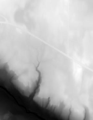
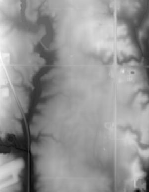
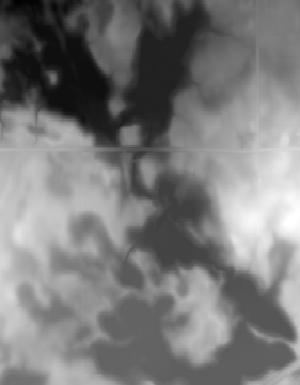
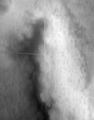
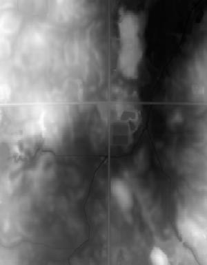
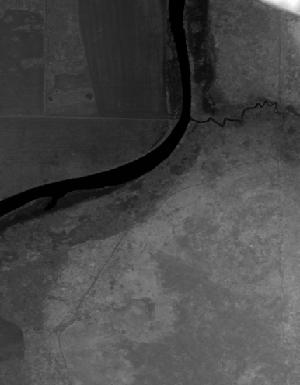