WARNING TO USERS OF THIS SYSTEM
This computer system, including all related equipment, networks, and network devices (including Internet access), is provided by the Department of the Interior (DOI) in accordance with the agency policy for official use and limited personal use.
All agency computer systems may be monitored for all lawful purposes,
including but not limited to, ensuring that use is authorized, for management of the system, to facilitate protection against unauthorized access, and to verify security procedures, survivability and operational security. Any information on this computer system may be examined, recorded, copied and used for authorized purposes at any time.
All information, including personal information, placed or sent over this system may be monitored, and users of this system are reminded that such monitoring does occur. Therefore, there should be no expectation of privacy with respect to use of this system.
By logging into this agency computer system, you acknowledge and consent to the monitoring of this system. Evidence of your use, authorized or
unauthorized, collected during monitoring may be used for civil, criminal, administrative, or other adverse action. Unauthorized or illegal use may subject you to prosecution.
 Name Last modified Size Description
![[PARENTDIR]](/icons/back.gif) Parent Directory -
Parent Directory -
![[ ]](/icons/unknown.gif) USGS_ID_SouthernID_9_2018_TileIndex.cpg 2022-11-22 08:23 5
USGS_ID_SouthernID_9_2018_TileIndex.cpg 2022-11-22 08:23 5
![[TXT]](/icons/text.gif) USGS_ID_SouthernID_9_2018_TileIndex.shp.xml 2022-11-22 08:23 12K
USGS_ID_SouthernID_9_2018_TileIndex.sbn 2022-11-22 08:23 3.9K
USGS_ID_SouthernID_9_2018_TileIndex.sbx 2022-11-22 08:23 444
USGS_ID_SouthernID_9_2018_TileIndex.shp 2022-11-22 08:43 68K
USGS_ID_SouthernID_9_2018_TileIndex.shx 2022-11-22 08:43 3.1K
USGS_ID_SouthernID_9_2018_TileIndex.dbf 2022-11-22 08:43 149K
USGS_ID_SouthernID_9_2018_TileIndex.prj 2022-11-22 08:43 581
USGS_ID_SouthernID_9_2018_Silhouette.gpkg 2022-11-22 08:43 120K
USGS_ID_SouthernID_9_2018_TileIndex.shp.xml 2022-11-22 08:23 12K
USGS_ID_SouthernID_9_2018_TileIndex.sbn 2022-11-22 08:23 3.9K
USGS_ID_SouthernID_9_2018_TileIndex.sbx 2022-11-22 08:23 444
USGS_ID_SouthernID_9_2018_TileIndex.shp 2022-11-22 08:43 68K
USGS_ID_SouthernID_9_2018_TileIndex.shx 2022-11-22 08:43 3.1K
USGS_ID_SouthernID_9_2018_TileIndex.dbf 2022-11-22 08:43 149K
USGS_ID_SouthernID_9_2018_TileIndex.prj 2022-11-22 08:43 581
USGS_ID_SouthernID_9_2018_Silhouette.gpkg 2022-11-22 08:43 120K
![[ ]](/icons/compressed.gif) USGS_ID_SouthernID_9_2018_TileIndex.zip 2022-11-22 08:43 35K
USGS_ID_SouthernID_9_2018_TileIndex.zip 2022-11-22 08:43 35K
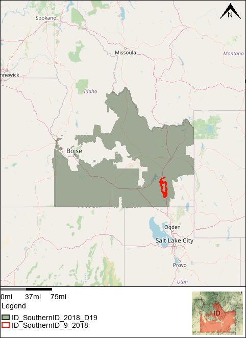
![[IMG]](/icons/image2.gif) USGS_ID_SouthernID_9_2018_AOI_MAP.png 2023-02-07 07:31 157K
USGS_ID_SouthernID_9_2018_SWATH_POLY.prj 2023-02-07 10:08 560
USGS_ID_SouthernID_9_2018_SWATH_POLY.shp 2023-02-07 10:08 5.6M
USGS_ID_SouthernID_9_2018_SWATH_POLY.shx 2023-02-07 10:08 716
USGS_ID_SouthernID_9_2018_SWATH_POLY.cpg 2023-02-07 10:08 5
USGS_ID_SouthernID_9_2018_SWATH_POLY.dbf 2023-02-07 10:08 51K
USGS_ID_SouthernID_9_2018_SWATH_POLY.shp.xml 2023-02-07 10:08 12K
USGS_ID_SouthernID_9_2018_SWATH_POLY.sbn 2023-02-07 10:08 804
USGS_ID_SouthernID_9_2018_SWATH_POLY.sbx 2023-02-07 10:08 148
USGS_ID_SouthernID_9_2018_SWATH_POLY.qix 2023-02-07 10:38 2.1K
USGS_ID_SouthernID_9_2018_TileIndex.qix 2023-02-07 10:38 22K
USGS_ID_SouthernID_9_2018_AOI_MAP.png 2023-02-07 07:31 157K
USGS_ID_SouthernID_9_2018_SWATH_POLY.prj 2023-02-07 10:08 560
USGS_ID_SouthernID_9_2018_SWATH_POLY.shp 2023-02-07 10:08 5.6M
USGS_ID_SouthernID_9_2018_SWATH_POLY.shx 2023-02-07 10:08 716
USGS_ID_SouthernID_9_2018_SWATH_POLY.cpg 2023-02-07 10:08 5
USGS_ID_SouthernID_9_2018_SWATH_POLY.dbf 2023-02-07 10:08 51K
USGS_ID_SouthernID_9_2018_SWATH_POLY.shp.xml 2023-02-07 10:08 12K
USGS_ID_SouthernID_9_2018_SWATH_POLY.sbn 2023-02-07 10:08 804
USGS_ID_SouthernID_9_2018_SWATH_POLY.sbx 2023-02-07 10:08 148
USGS_ID_SouthernID_9_2018_SWATH_POLY.qix 2023-02-07 10:38 2.1K
USGS_ID_SouthernID_9_2018_TileIndex.qix 2023-02-07 10:38 22K
![[DIR]](/icons/folder.gif) USGS_Maximum_Surface_Height_Raster/ 2023-02-10 06:42 -
USGS_ID_SoutherID_9_2018_FINAL_DEM_Silhouette.prj 2023-02-10 06:45 418
USGS_ID_SoutherID_9_2018_FINAL_DEM_Silhouette.dbf 2023-02-10 06:45 134
USGS_ID_SoutherID_9_2018_FINAL_DEM_Silhouette.shx 2023-02-10 06:45 108
USGS_ID_SoutherID_9_2018_FINAL_DEM_Silhouette.shp 2023-02-10 06:45 1.6M
USGS_ID_SoutherID_9_2018_FINAL_DEM_Silhouette.gpkg 2023-02-10 06:45 1.7M
lpc_index.gpkg 2023-02-15 12:23 496K
opr_index.gpkg 2023-02-15 12:23 200K
USGS_Maximum_Surface_Height_Raster/ 2023-02-10 06:42 -
USGS_ID_SoutherID_9_2018_FINAL_DEM_Silhouette.prj 2023-02-10 06:45 418
USGS_ID_SoutherID_9_2018_FINAL_DEM_Silhouette.dbf 2023-02-10 06:45 134
USGS_ID_SoutherID_9_2018_FINAL_DEM_Silhouette.shx 2023-02-10 06:45 108
USGS_ID_SoutherID_9_2018_FINAL_DEM_Silhouette.shp 2023-02-10 06:45 1.6M
USGS_ID_SoutherID_9_2018_FINAL_DEM_Silhouette.gpkg 2023-02-10 06:45 1.7M
lpc_index.gpkg 2023-02-15 12:23 496K
opr_index.gpkg 2023-02-15 12:23 200K