WARNING TO USERS OF THIS SYSTEM
This computer system, including all related equipment, networks, and network devices (including Internet access), is provided by the Department of the Interior (DOI) in accordance with the agency policy for official use and limited personal use.
All agency computer systems may be monitored for all lawful purposes,
including but not limited to, ensuring that use is authorized, for management of the system, to facilitate protection against unauthorized access, and to verify security procedures, survivability and operational security. Any information on this computer system may be examined, recorded, copied and used for authorized purposes at any time.
All information, including personal information, placed or sent over this system may be monitored, and users of this system are reminded that such monitoring does occur. Therefore, there should be no expectation of privacy with respect to use of this system.
By logging into this agency computer system, you acknowledge and consent to the monitoring of this system. Evidence of your use, authorized or
unauthorized, collected during monitoring may be used for civil, criminal, administrative, or other adverse action. Unauthorized or illegal use may subject you to prosecution.
 Name Last modified Size Description
![[PARENTDIR]](/icons/back.gif) Parent Directory -
Parent Directory -
![[ ]](/icons/unknown.gif) USGS_NE_Southwest_1_2020_SWATH_POLY.cpg 2021-10-19 09:38 5
USGS_NE_Southwest_1_2020_TileIndex.cpg 2021-06-30 11:48 5
NE_Southwest_1_2020_FINAL_DEM_ReportSilhouette.shx 2021-11-03 22:07 108
NE_Southwest_1_2020_FINAL_DEM_ReportSilhouette.dbf 2021-11-03 22:07 134
USGS_NE_Southwest_1_2020_SWATH_POLY.sbx 2021-10-19 09:38 212
USGS_NE_Southwest_1_2020_SWATH_POLY.prj 2021-10-19 09:38 418
USGS_NE_Southwest_1_2020_TileIndex.prj 2021-06-30 11:48 418
NE_Southwest_1_2020_FINAL_DEM_ReportSilhouette.prj 2021-11-03 22:03 432
USGS_NE_Southwest_1_2020_SWATH_POLY.cpg 2021-10-19 09:38 5
USGS_NE_Southwest_1_2020_TileIndex.cpg 2021-06-30 11:48 5
NE_Southwest_1_2020_FINAL_DEM_ReportSilhouette.shx 2021-11-03 22:07 108
NE_Southwest_1_2020_FINAL_DEM_ReportSilhouette.dbf 2021-11-03 22:07 134
USGS_NE_Southwest_1_2020_SWATH_POLY.sbx 2021-10-19 09:38 212
USGS_NE_Southwest_1_2020_SWATH_POLY.prj 2021-10-19 09:38 418
USGS_NE_Southwest_1_2020_TileIndex.prj 2021-06-30 11:48 418
NE_Southwest_1_2020_FINAL_DEM_ReportSilhouette.prj 2021-11-03 22:03 432
![[TXT]](/icons/text.gif) USGS_NE_Southwest_1_2020_SWATH_POLY.shp.xml 2021-10-19 09:38 903
USGS_NE_Southwest_1_2020_TileIndex.shp.xml 2021-06-30 11:48 969
USGS_NE_Southwest_1_2020_SWATH_POLY.shx 2021-10-19 09:38 1.2K
USGS_NE_Southwest_1_2020_SWATH_POLY.sbn 2021-10-19 09:38 1.5K
USGS_NE_Southwest_1_2020_TileIndex.sbx 2021-06-30 11:48 5.8K
USGS_NE_Southwest_1_2020_SWATH_POLY.dbf 2021-10-19 09:38 45K
USGS_NE_Southwest_1_2020_SWATH_POLY.shp.xml 2021-10-19 09:38 903
USGS_NE_Southwest_1_2020_TileIndex.shp.xml 2021-06-30 11:48 969
USGS_NE_Southwest_1_2020_SWATH_POLY.shx 2021-10-19 09:38 1.2K
USGS_NE_Southwest_1_2020_SWATH_POLY.sbn 2021-10-19 09:38 1.5K
USGS_NE_Southwest_1_2020_TileIndex.sbx 2021-06-30 11:48 5.8K
USGS_NE_Southwest_1_2020_SWATH_POLY.dbf 2021-10-19 09:38 45K
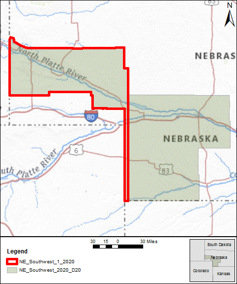
![[IMG]](/icons/image2.gif) USGS_NE_Southwest_1_2020_AOI_MAP.gif 2021-10-20 09:19 63K
USGS_NE_Southwest_1_2020_TileIndex.shx 2021-06-30 11:48 105K
USGS_NE_Southwest_1_2020_TileIndex.sbn 2021-06-30 11:48 125K
NE_Southwest_1_2020_FINAL_DEM_ReportSilhouette.shp 2021-11-03 22:07 399K
USGS_NE_Southwest_1_2020_AOI_MAP.mxd 2021-10-20 09:19 620K
USGS_NE_Southwest_1_2020_AOI_MAP.gif 2021-10-20 09:19 63K
USGS_NE_Southwest_1_2020_TileIndex.shx 2021-06-30 11:48 105K
USGS_NE_Southwest_1_2020_TileIndex.sbn 2021-06-30 11:48 125K
NE_Southwest_1_2020_FINAL_DEM_ReportSilhouette.shp 2021-11-03 22:07 399K
USGS_NE_Southwest_1_2020_AOI_MAP.mxd 2021-10-20 09:19 620K
![[ ]](/icons/compressed.gif) 20210630115154_USGS_NE_Southwest_1_2020_TileIndex.zip 2021-08-17 22:59 687K
USGS_NE_Southwest_1_2020_TileIndex.shp 2021-06-30 11:48 1.8M
USGS_NE_Southwest_1_2020_TileIndex.dbf 2021-06-30 11:48 2.3M
opr_index.gpkg 2021-11-15 18:52 3.7M
lpc_index.gpkg 2021-11-15 18:45 14M
USGS_NE_Southwest_1_2020_SWATH_POLY.shp 2021-10-19 09:38 176M
20210630115154_USGS_NE_Southwest_1_2020_TileIndex.zip 2021-08-17 22:59 687K
USGS_NE_Southwest_1_2020_TileIndex.shp 2021-06-30 11:48 1.8M
USGS_NE_Southwest_1_2020_TileIndex.dbf 2021-06-30 11:48 2.3M
opr_index.gpkg 2021-11-15 18:52 3.7M
lpc_index.gpkg 2021-11-15 18:45 14M
USGS_NE_Southwest_1_2020_SWATH_POLY.shp 2021-10-19 09:38 176M